Category:Aerial photographs of Landkreis Merzig-Wadern
Jump to navigation
Jump to search
Districts of Saarland:
Media in category "Aerial photographs of Landkreis Merzig-Wadern"
The following 19 files are in this category, out of 19 total.
-
 Aerial image of the Saarschleife.jpg 5,400 × 2,700; 3.98 MB
-
 Aussichtsturm Baumwipfelpfad Saarschleife im Nebel.jpg 5,333 × 3,555; 4.28 MB
-
 Aussichtsturm Baumwipfelpfad Saarschleife.jpg 5,472 × 3,648; 6.89 MB
-
 Burg Dagstuhl aus der Vogelperspektive.jpg 4,500 × 3,000; 7.91 MB
-
 Burg Neu-Montclair aus der Vogelperspektive.jpg 4,227 × 2,817; 11.98 MB
-
 Burgturm Burgruine Dagstuhl.jpg 4,500 × 6,000; 31.48 MB
-
 Cloef und Aussichtsturm Saarschleife.jpg 5,472 × 3,648; 8.28 MB
-
 Kreuzbergkapelle auf dem Kreuzberg bei Merzig.jpg 5,472 × 3,648; 7.61 MB
-
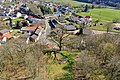
 Losheim am See Germany.jpg 1,728 × 2,304; 689 KB
-
 Luftbild Burg Dagstuhl.jpg 5,250 × 3,500; 9.95 MB
-
 Luftbild Burg-Neu Montclair mit Dreisbach und Saar.jpg 5,471 × 3,647; 16.3 MB
-
 Luftbild Ensemble Schloss Dagstuhl.jpg 4,656 × 3,104; 8.24 MB
-
 Luftbild Höckerlinienpfad.jpg 5,472 × 3,648; 11.58 MB
-
 Luftbild Panzersperre Orscholzriegel.jpg 5,472 × 3,648; 11.12 MB
-
 Luftbild Urwahlener Kapelle.jpg 5,202 × 3,467; 6.54 MB
-
 Panzersperre zwischen Orscholz und Oberleuken.jpg 5,472 × 3,648; 9.3 MB
-
 Steiler Felsen mit der Kaisereiche 1870-71.jpg 5,472 × 3,648; 17.87 MB
-
 Vignobles de la moselle.jpg 600 × 400; 35 KB
-
 Wadern Germany aerial view.jpg 2,304 × 1,728; 710 KB


