Category:Aerial photographs of New York City
Jump to navigation
Jump to search
- 100 most populous cities of the United States
- 1–25
- Austin
- Boston
- Charlotte
- Chicago
- Columbus
- Houston
- Indianapolis
- Los Angeles
- Nashville
- New York City
- Oklahoma City
- Philadelphia
- Phoenix
- Portland
- San Antonio
- San Diego
- San Francisco
- Seattle
- Washington, D.C.
- 26–50
- Albuquerque
- Atlanta
- Baltimore
- Colorado Springs
- Detroit
- Kansas City
- Las Vegas
- Long Beach
- Memphis
- Miami
- Milwaukee
- Minneapolis
- Oakland
- Sacramento
- 51–75
- Anchorage
- Cincinnati
- Cleveland
- Durham
- Henderson
- Honolulu
- Lincoln
- Newark
- New Orleans
- Orlando
- Pittsburgh
- Riverside
- Saint Paul
- St. Louis
- Tampa
- 76–100
- Buffalo
- Fort Wayne
- Fremont
- Madison
- Norfolk
- Reno
- Richmond
- Spokane
- Toledo
- Winston-Salem
Español: Fotografías aéreas de la Ciudad de Nueva York. Véase también: Categoría:Imágenes de satélite en el Estado de Nueva York
Subcategories
This category has the following 12 subcategories, out of 12 total.
A
Media in category "Aerial photographs of New York City"
The following 165 files are in this category, out of 165 total.
-

-
-

-

-

-
-

-

-

-

-
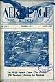 Aerial Age Nov. 7 1921.jpg 4,820 × 7,199; 10.42 MB
-
 Aerial NYC 1 (36106318683).jpg 2,400 × 1,600; 3.11 MB
-
 Aerial NYC 4 (36080141074).jpg 1,600 × 2,400; 2.76 MB
-

-
 Aerial of New York City LCCN2011631202.tif 7,583 × 5,901; 256.07 MB
-
 Aerial of New York, New York LCCN2011632052.tif 6,612 × 5,178; 195.93 MB
-
 Aerial of New York, New York LCCN2011635629.tif 6,363 × 2,867; 104.41 MB
-
 Aerial of the Empire State Building in New York LCCN2011632913.tif 2,284 × 1,488; 19.47 MB
-

-
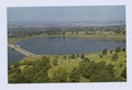
 Aerial photo of the Ridgewood Reservoir, February 2020.jpg 3,201 × 2,030; 2.57 MB
-
 Aerial photograph of New York City.jpg 4,592 × 3,448; 3.78 MB
-
 Aerial photos of NYC (17227289001).jpg 4,016 × 6,016; 12.12 MB
-
 Aerial view of 2012 Bronx accident (11170803535).jpg 4,576 × 2,766; 2.12 MB
-
 Aerial view of high-rise buildings, New York, New York LCCN2011632098.tif 5,428 × 6,847; 212.69 MB
-
 Aerial view of lower Manhattan with World Trade Center towers, New York, New York LCCN2011633803.tif 5,843 × 4,528; 151.41 MB
-
 Aerial view of Manhattan, New York, New York LCCN2011632999.tif 6,532 × 5,091; 190.31 MB
-

-
-

-

-

-

-
 Aerial view of New York City, with the World Trade Center Twin Towers prominent LCCN2011633675.tif 6,015 × 4,206; 144.79 MB
-
 Aerial view of New York City, with the World Trade Center Twin Towers prominent LCCN2011633749.tif 6,031 × 4,698; 162.15 MB
-
 Aerial view of New York City, with Twin Towers of the World Trade Center visible LCCN2011634926.tif 7,720 × 6,034; 266.58 MB
-
 Aerial view of New York City, with Twin Towers of the World Trade Center visible LCCN2011634927.tif 7,574 × 5,960; 258.32 MB
-
 Aerial view of New York City, with Twin Towers of the World Trade Center visible LCCN2011634929.tif 7,435 × 5,874; 249.93 MB
-
 Aerial view of New York City, with Twin Towers of the World Trade Center visible LCCN2011634931.tif 7,639 × 6,099; 266.62 MB
-
 Aerial view of New York City, with Twin Towers of the World Trade Center visible LCCN2011634933.tif 7,591 × 5,959; 258.86 MB
-
 Aerial view of New York City, with Twin Towers of the World Trade Center visible LCCN2011634991.tif 6,036 × 4,806; 166.02 MB
-
-
 Aerial view of New York taken in the 1980s LCCN2011631338.tif 9,322 × 7,152; 381.52 MB
-
 Aerial view of New York, New York LCCN2011632053.tif 6,603 × 5,110; 193.09 MB
-
 Aerial view of New York, New York LCCN2011632054.tif 6,609 × 5,076; 191.98 MB
-
 Aerial view of New York, New York LCCN2011632055.tif 6,241 × 3,200; 114.3 MB
-
 Aerial view of New York, New York LCCN2011632056.tif 6,600 × 4,614; 174.27 MB
-
 Aerial view of New York, New York LCCN2011632100.tif 6,948 × 5,328; 211.85 MB
-
 Aerial view of New York, New York LCCN2011632429.tif 6,145 × 4,794; 168.59 MB
-
 Aerial view of New York, New York LCCN2011632430.tif 6,085 × 4,752; 165.48 MB
-
 Aerial view of New York, New York LCCN2011632431.tif 6,049 × 4,644; 160.77 MB
-
 Aerial view of New York, New York LCCN2011632434.tif 6,102 × 4,740; 165.53 MB
-
 Aerial view of New York, New York LCCN2011632577.tif 6,074 × 4,630; 160.94 MB
-
 Aerial view of New York, New York LCCN2011632578.tif 6,137 × 4,774; 167.67 MB
-
 Aerial view of New York, New York LCCN2011632579.tif 6,099 × 3,478; 121.4 MB
-
 Aerial view of New York, New York LCCN2011632584.tif 6,097 × 4,740; 165.39 MB
-
 Aerial view of New York, New York LCCN2011632585.tif 5,988 × 4,414; 151.26 MB
-
 Aerial view of New York, New York LCCN2011632586.tif 6,139 × 4,871; 171.13 MB
-
 Aerial view of New York, New York LCCN2011632587.tif 6,099 × 4,759; 166.11 MB
-
 Aerial view of New York, New York LCCN2011632589.tif 6,117 × 4,723; 165.34 MB
-
 Aerial view of New York, New York LCCN2011632590.tif 5,568 × 4,047; 128.96 MB
-
 Aerial view of New York, New York LCCN2011632591.tif 6,169 × 4,888; 172.57 MB
-
 Aerial view of New York, New York LCCN2011633024.tif 6,555 × 5,120; 192.07 MB
-
 Aerial view of New York, New York LCCN2011635119.tif 5,428 × 6,847; 212.69 MB
-

-
 Aerial view of the World Trade Center taken a month before September 11, 2001 LCCN2011632033.tif 7,668 × 5,848; 256.61 MB
-

-
 Aerial view of West Orange, New Jersey, 2008-05-10.jpg 1,024 × 768; 646 KB
-
 Aerial view, New York, New York LCCN2011632097.tif 6,947 × 5,331; 211.94 MB
-
 Aerial views of Ground Zero and Fresh Kills Landfill 011003-Z-AL508-001.jpg 2,382 × 1,568; 1.95 MB
-
 Aerial views of Ground Zero and Fresh Kills Landfill 011003-Z-AL508-002.jpg 2,180 × 1,562; 2.31 MB
-
 Aerial views of Ground Zero and Fresh Kills Landfill 011003-Z-AL508-003.jpg 2,460 × 1,562; 1.7 MB
-
-
 And Away We Go Again (29514625523).jpg 4,007 × 2,667; 4.09 MB
-
 APARTMENT BUILDINGS - NARA - 548374.jpg 2,041 × 3,000; 932 KB
-
 Approach to JFK, 1969 - Flickr - PhillipC.jpg 1,598 × 997; 329 KB
-
 Arriving New York City (2800027265).jpg 2,272 × 1,704; 459 KB
-
 Bell telephone magazine (1922) (14569756169).jpg 1,208 × 2,906; 702 KB
-
 Bell telephone magazine (1922) (14756406825).jpg 2,428 × 1,536; 1.19 MB
-
 Bridge, river, ships, boat- NYC (5720972439).jpg 2,896 × 1,944; 2.5 MB
-

-

-
 Bush Terminal - North aerial - 1958.jpg 3,504 × 2,760; 4.23 MB
-
 BW3 (13720446683).jpg 1,929 × 1,405; 366 KB
-
-
 Chrysler Building1.jpg 3,448 × 4,592; 2.65 MB
-

-
 DC-4 NewYork.jpg 2,784 × 2,040; 1.6 MB
-
 EAST RIVER AND MANHATTAN SKYLINE IN HEAVY SMOG - NARA - 548365 (restored).jpg 2,954 × 1,962; 1.18 MB
-
 EAST RIVER AND MANHATTAN SKYLINE IN HEAVY SMOG - NARA - 548365.jpg 3,000 × 2,010; 498 KB
-
 Fort Greene Park in Winter from Above.jpg 4,073 × 3,258; 10.87 MB
-
 George Washington Bridge 001.JPG 3,580 × 2,685; 4.09 MB
-
 Greater New York, metropolis of mankind (2674449643).jpg 2,000 × 1,655; 2.73 MB
-
 HARLEM RIVER-HARLEM ON LEFT. BRONX ON RIGHT - NARA - 548427.jpg 3,000 × 2,019; 859 KB
-
 Henry Hudson Bridge.jpg 1,200 × 800; 143 KB
-
 Hindenburg over New York 1937 (cropped).jpg 716 × 495; 101 KB
-
 Hindenburg over New York 1937.jpg 884 × 674; 174 KB
-
 ISS030-E-136358 - View of Earth.jpg 6,048 × 4,032; 3.99 MB
-
 It goes on for miles (Unsplash).jpg 3,765 × 5,889; 20.34 MB
-
 Jersey City, New Jersey and the Manhattan Financial District (7238108172).jpg 4,000 × 3,000; 2.22 MB
-
 Jersey City, New Jersey and the Manhattan Financial District (7238109016).jpg 4,000 × 3,000; 2.14 MB
-
 John B. Caddell beached by Hurricane Sandy - 130404-A-CE999-025.jpeg 3,000 × 2,000; 4.67 MB
-
 LaGuardia Airport and Rikers Island (4430036264).jpg 3,504 × 2,336; 7.78 MB
-
 Liberty.Ellis.Island.Upper.Bay.tif 407 × 266; 203 KB
-
 LOOKING SOUTH-FROM THE BRONX TO MANHATTAN - NARA - 548407.jpg 3,000 × 2,027; 638 KB
-
 Lower Manhattan, New York, NY, USA - panoramio (23).jpg 2,448 × 3,264; 2.83 MB
-
 Lower Manhattan, New York, NY, USA - panoramio.jpg 2,048 × 1,536; 1.16 MB
-
 MANHATTAN SKYLINE SEEN FROM THE SOUTH - NARA - 548384.jpg 3,000 × 2,023; 670 KB
-

-
 Manhattan01 ST 07.JPG 1,596 × 1,034; 1.01 MB
-
 New York Areal January 2015.jpg 4,592 × 3,064; 3.47 MB
-
 New York by Air - Flickr - John Morton.jpg 2,832 × 1,888; 1.63 MB
-
 New York City (2800875646).jpg 2,272 × 1,704; 509 KB
-
 New York City 3 July 1979 - 48190703711.jpg 2,400 × 2,392; 626 KB
-
 New York City and its islands (4968697993).jpg 1,980 × 2,640; 1.23 MB
-
 New York City from United 41 (7175080950).jpg 1,600 × 1,200; 314 KB
-
 New York City, 1967 (2080787459).jpg 2,670 × 1,772; 602 KB
-
 New York City, 1967 (2089549496).jpg 2,456 × 2,665; 2.21 MB
-
 New York City,New York,USA. - panoramio - Roman Eugeniusz.jpg 1,448 × 1,028; 330 KB
-
 New York City,New York.USA. - panoramio (3).jpg 1,322 × 808; 312 KB
-
 New York City,New York.USA. - panoramio (5).jpg 1,326 × 837; 314 KB
-
 New York from the air (5721533688).jpg 2,896 × 1,944; 2.45 MB
-
 New York GOPRO Heli (8322286668).jpg 2,736 × 3,648; 3.92 MB
-
 New York Helicopter (8382064394).jpg 3,840 × 2,880; 5.57 MB
-
 New York Plane.jpg 4,608 × 3,456; 3.56 MB
-
 New York, New York - 1977 (21).tif 2,968 × 1,972, 2 pages; 16.77 MB
-
 New York, New York 1977 (13).jpg 2,288 × 3,534; 885 KB
-
 NorthHudsonNJtoManhattan.tiff 395 × 204; 211 KB
-
 NYC Empire State 3.JPG 5,184 × 3,456; 8.36 MB
-
 NYC skyline May 2014.jpg 2,269 × 1,056; 663 KB
-
 NYC, New York City 07.jpg 1,728 × 2,592; 679 KB
-
 NYC2byJonasNilssonLee.jpg 5,472 × 3,648; 12.47 MB
-
 New York and Brooklyn Bridge (both ends), New York, N. Y (NYPL b12647398-69850).tiff 2,400 × 1,607; 11.04 MB
-
 Marine Hospital (NYPL b15279351-104767).tiff 2,200 × 1,362; 11.43 MB
-
 Silver Lake (aerial view of reservoir and surrounding area) (NYPL b15279351-104842).tiff 2,440 × 1,664; 11.62 MB
-
 Augustinian Academy, Grymes Hill, Staten Island, N.Y. (aerial view) (NYPL b15279351-104950).tiff 2,464 × 1,627; 11.48 MB
-

-

-
 Randalls and Wards Islands.JPG 3,138 × 2,272; 3.28 MB
-
 RESIDENTIAL AREA - NARA - 548396.jpg 3,000 × 2,031; 901 KB
-
 Rikers Island from the air.JPG 3,264 × 2,448; 3.89 MB
-
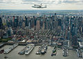 Shuttle Enterprise Flight to New York (201204270023HQ).jpg 3,245 × 2,291; 2.23 MB
-
 SLEEK NEW CRUISE SHIPS IN DOCK AT NEW YORK HARBOUR - NARA - 548400.jpg 2,021 × 3,000; 852 KB
-
 Snowy Manhattan - Flickr - Joi.jpg 5,212 × 3,468; 4 MB
-
 Tanker in the distance (5721531100).jpg 2,896 × 1,944; 2.03 MB
-
 The City of New York Brooklyn on left, Manhattan on right (7533830828).jpg 3,872 × 2,592; 6.89 MB
-
 The City of New York under our wings (7533827798).jpg 3,872 × 2,592; 8.15 MB
-
 The City of New York under our wings (7533828784).jpg 3,872 × 2,592; 3.45 MB
-

-

-

-
 The Statue of Liberty, Jersey City, New Jersey and New York Harbor (7238107320).jpg 4,000 × 3,000; 3.08 MB
-

-
 Thunderbirds 050526-F-6701P-172.jpg 4,288 × 2,848; 6.68 MB
-
 Triboro island.JPG 3,072 × 2,304; 1.49 MB
-
 Upper Manhattan aerial view.jpg 3,504 × 1,212; 3.89 MB
-
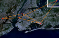 Us-helicopter-routes-with-arrows.png 1,450 × 932; 2.54 MB
-
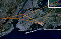 Us-helicopter-routes.png 1,450 × 932; 2.54 MB
-
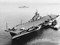 USS Bon Homme Richard (CV-31) anchored in New York harbor on 9 January 1945.jpg 5,710 × 4,259; 6.85 MB
-

-

-
 Valley of Ashes.jpg 3,177 × 3,177; 10.68 MB
-
 View of New York City..jpg 5,634 × 2,397; 7.98 MB
-
 Vista arerea della USS Intrepid - porto di New York.jpg 3,407 × 2,271; 2.99 MB
-
 WATERFRONT INDUSTRIAL AREA - NARA - 548353.jpg 2,673 × 1,805; 840 KB
-


_(16045595893).jpg)


.jpg)
.jpg)


.jpg)
.jpg)


.jpg)


.jpg)
_(14569756169).jpg)
_(14756406825).jpg)
.jpg)
.jpg)

.jpg)


.jpg)


.jpg)


.jpg)


.jpg)
.jpg)
.jpg)

.jpg)

.jpg)


.jpg)

.jpg)
.jpg)
.jpg)
.jpg)

.jpg)
.jpg)
.jpg)
.jpg)
.jpg)

.jpg)


.jpg)


.jpg)


.jpg)
.jpg)
.jpg)
.jpg)


.jpg)


_anchored_in_New_York_harbor_on_9_January_1945.jpg)
_underway_in_the_Atlantic_Ocean_on_16_August_1944_(80-G-245429).jpg)
_underway_off_New_York_City_(USA)_on_16_August_1944_(80-G-245423).jpg)


