Category:Aerial photographs of Washington, D.C.
Jump to navigation
Jump to search
States of the United States: Alabama · Alaska · Arizona · Arkansas · California · Colorado · Connecticut · Delaware · Florida · Georgia · Hawaii · Idaho · Illinois · Indiana · Iowa · Kansas · Kentucky · Louisiana · Maine · Maryland · Massachusetts · Michigan · Minnesota · Mississippi · Missouri · Montana · Nebraska · Nevada · New Hampshire · New Jersey · New Mexico · New York · North Carolina · North Dakota · Ohio · Oklahoma · Oregon · Pennsylvania · Rhode Island · South Carolina · South Dakota · Tennessee · Texas · Utah · Vermont · Virginia · Washington · West Virginia · Wisconsin · Wyoming – District of Columbia: Washington, D.C.
insular area of the United States: American Samoa · Guam · Northern Mariana Islands · Puerto Rico · United States Virgin Islands – United States Minor Outlying Islands: Baker Island · Midway Atoll · Wake Island
insular area of the United States: American Samoa · Guam · Northern Mariana Islands · Puerto Rico · United States Virgin Islands – United States Minor Outlying Islands: Baker Island · Midway Atoll · Wake Island
English: Aerial photographs of Washington, D.C.
Subcategories
This category has the following 13 subcategories, out of 13 total.
A
L
Media in category "Aerial photographs of Washington, D.C."
The following 200 files are in this category, out of 983 total.
(previous page) (next page)-
-
 090508-F-9832R-002 1st Helicopter Squadron UH-1N Capitol flyby.jpg 1,782 × 1,356; 1.73 MB
-
-
 11thstreetbridges 1992.jpg 4,395 × 3,372; 1.87 MB
-
 14th Street Bridge 1932.jpg 3,664 × 2,676; 828 KB
-
 14th street bridge aerial c04055058dfd70e4a67dfe9f17d14f60.jpg 2,944 × 2,344; 1,009 KB
-
 14th street bridge traffic aerial 9a31aa53f415cbe27dc5f402132b16fc.jpg 2,929 × 2,355; 1.15 MB
-

-
 14TH STREET BRIDGE, LOOKING NORTH, FROM VIRGINIA TO THE DISTRICT - NARA - 546677.jpg 2,025 × 3,000; 1.17 MB
-
 14th Street Bridge.jpg 3,264 × 2,448; 2.52 MB
-
 14TH STREET LOOKING NORTH. INDEPENDENCE AVENUE IN FOREGROUND - NARA - 546745.jpg 2,027 × 3,000; 1.13 MB
-
 Washington Navy Yard aerial view 1918.jpg 740 × 592; 146 KB
-
 1923CapitolComplex.jpg 520 × 320; 47 KB
-
 WestPotomacParkAerial1943.jpg 740 × 588; 143 KB
-
 1948 aerial photos of Chevy Chase Circle and Logan Circle in Washington, D.C.jpg 7,019 × 5,100; 6.45 MB
-
 Washington Navy Yard aerial view 1960.jpg 690 × 596; 169 KB
-
 Aerial view of original convention center, Washington, D.C LCCN2011632822.tif 2,303 × 1,534; 20.25 MB
-

-

-
 2 aerial view farragut suare 042626pu.tif 4,743 × 3,809; 17.23 MB
-
 2. AERIAL VIEW OF FARRAGUT SQUARE, LOOKING SOUTHEAST042626pv.jpg 952 × 746; 520 KB
-
 2. UNION STATION PLAZA. WASHINGTON, D. C. 030164pv.jpg 1,024 × 787; 192 KB
-
-

-

-

-

-

-

-

-

-

-

-

-
 210908-H-NI589-089.jpg 6,509 × 4,339; 9.57 MB
-
 210908-H-NI589-097.jpg 6,720 × 4,480; 9.73 MB
-
 210908-H-NI589-152.jpg 4,950 × 3,577; 7.79 MB
-
 210908-H-NI589-158.jpg 4,995 × 2,999; 6.63 MB
-
 210908-H-NI589-159.jpg 3,556 × 2,553; 4.03 MB
-
 295 expressway aerial 47ce4f18d26f68e27a907c883ce52b60.jpg 2,880 × 2,291; 807 KB
-
 295 expressway aerial 98b06d893c707a1f2c126935542f9f86.jpg 2,850 × 2,250; 1.32 MB
-
 3. TRACKS, PLATFORMS AND UMBRELLA SHEDS BEHIND UNION STATION. 030165pv.jpg 1,024 × 826; 202 KB
-

-
 316og-uh1-huey.png 1,000 × 761; 1.43 MB
-
 4. RAIL YARD BEHIND UNION STATION. WASHINGTON, D. C. 030166pv.jpg 1,024 × 815; 231 KB
-
 428-GX-K-121166 (24194578810).jpg 2,559 × 1,636; 1.97 MB
-
 428-GX-USN-1148370 (24407756501).jpg 2,560 × 2,056; 2.37 MB
-
 4th street tunnel aerial 0fa9e6884f905730338055f9c00efca0.jpg 2,945 × 2,373; 2.83 MB
-
 4th street tunnel aerial 4d53f76db8e3063952e46addf3fc872a.jpg 2,941 × 2,383; 3.09 MB
-
 4th street tunnel aerial 7dcbb388b277c8c38b34cf1ca4e2dc42.jpg 2,949 × 2,373; 2.89 MB
-
 4th street tunnel aerial e7b739591affb596ebfe08f2d3c86235.jpg 2,957 × 2,385; 3.12 MB
-
 5. 'A' INTERLOCKING TOWER AND TURNTABLE BEHIND UNION STATION. 030167pv.jpg 1,024 × 785; 212 KB
-
 6. IVY CITY ROUNDHOUSE. WASHINGTON, D. C. 030168pv.jpg 1,024 × 788; 198 KB
-
 7 aerial view at m street and pennsylvania ave.tif 5,000 × 3,995; 19.05 MB
-
 7. AERIAL VIEW AT M STREET AND PENNSYLVANIA AVENUE.jpg 959 × 754; 478 KB
-
 7. ANACOSTIA RIVER BRIDGE. WASHINGTON, D. C. 030169pv.jpg 1,024 × 785; 168 KB
-
 80-G-147387 (27158514471).jpg 2,883 × 2,328; 1.22 MB
-
 80-G-454982 (31734220046).jpg 2,842 × 2,276; 770 KB
-
 80-G-457007 (28287400470).jpg 2,668 × 2,156; 768 KB
-
 80-G-88906 (29888749661).jpg 2,484 × 1,888; 2.12 MB
-
 80-G-K-1014 Washington, D.C.jpg 1,280 × 1,027; 339 KB
-

-
 Aerial image taken during the 1980s of Washington, D.C LCCN2011632527.tif 6,116 × 4,732; 165.63 MB
-
 Aerial Lincoln Memorial 12 2014 DC 707.JPG 1,500 × 1,000; 1.55 MB
-
 Aerial Lincoln Memorial 12 2014 DC 712.JPG 900 × 600; 626 KB
-
 Aerial National Mall 12 2014 DC 696.JPG 2,948 × 1,250; 4.48 MB
-
 Aerial National Mall 12 2014 DC 706.JPG 2,796 × 1,600; 4.67 MB
-
 Aerial National Mall 12 2014 DC 708.JPG 2,100 × 1,400; 2.83 MB
-
 Aerial of the U.S. Capitol under restoration 04879v.jpg 1,024 × 683; 273 KB
-
 Aerial of Union Station in Washington, D.C LCCN2011631698 (cropped).tif 2,264 × 1,385; 17.97 MB
-
 Aerial of Union Station in Washington, D.C LCCN2011631698.tif 6,673 × 5,246; 200.34 MB
-
 Aerial of Washington, D.C LCCN2011632736.tif 1,534 × 2,297; 20.19 MB
-
 Aerial of Washington, D.C LCCN2011632741.tif 2,281 × 1,503; 19.64 MB
-
 Aerial of Washington, D.C LCCN2011632749.tif 2,280 × 1,488; 19.44 MB
-
 Aerial of Washington, D.C LCCN2011632825.tif 2,256 × 1,509; 19.5 MB
-
 Aerial of Washington, D.C LCCN2011633117.tif 2,273 × 1,515; 19.74 MB
-
 Aerial of Washington, D.C. 14555v.jpg 1,024 × 668; 405 KB
-
 Aerial of Washington, D.C.14549v.jpg 1,024 × 691; 384 KB
-
 Aerial of Washington, D.C.14550v.jpg 1,024 × 706; 455 KB
-
 Aerial of Washington, D.C.14552v.jpg 1,024 × 690; 388 KB
-
 Aerial of Washington, D.C.14553v.jpg 1,024 × 658; 402 KB
-
 Aerial of Washington, D.C.14556v.jpg 1,024 × 666; 451 KB
-
 Aerial of Washington, D.C.14557v.jpg 1,024 × 669; 453 KB
-
 Aerial Photography of Washington, DC 100 - DPLA - 343c5181ef7a2a4ce6b65ed9679faa04.jpg 2,772 × 2,758; 2.54 MB
-
 Aerial Photography of Washington, DC 105 - DPLA - d5fe2dfd876e5816b2ffa713f4719c60.jpg 2,700 × 2,671; 894 KB
-
 Aerial Photography of Washington, DC 106 - DPLA - 7035223ff055b8f35395c72a30374510.jpg 3,040 × 3,112; 1.21 MB
-
 Aerial Photography of Washington, DC 107 - DPLA - d8b2f6c14fd3643efb36adef3f669f20.jpg 2,700 × 2,709; 1.05 MB
-
 Aerial Photography of Washington, DC 11 - DPLA - 7e260546a8ffa77d476f7bfa1e7bce73.jpg 3,012 × 3,112; 2.48 MB
-
 Aerial Photography of Washington, DC 111 - DPLA - 66fd5946019dcae02713f83b3b22b95f.jpg 2,780 × 2,755; 2.46 MB
-
 Aerial Photography of Washington, DC 116 - DPLA - fc508d239d55b405b9cffdbd1c57c646.jpg 2,700 × 2,712; 597 KB
-
 Aerial Photography of Washington, DC 125 - DPLA - 2360f1587d74bf9d218d5755526f7074.jpg 2,776 × 2,731; 2.33 MB
-
 Aerial Photography of Washington, DC 128 - DPLA - 87a1b3680fef1b2b72aaf6862cfadbb4.jpg 2,700 × 2,849; 2.33 MB
-
 Aerial Photography of Washington, DC 132 - DPLA - 561b4b28e9d663b27e9b5a319e22de45.jpg 2,699 × 2,808; 2.08 MB
-
 Aerial Photography of Washington, DC 137 - DPLA - dbb14e715565e13d14f47b4d6d11fac0.jpg 10,136 × 3,587; 3.02 MB
-
 Aerial Photography of Washington, DC 140 - DPLA - eb8f484b454dd83ee3fe25093f6e48ab.jpg 2,700 × 2,691; 474 KB
-
 Aerial Photography of Washington, DC 15 - DPLA - 04857757035da519e5f5ee1594a70063.jpg 2,700 × 2,674; 894 KB
-
 Aerial Photography of Washington, DC 152 - DPLA - 27f343a2ae2569e8aa2425172ddc01c3.jpg 2,700 × 2,685; 551 KB
-
 Aerial Photography of Washington, DC 153 - DPLA - cdc6a3bd2b3cd0d33968f9c8d4224a7f.jpg 10,200 × 3,432; 3.54 MB
-
 Aerial Photography of Washington, DC 155 - DPLA - 4f045aeb1836f9d0e78985825f15440c.jpg 2,700 × 2,711; 511 KB
-
 Aerial Photography of Washington, DC 175 - DPLA - 5a4237ca86722ded7d2a55143b5023db.jpg 2,700 × 2,739; 1,024 KB
-
 Aerial Photography of Washington, DC 19 - DPLA - 12ac817b41bc965e3cd93635cc47650e.jpg 2,764 × 2,715; 996 KB
-
 Aerial Photography of Washington, DC 20 - DPLA - 2f496dfa3d977ef9c56331f413fc1356.jpg 2,700 × 2,694; 891 KB
-
 Aerial Photography of Washington, DC 205 - DPLA - 1ed00f8d184345c36a9645431be39539.jpg 2,788 × 2,760; 640 KB
-
 Aerial Photography of Washington, DC 21 - DPLA - bf7fa91ad3cf8871afeaffbaf15cafea.jpg 3,014 × 3,112; 1.69 MB
-
 Aerial Photography of Washington, DC 212 - DPLA - 411c52e24edd003d13cd55c5e8876cc2.jpg 2,760 × 2,736; 486 KB
-
 Aerial Photography of Washington, DC 217 - DPLA - 11d58fa58fda3ec293d02139a679e354.jpg 2,776 × 2,756; 506 KB
-
 Aerial Photography of Washington, DC 25 - DPLA - d11994d46cb754535ea0d27d7bf0cf67.jpg 2,700 × 2,671; 1.02 MB
-
 Aerial Photography of Washington, DC 251 - DPLA - c52abebfb96e8f760c3a2234e8abc794.jpg 2,700 × 2,727; 431 KB
-
 Aerial Photography of Washington, DC 263 - DPLA - f5fdbb9e4647e6f625dd667e8b6223f0.jpg 2,700 × 2,742; 471 KB
-
 Aerial Photography of Washington, DC 272 - DPLA - 328fb2bcb5bfa155c571f7a0b797db36.jpg 2,772 × 2,702; 411 KB
-
 Aerial Photography of Washington, DC 280 - DPLA - b5ffd148c8621a2ca48a9621d8d548b9.jpg 2,800 × 2,762; 398 KB
-
 Aerial Photography of Washington, DC 307 - DPLA - d81c27b64b6746efef8a9b627cc71b44.jpg 2,760 × 2,788; 402 KB
-
 Aerial Photography of Washington, DC 31 - DPLA - a224d680174d9276981aa0b45d3d5899.jpg 2,776 × 2,761; 1.49 MB
-
 Aerial Photography of Washington, DC 32 - DPLA - 0f6ecef0c9533dc1151c674451eff33d.jpg 3,016 × 3,112; 1.88 MB
-
 Aerial Photography of Washington, DC 323 - DPLA - 9b0c0a6a16582fdaa125b67499d7e210.jpg 2,760 × 2,760; 455 KB
-
 Aerial Photography of Washington, DC 35 - DPLA - 29906448126943ee3d540f28f63f4bd9.jpg 2,772 × 2,752; 973 KB
-
 Aerial Photography of Washington, DC 35 - DPLA - f1b588be319d84fdcfc724e5a7444235.jpg 2,776 × 2,778; 2.1 MB
-
 Aerial Photography of Washington, DC 35 - DPLA - f58c9b0dc3af811ed10faa3f4b7ed03d.jpg 2,784 × 2,770; 1.08 MB
-
 Aerial Photography of Washington, DC 36 - DPLA - 68ae9e36a3ed24476bb8c8c0735c562d.jpg 2,700 × 2,660; 933 KB
-
 Aerial Photography of Washington, DC 362 - DPLA - 5351471d0e338b85d796d9c2b2506c5d.jpg 2,700 × 2,728; 573 KB
-
 Aerial Photography of Washington, DC 370 - DPLA - 0b0676112992605e4cc913f6c67727e0.jpg 2,768 × 2,752; 432 KB
-
 Aerial Photography of Washington, DC 384 - DPLA - 8009cabc1baa788871086f075add75a5.jpg 2,776 × 2,738; 411 KB
-
 Aerial Photography of Washington, DC 389 - DPLA - dd83936ab3259d4ac6ffb9d399662b40.jpg 2,700 × 2,748; 416 KB
-
 Aerial Photography of Washington, DC 39 - DPLA - 27553c241d0a008141c9847a329b359a.jpg 2,784 × 2,168; 341 KB
-
 Aerial Photography of Washington, DC 391 - DPLA - c029316fd796ddefdda2c4572a751136.jpg 2,700 × 2,746; 527 KB
-
 Aerial Photography of Washington, DC 4 - DPLA - 621f9d97f4180f5b3226fc5e79c565d6.jpg 2,700 × 2,692; 429 KB
-
 Aerial Photography of Washington, DC 401 - DPLA - 9bfcc2a225d466b1f86f280a6611d088.jpg 2,700 × 2,712; 510 KB
-
 Aerial Photography of Washington, DC 44 - DPLA - 4a6fe03ce5dc30e1f50d9ae40966c071.jpg 2,784 × 2,763; 1.94 MB
-
 Aerial Photography of Washington, DC 56 - DPLA - e146ab26f81ccad518137933ee5b1712.jpg 3,009 × 3,112; 2.41 MB
-
 Aerial Photography of Washington, DC 58 - DPLA - 157e151872fd24af33a7daf39565a86c.jpg 2,796 × 2,168; 472 KB
-
 Aerial Photography of Washington, DC 59 - DPLA - 75795db282bbdf5b1166629bcde84017.jpg 2,784 × 2,773; 2.02 MB
-
 Aerial Photography of Washington, DC 6 - DPLA - 51311c369a84d52ca63474d1adc7dd33.jpg 2,669 × 2,800; 1.92 MB
-
 Aerial Photography of Washington, DC 61 - DPLA - e5d9cc2d461019557975523be273f989.jpg 9,904 × 3,441; 3.08 MB
-
 Aerial Photography of Washington, DC 63 - DPLA - d2737037d5e4d01d86fce270c33cc8af.jpg 2,700 × 2,755; 2.39 MB
-
 Aerial Photography of Washington, DC 64 - DPLA - 8d02d3ad9b885621c7c393b91998e183.jpg 2,700 × 2,673; 500 KB
-
 Aerial Photography of Washington, DC 65 - DPLA - 7080f497398bbb4b33dc0c8df90c37ce.jpg 2,780 × 2,866; 2.54 MB
-
 Aerial Photography of Washington, DC 70 - DPLA - 8bad72791e739122e892ba646f06f8f5.jpg 2,824 × 2,763; 2.14 MB
-
 Aerial Photography of Washington, DC 71 - DPLA - 22b0f8975add44a222e758fa2ab2c208.jpg 3,013 × 3,108; 2.66 MB
-
 Aerial Photography of Washington, DC 73 - DPLA - 7cc4b5063209ce4a0b918b4dad3a5c55.jpg 2,780 × 2,755; 2.32 MB
-
 Aerial Photography of Washington, DC 77 - DPLA - 76d481297fe197da72581678258b15aa.jpg 2,784 × 2,778; 2.01 MB
-
 Aerial Photography of Washington, DC 80 - DPLA - 4ba84995f4f1060dea419beb76d1c223.jpg 2,700 × 2,716; 441 KB
-
 Aerial Photography of Washington, DC 89 - DPLA - 8556c6cf423d1eb9ae606a3b561b1e72.jpg 9,904 × 3,434; 2.86 MB
-
 Aerial Photography of Washington, DC 9 - DPLA - c8e25e41ebded7f10ac3f7c1f6ee49ef.jpg 2,700 × 2,686; 918 KB
-
 Aerial Photography of Washington, DC 90 - DPLA - e755f82f221b2cad59b9e43a168bebc2.jpg 2,700 × 2,676; 984 KB
-
 Aerial Photography of Washington, DC 91 - DPLA - f068f141fc579847fc234a716a988ce2.jpg 2,700 × 2,701; 483 KB
-
 Aerial Photography of Washington, DC 93 - DPLA - 0c3461fd41d728471686011c880a5c4b.jpg 3,014 × 3,112; 2.62 MB
-
 Aerial Photography of Washington, DC 94 - DPLA - 22ffb60b2fc191e55b7c1451cee4473c.jpg 3,005 × 3,112; 2.65 MB
-
 Aerial Photography of Washington, DC 99 - DPLA - 34e4abaef93904a5ce6f2fce952f0fdd.jpg 2,764 × 2,752; 2.33 MB
-

-
-

-

-
-

-
 Aerial Tidal Basin 12 2014 DC 700.JPG 2,803 × 1,600; 4.13 MB
-
 Aerial view Cathedral Heights 12 2014 DC 733 (cropped).JPG 1,524 × 1,036; 2.38 MB
-
 Aerial view Cathedral Heights 12 2014 DC 733.JPG 2,400 × 1,600; 4.89 MB
-
 Aerial view crowd stage march on washington 37248u.tif 4,727 × 3,236, 2 pages; 29.2 MB
-

-
 Aerial view from above the U.S. Capitol 17213v.jpg 1,024 × 847; 478 KB
-
 Aerial view from above the U.S. Capitol 17223v.jpg 1,024 × 804; 472 KB
-

-

-
 Aerial view from above the U.S. Capitol17374v.jpg 1,024 × 774; 351 KB
-

-

-
 Aerial view Kennedy Center DC 06 2011 2447.JPG 1,064 × 1,596; 1.37 MB
-
 Aerial view Kennedy Center DC 06 2011 2449.JPG 1,500 × 1,000; 1.39 MB
-
 Aerial view Lincoln Memorial 06 2011 2446v.jpg 1,371 × 2,056; 2.1 MB
-
 Aerial view looking down the tracks leading into Union Station, Washington, D.C LCCN2011633802.tif 6,473 × 5,141; 190.44 MB
-
 Aerial view looking down the tracks leading into Union Station.jpg 1,024 × 813; 479 KB
-

-
 Aerial view looking north across National Mall 16059v.jpg 1,024 × 797; 384 KB
-
 Aerial view looking north across National Mall, Washington, D.C LCCN2011634252.tif 6,645 × 5,175; 196.8 MB
-

-
 Aerial view looking north, with the National Gallery of Art17375v.jpg 1,024 × 697; 432 KB
-

-

-

-

-
 Aerial view looking toward the Washington Monument, Washington, D.C LCCN2011635423.tif 4,841 × 6,164; 170.77 MB
-
 Aerial view National Mall (26543253259).jpg 1,800 × 1,200; 2.25 MB
-
 Aerial view National Mall (26543259609).jpg 2,948 × 1,250; 4.65 MB
-
 Aerial view National Mall (37601335094).jpg 2,796 × 1,600; 4.88 MB
-
 Aerial view National Mall (37601339644).jpg 2,400 × 1,600; 4.71 MB
-
 Aerial view National Mall (37601341764).jpg 1,925 × 900; 2.44 MB
-
 Aerial view National Mall (38285160852).jpg 2,803 × 1,600; 4.38 MB
-
 Aerial view National Mall (38316943211).jpg 1,500 × 1,000; 1.6 MB
-
 Aerial view National Mall (38316948731).jpg 2,100 × 1,400; 2.95 MB
-
 Aerial view National Mall (38316956821).jpg 900 × 600; 646 KB
-
 Aerial view National Mall 12 2014 DC 711.JPG 2,400 × 1,600; 4.54 MB
-
 Aerial view of (Federal Triangle,) Washington, D.C LCCN2011632608.tif 6,079 × 4,788; 166.57 MB
-

-

-
 Aerial view of Archives and Navy Memorial, Pennsylvania Avenue, Washington, D.C LCCN2010630795.tif 6,150 × 4,096; 144.18 MB
-

-

-

-
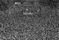 Aerial view of crowd and stage at the March on Washington.jpg 993 × 667; 705 KB
-


.jpg)


.jpg)
.jpg)


.jpg)
.jpg)
.jpg)
.jpg)


,_TENTS.jpg)
_(3198483801).jpg)

.JPG)


.jpg)
.jpg)
.jpg)
.jpg)
.jpg)
.jpg)
.jpg)
.jpg)
.jpg)


