Category:Aerial photographs of Mozambique
Jump to navigation
Jump to search
Countries of Africa: Algeria · Angola · Benin · Botswana · Burkina Faso · Burundi · Cameroon · Cape Verde · Central African Republic · Chad · Democratic Republic of the Congo · Djibouti · Egypt‡ · Equatorial Guinea · Eritrea · Ethiopia · The Gambia · Ghana · Guinea · Guinea-Bissau · Ivory Coast · Kenya · Lesotho · Liberia · Libya · Madagascar · Malawi · Mali · Mauritania · Mauritius · Morocco · Mozambique · Namibia · Niger · Nigeria · Rwanda · São Tomé and Príncipe · Senegal · Seychelles · Sierra Leone · Somalia · South Africa · South Sudan · Sudan · Tanzania · Togo · Tunisia · Uganda · Zambia · Zimbabwe
Limited recognition: Somaliland – Other areas: Canary Islands · Madeira · Mayotte · Réunion · Western Sahara
‡: partly located in Africa
Limited recognition: Somaliland – Other areas: Canary Islands · Madeira · Mayotte · Réunion · Western Sahara
‡: partly located in Africa
Subcategories
This category has the following 2 subcategories, out of 2 total.
B
- Aerial photographs of Beira (28 F)
Media in category "Aerial photographs of Mozambique"
The following 36 files are in this category, out of 36 total.
-
 2010-10-18 10-46-48 Mozambique Gaza Dambe.jpg 4,288 × 2,848; 4.27 MB
-
 2010-10-18 10-47-14 Mozambique Maputo Estevel.jpg 4,255 × 2,827; 4.01 MB
-
 2010-10-18 10-50-02 Mozambique Maputo Chefe Mucapane.jpg 4,071 × 2,703; 4.3 MB
-
 2010-10-18 10-50-47 Mozambique Maputo Manguissa.jpg 4,213 × 2,340; 3.31 MB
-
 2010-10-18 10-51-00 Mozambique Maputo M. Batista.jpg 3,757 × 2,347; 2.95 MB
-
 2010-10-18 10-51-30 Mozambique Maputo M. Batista.jpg 4,191 × 2,783; 3.95 MB
-
 2010-10-18 10-54-37 Mozambique Maputo Mapoissane.jpg 4,179 × 2,775; 3.72 MB
-
 2010-10-18 10-54-48 Mozambique Maputo Mapoissane.jpg 4,288 × 2,848; 4.91 MB
-
 2010-10-18 10-54-52 Mozambique Maputo Cassana.jpg 4,288 × 2,848; 5.53 MB
-
 2010-10-18 10-55-00 Mozambique Maputo Macamo.jpg 4,203 × 2,791; 7.04 MB
-
 2010-10-18 10-55-36 Mozambique Maputo Chamanculo ”B”.jpg 4,201 × 2,775; 4.93 MB
-
 2010-10-18 10-55-38 Mozambique Maputo Chamanculo ”B”.jpg 4,288 × 2,848; 6.32 MB
-
 2010-10-18 10-55-44 Mozambique Maputo Chamanculo ”B”.jpg 4,244 × 2,772; 4.72 MB
-
 2010-10-18 10-56-01 Mozambique Maputo Aeroporto ”B”.jpg 3,968 × 2,753; 4.84 MB
-
 2010-10-18 10-56-03 Mozambique Maputo Aeroporto ”B”.jpg 4,123 × 2,739; 4.29 MB
-
 2010-10-18 10-56-09 Mozambique Maputo Aeroporto ”B”.jpg 3,494 × 2,523; 3.55 MB
-
 Bazaruto island.jpg 639 × 639; 117 KB
-
 Chókwè.jpg 3,264 × 2,448; 2.8 MB
-
 Helicopter over flooded Central Mozambique.jpg 1,024 × 683; 385 KB
-
 JNB-MRU 22.08.2009 11-59-25.jpg 4,288 × 2,848; 2.98 MB
-
 JNB-MRU 22.08.2009 12-00-57.jpg 4,288 × 2,848; 3.71 MB
-
 JNB-MRU 22.08.2009 12-01-07.jpg 4,288 × 2,848; 3.26 MB
-
 JNB-MRU 22.08.2009 12-01-51.jpg 4,288 × 2,848; 3.24 MB
-
 JNB-MRU 22.08.2009 12-02-06.2009 12-02-7.jpg 4,010 × 2,611; 2.17 MB
-
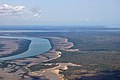
 Limpopo.jpg 1,681 × 1,105; 533 KB
-
 Maputo - Xipamanine.jpg 1,747 × 1,343; 744 KB
-
 Maputo outskirts - March 2005.jpg 2,304 × 1,704; 932 KB
-
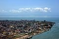
 Maputo seen from southeast - October 2006.jpg 1,973 × 1,313; 2.13 MB
-
 Maputo, Mozambique view.jpg 1,280 × 960; 317 KB
-
 Maputo-aerial.jpg 1,000 × 667; 655 KB
-
 MH-53M Pave Low IV refueling from a MC-130P - 000320-F-5772H-011.jpg 1,728 × 1,152; 938 KB
-
 Mozambique flood.jpg 2,560 × 1,920; 564 KB
-
 Mozambique preflood.jpg 2,560 × 1,920; 669 KB
-
 Operation ATLAS RESPONSE.jpg 1,728 × 1,152; 420 KB
-
 Satellite image of Mozambique in September 2002.jpg 4,977 × 6,715; 4.45 MB
-
 Zambezi River Delta.jpg 720 × 480; 148 KB


