Category:Aerial photographs of Botswana
Jump to navigation
Jump to search
Countries of Africa: Algeria · Angola · Benin · Botswana · Burkina Faso · Burundi · Cameroon · Cape Verde · Central African Republic · Chad · Democratic Republic of the Congo · Djibouti · Egypt‡ · Equatorial Guinea · Eritrea · Ethiopia · The Gambia · Ghana · Guinea · Guinea-Bissau · Ivory Coast · Kenya · Lesotho · Liberia · Libya · Madagascar · Malawi · Mali · Mauritania · Mauritius · Morocco · Mozambique · Namibia · Niger · Nigeria · Rwanda · São Tomé and Príncipe · Senegal · Seychelles · Sierra Leone · Somalia · South Africa · South Sudan · Sudan · Tanzania · Togo · Tunisia · Uganda · Zambia · Zimbabwe
Limited recognition: Somaliland – Other areas: Canary Islands · Madeira · Mayotte · Réunion · Western Sahara
‡: partly located in Africa
Limited recognition: Somaliland – Other areas: Canary Islands · Madeira · Mayotte · Réunion · Western Sahara
‡: partly located in Africa

English: Aerial photographs of Botswana
Suomi: Ilmakuvia Botswanasta
Subcategories
This category has the following 5 subcategories, out of 5 total.
Media in category "Aerial photographs of Botswana"
The following 13 files are in this category, out of 13 total.
-
 Above the skies.jpg 2,961 × 3,620; 3.66 MB
-
 Buitepos Namibia (2019).jpg 5,472 × 3,648; 14.39 MB
-
-
 Gaberone aerial.jpg 3,264 × 2,448; 8.06 MB
-
 GaberoneAerial.jpg 3,648 × 2,736; 2.29 MB
-
 Kasane (2019).jpg 3,568 × 2,112; 4 MB
-
 Kasane aerial view (2019).jpg 4,896 × 3,264; 8.53 MB
-
 Kavimba Botswana (2017).jpg 4,557 × 3,062; 7.93 MB
-
 Legotlhwana aerial view.jpg 4,896 × 3,264; 7.1 MB
-
 Legotlhwana.jpg 4,896 × 3,264; 9.26 MB
-
-

-
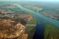
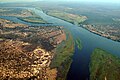 Zambezi River at junction of Namibia, Zambia, Zimbabwe & Botswana.jpg 600 × 399; 100 KB

.jpg)
,_vista_a%C3%A9rea_del_delta_del_Okavango,_Botsuana,_2018-08-01,_DD_30.jpg)


.jpg)
.jpg)
.jpg)


