Category:Aerial photographs of East Dunbartonshire
Jump to navigation
Jump to search
Council areas (municipalities) of Scotland: Aberdeen · Aberdeenshire · Angus · Argyll and Bute · Clackmannanshire · Dumfries and Galloway · Dundee · East Ayrshire · East Dunbartonshire · East Lothian · East Renfrewshire · Edinburgh · Falkirk · Fife · Glasgow · Highland · Inverclyde · Midlothian · Moray · North Ayrshire · North Lanarkshire · Outer Hebrides · Orkney Islands · Perth and Kinross · Renfrewshire · Scottish Borders · Shetland Islands · South Ayrshire · South Lanarkshire · Stirling · West Dunbartonshire · West Lothian
Media in category "Aerial photographs of East Dunbartonshire"
The following 43 files are in this category, out of 43 total.
-
 Aerial view of Renfrew 04.jpg 4,032 × 3,024; 1.92 MB
-
 Aerial view of Renfrew 05.jpg 4,032 × 3,024; 2.33 MB
-
 Aerial view of Renfrew 06.jpg 4,032 × 3,024; 2.26 MB
-
 Aerial view of Renfrew 07.jpg 4,032 × 3,024; 2.37 MB
-
 Antonine Wall and Glasgow Bridge from the air (geograph 2965671).jpg 640 × 191; 61 KB
-
 Auchenhowie from the air (geograph 6262776).jpg 1,024 × 768; 314 KB
-
 Bearsden Academy from the air (geograph 5599775).jpg 640 × 480; 187 KB
-
 Bearsden and Hillfoot from the air (geograph 2988025).jpg 640 × 480; 178 KB
-
 Bearsden from the air (geograph 5310285).jpg 640 × 480; 173 KB
-
 Bishopbriggs from the air (geograph 5374041).jpg 640 × 480; 202 KB
-
 Bishopbriggs from the air (geograph 5374043) (cropped).jpg 444 × 333; 108 KB
-
 Bishopbriggs from the air (geograph 5374043).jpg 640 × 480; 197 KB
-
 Bishopbriggs from the air (geograph 5716150).jpg 640 × 480; 218 KB
-
 Bishopbriggs from the air (geograph 5716293).jpg 640 × 480; 238 KB
-
 Castle Circle and Village Green (geograph 3500543).jpg 640 × 360; 209 KB
-
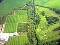
 Celtic FC Training Centre from the air (geograph 4915257).jpg 640 × 480; 145 KB
-
 Celtic FC training ground from the air (geograph 5221154).jpg 640 × 480; 121 KB
-
 Celtic FC training ground from the air (geograph 5221158).jpg 640 × 480; 136 KB
-
 Celtic FC training ground from the air (geograph 5629161).jpg 640 × 480; 138 KB
-
 Dobies Garden World from the air (geograph 2988009).jpg 640 × 480; 115 KB
-
 Douglas Academy from the air (geograph 7424898).jpg 1,600 × 1,200; 735 KB
-
 HM Prison Low Moss from the air (geograph 5679245).jpg 640 × 480; 151 KB
-
 HMP Low Moss from the air (Geograph 2518598 by Thomas Nugent).jpg 587 × 640; 111 KB
-
 HMP Low Moss from the air, 2012 (geograph 2965671).jpg 640 × 480; 141 KB
-
 Kirkintilloch town centre - geograph.org.uk - 881110.jpg 640 × 423; 98 KB
-
 Lennox Castle shapes from the air (geograph 5179933).jpg 640 × 480; 160 KB
-
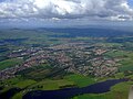
 Lennoxtown from the air (geograph 4915245).jpg 640 × 480; 171 KB
-
 Lennoxtown from the air (geograph 5179924).jpg 480 × 640; 157 KB
-
 Lennoxtown from the air (geograph 5221164).jpg 640 × 480; 199 KB
-
 Lennoxtown from the air (geograph 5629165).jpg 640 × 480; 189 KB
-
 Lennoxtown from the air (geograph 5629207).jpg 640 × 428; 140 KB
-
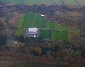 Lennoxtown training complex from the air.jpg 640 × 504; 128 KB
-
 Lenzie from the air (Geograph 2518981 by Thomas Nugent).jpg 640 × 480; 88 KB
-
 Milngavie from the air (geograph 2988019).jpg 640 × 480; 158 KB
-
 Milngavie from the air (geograph 5609681).jpg 640 × 480; 249 KB
-
 Milngavie reservoirs and waterworks - geograph.org.uk - 1195464.jpg 640 × 480; 48 KB
-
 Murray Park from the air (geograph 3197503).jpg 586 × 640; 188 KB
-
 Murray Park, Milngavie (geograph 4533327).jpg 3,264 × 2,448; 4.04 MB
-
 Torrance from the air (geograph 2965680).jpg 615 × 414; 136 KB
-
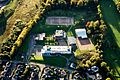 Turnbull High aerial.jpg 885 × 589; 122 KB
-
 Twechar from the air (geograph 4517301).jpg 640 × 480; 133 KB
-
 Waverley Park, Kirkintilloch - geograph.org.uk - 881098.jpg 640 × 512; 87 KB
-
 Westerton from the air (geograph 6125190).jpg 768 × 1,024; 439 KB


.jpg)
.jpg)
.jpg)
.jpg)
.jpg)
_(cropped).jpg)
.jpg)
.jpg)
.jpg)
.jpg)
.jpg)
.jpg)
.jpg)
.jpg)
.jpg)
.jpg)
.jpg)
.jpg)
.jpg)

.jpg)
.jpg)
.jpg)
.jpg)
.jpg)
.jpg)

.jpg)
.jpg)
.jpg)

.jpg)
.jpg)
.jpg)

.jpg)

.jpg)
.jpg)