Category:1956 United States Senate election maps
Jump to navigation
Jump to search
Media in category "1956 United States Senate election maps"
The following 29 files are in this category, out of 29 total.
-
 1956 Florida senatorial election results map by county.svg 744 × 727; 422 KB
-
-

-
-

-

-

-

-
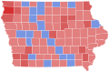 1956 United States Senate election in Iowa results map by county.svg 810 × 532; 23 KB
-

-

-

-

-

-
-

-
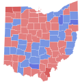 1956 United States Senate election in Ohio results map by county.svg 744 × 744; 213 KB
-

-
-
 1956 United States Senate election in South Carolina results map by county.svg 2,831 × 2,257; 44 KB
-

-

-
 1956 United States Senate Election in West Virginia by County.svg 512 × 486; 12 KB
-
-
 1956 United States Senate elections results map.svg 959 × 593; 59 KB
-

-
 Oregon 1956 US Senator.svg 806 × 601; 105 KB
-
 Oregon Senate Election Results by County, 1956.png 2,000 × 1,516; 209 KB
-
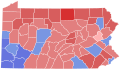
 Pennsylvania Senate Election Results by County, 1956.png 2,000 × 1,166; 229 KB


