Category:1930s maps of Japan
Jump to navigation
Jump to search
Countries of Asia: Afghanistan · Armenia‡ · Azerbaijan‡ · Cambodia · People's Republic of China · Egypt‡ · Georgia‡ · India · Indonesia‡ · Iran · Iraq · Israel · Japan · Jordan · Lebanon · Philippines · Russia‡ · Syria · Thailand · Turkey‡ · Vietnam
Limited recognition: Taiwan · State of Palestine
‡: partly located in Asia
Limited recognition: Taiwan · State of Palestine
‡: partly located in Asia
Subcategories
This category has the following 7 subcategories, out of 7 total.
- 1934 maps of Japan (1 F)
N
- Nijūmanbun no ichi teikokuzu (1 F)
Media in category "1930s maps of Japan"
The following 16 files are in this category, out of 16 total.
-
 1930 Map of the Republic of China.JPG 1,171 × 817; 272 KB
-
 Asia 1932.jpg 8,315 × 9,984; 12.4 MB
-
 1932 Japanese map of China.jpg 4,793 × 7,000; 8.1 MB
-

-
 Battle of Shiroyama map.jpg 1,200 × 910; 357 KB
-
 1936 Japanese anti Communist propaganda map of East Asia.tif 10,951 × 14,792; 463.47 MB
-
 1937 Japanese pictorial map of East Asia during the Second Sino-Japanese War - verso.tif 9,400 × 12,851; 345.63 MB
-
 1937年的臺北(臺北飛行場)-那霸-福岡民航路線圖 Airline Map of Taipei - Naha - Fukuoka.jpg 570 × 185; 104 KB
-

-

-
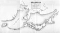 Japanese airlines in 1936.jpg 4,465 × 2,465; 1.21 MB
-
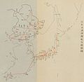 Japanese airlines in 1937.jpg 3,097 × 3,009; 1.22 MB
-
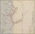 Japanese airlines in 1939.jpg 3,153 × 3,065; 1.37 MB
-
 Lange diercke sachsen asien japan.jpg 1,564 × 1,526; 1.22 MB
-
 Sightseeing along the Nankai Railway in 1936.jpg 5,471 × 5,715; 6.4 MB
-
 Tsunohazu 1chome map 1937.jpg 600 × 568; 90 KB


-%E9%82%A3%E9%9C%B8-%E7%A6%8F%E5%B2%A1%E6%B0%91%E8%88%AA%E8%B7%AF%E7%B7%9A%E5%9C%96_Airline_Map_of_Taipei_-_Naha_-_Fukuoka.jpg)