Category:1920s maps of Indonesia
Jump to navigation
Jump to search
Countries of Asia: Armenia‡ · Azerbaijan‡ · Cambodia · People's Republic of China · Egypt‡ · Georgia‡ · India · Indonesia‡ · Iran · Iraq · Israel · Japan · Jordan · Laos · Lebanon · Philippines · Russia‡ · Syria · Turkey‡ · Vietnam
Limited recognition: Taiwan · State of Palestine
‡: partly located in Asia
Limited recognition: Taiwan · State of Palestine
‡: partly located in Asia
Subcategories
This category has the following 3 subcategories, out of 3 total.
- 1922 maps of Indonesia (1 F)
- 1928 maps of Indonesia (2 F)
J
- 1920s maps of Java (10 F)
Media in category "1920s maps of Indonesia"
The following 13 files are in this category, out of 13 total.
-
 1920s Timor Island Map.jpg 2,737 × 1,936; 1.08 MB
-
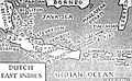 1925 Air Routes of the Dutch East Indies.jpg 960 × 592; 286 KB
-
-
 Oceania, mapa politico - trazado por J. Forest... - btv1b53066540p.jpg 15,967 × 12,391; 34.12 MB
-
 Oceânia politica traçado - por J. Forest ; Revisao de Pimentel ; e Casquilho... - btv1b530665414.jpg 15,821 × 12,362; 34.9 MB
-
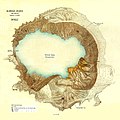 Kawah Ijen.JPG 1,503 × 1,500; 516 KB
-
 Map of the Government Railways of the Neth. East Indies.jpg 14,823 × 11,049; 54.91 MB
-

-
 Peta Jawa Barat 1922.jpg 581 × 304; 31 KB
-
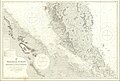
 Peta Pulau Jawa 1922.jpg 3,232 × 1,689; 735 KB
-
 Raung-Krater mit Bergsturz.JPG 938 × 642; 209 KB
-
 Sf bandjardawa pada peta tahun 1942.jpg 1,500 × 1,500; 814 KB
-


.jpg)