Category:1920s maps of India
Jump to navigation
Jump to search
Countries of Asia: Armenia‡ · Azerbaijan‡ · Cambodia · People's Republic of China · Egypt‡ · Georgia‡ · India · Indonesia‡ · Iran · Iraq · Israel · Japan · Jordan · Laos · Lebanon · Philippines · Russia‡ · Syria · Turkey‡ · Vietnam
Limited recognition: Taiwan · State of Palestine
‡: partly located in Asia
Limited recognition: Taiwan · State of Palestine
‡: partly located in Asia
Subcategories
This category has the following 10 subcategories, out of 10 total.
- 1920 maps of India (1 F)
- 1921 maps of India (2 F)
- 1922 maps of India (4 F)
- 1923 maps of India (1 F)
- 1924 maps of India (3 F)
- 1925 maps of India (empty)
- 1926 maps of India (empty)
- 1927 maps of India (empty)
- 1928 maps of India (empty)
- 1929 maps of India (empty)
Media in category "1920s maps of India"
The following 6 files are in this category, out of 6 total.
-
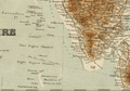 1920 Maldives map BPL 12595 detail.png 1,069 × 748; 1.53 MB
-
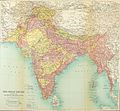 1922 Map of India by Bartholomew in Imperial Gazetteer of India.jpg 3,729 × 3,449; 4.79 MB
-
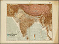
 1925 Air Routes of British India.jpg 1,224 × 639; 216 KB
-
 India 1920.jpg 2,000 × 1,499; 3.25 MB
-
 India orographic map - Longmans 1924.jpg 1,216 × 1,527; 362 KB
-
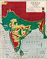
 Sir Patrick Hehir, Malaria in India Wellcome L0026242.jpg 1,554 × 1,344; 764 KB


