Category:1903 maps of Massachusetts
Jump to navigation
Jump to search
States of the United States: California · Hawaii · Idaho · Illinois · Indiana · Iowa · Kentucky · Louisiana · Maryland · Massachusetts · Michigan · Minnesota · Missouri · Nebraska · New York · Oklahoma · Pennsylvania · South Dakota · Utah · Vermont · Washington · Wisconsin · Wyoming – Washington, D.C.
| ← 1900 1901 1902 1903 1904 1905 1906 1907 1908 1909 → |
Media in category "1903 maps of Massachusetts"
The following 20 files are in this category, out of 20 total.
-
 1903 Boston map.jpg 7,960 × 11,560; 25.49 MB
-
 1903 Boston suburban railroads map.jpg 4,131 × 3,180; 4.47 MB
-
 1903 map of Boston proper.png 2,436 × 3,500; 16.99 MB
-
 1903 Map of Salem and surrounding places (7557369652).jpg 7,605 × 5,602; 41.1 MB
-
 Boston (2675599896).jpg 1,487 × 2,000; 2.76 MB
-
 Boston 1903 map.jpg 1,264 × 1,960; 1.57 MB
-
 Boston Harbor (7557396602).jpg 4,337 × 2,987; 13.61 MB
-
 Boston, the place and the people (1903) (14763949052).jpg 1,851 × 2,859; 437 KB
-
 East Boston Tunnel map and profile, 1903.jpg 3,408 × 1,782; 1.78 MB
-
 Map Boston Bacon1903.png 393 × 447; 72 KB
-
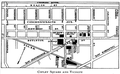 Map CopleySq Boston Bacon1903.png 638 × 391; 100 KB
-
 Map of Cambridge in the vicinity of Harvard College 1903-4 (3855463045).jpg 2,000 × 1,683; 3.39 MB
-
 Map of the city of Boston and vicinity (3721026240).jpg 1,013 × 1,024; 1.04 MB
-
 Map of the city of Boston and vicinity (8253081596).jpg 1,804 × 2,000; 3.66 MB
-
 Map of the village of Great Barrington, Mass. LOC 76692095.jpg 7,412 × 7,809; 5.79 MB
-
 Map of the village of Great Barrington, Mass. LOC 76692095.tif 7,412 × 7,809; 165.6 MB
-
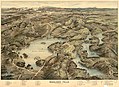 Middlesex Fells. LOC gm72003086.jpg 8,266 × 6,027; 9.95 MB
-
 Middlesex Fells. LOC gm72003086.tif 8,266 × 6,027; 142.53 MB
-
 NIE 1905 Massachusetts.jpg 2,101 × 1,744; 862 KB
-
 Plan of Boston showing existing ways and owners on December 25, 1645 (2675221226).jpg 2,000 × 1,599; 2.52 MB


.jpg)
.jpg)

.jpg)
_(14763949052).jpg)


.jpg)
.jpg)
.jpg)


.jpg)