Category:1910 maps of Massachusetts
Jump to navigation
Jump to search
States of the United States: California · Idaho · Illinois · Indiana · Iowa · Louisiana · Massachusetts · Michigan · Minnesota · Missouri · New Jersey · New York · North Dakota · Ohio · Oklahoma · Pennsylvania · South Dakota · Texas · Utah · Vermont · Virginia · Wisconsin – Washington, D.C.
| ← 1910 1911 1912 1913 1914 1915 1916 1917 → |
Media in category "1910 maps of Massachusetts"
The following 22 files are in this category, out of 22 total.
-
 1910 BERy extensions map.jpg 2,127 × 2,928; 1.93 MB
-
 1910 BERy system map (2).png 2,722 × 3,500; 7.3 MB
-
 1910 BERy system map.png 2,417 × 3,500; 21.47 MB
-
 1910 map of Boston subway including proposed Riverbank Subway.jpg 9,032 × 4,808; 5.86 MB
-
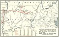
 1910 map of Salem tunnel proposal.jpg 2,674 × 573; 374 KB
-
 1910 Tri-state Trolley Map.jpg 2,864 × 4,740; 3.4 MB
-
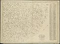
 Annual report of the Massachusetts Highway Commission (1912) (14753576701).jpg 3,230 × 2,022; 1.3 MB
-
 BERy surface lines constructed between 1898 and 1910.png 2,629 × 3,500; 11.12 MB
-
 Connecticut Valley Street Railway 1910 map.jpg 1,518 × 957; 376 KB
-

-

-

-

-
 Historical map of the north and central parts of Old Boston (3121051224).jpg 2,000 × 1,461; 3.03 MB
-
 Map of Brookline and vicinity (9474974168).jpg 799 × 594; 138 KB
-
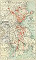
 Metropolitan Water District map (Boston, MA, 1910).jpg 2,571 × 1,115; 1.26 MB
-
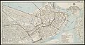
 Provincetown, Mass. LOC 79690261.jpg 5,384 × 3,472; 3.3 MB
-
 Provincetown, Mass. LOC 79690261.tif 5,384 × 3,472; 53.48 MB
-
 Sketch map of Boston and the Public Library system (3121051380).jpg 1,726 × 2,000; 3.21 MB
-
 Sketch map of Boston and the Public Library system (3121051550).jpg 1,419 × 2,000; 2.85 MB
-
 Town of Westport. LOC gm71000573.jpg 9,603 × 6,578; 6.79 MB
-
 Town of Westport. LOC gm71000573.tif 9,603 × 6,578; 180.73 MB

.png)


_(14753576701).jpg)


_The_scalloping_grounds.jpeg)
.jpg)
.jpg)
.jpg)

.jpg)
.jpg)
