Category:1861 maps
Jump to navigation
Jump to search
| ← · 1860 · 1861 · 1862 · 1863 · 1864 · 1865 · 1866 · 1867 · 1868 · 1869 · → |
Deutsch: Karten mit Bezug zum Jahr 1861
English: Maps related to the year 1861
Español: Mapas relativos al año 1861
Français : Cartes concernant l’an 1861
Русский: Карты 1861 года
Subcategories
This category has the following 10 subcategories, out of 10 total.
A
- 1861 maps of Africa (22 F)
E
G
N
O
- 1861 maps of Oceania (empty)
S
- 1861 maps of South America (4 F)
Media in category "1861 maps"
The following 200 files are in this category, out of 512 total.
(previous page) (next page)-
 (Battery no. 3) ; - outwork no. 1 ; outwork no. 2. LOC lva0000110.jpg 4,872 × 3,907; 1.24 MB
-
 (Battery no. 3) ; - outwork no. 1 ; outwork no. 2. LOC lva0000110.tif 4,872 × 3,907; 54.46 MB
-
 (Map of the Potomac River). LOC gvhs01.vhs00125.tif 810 × 1,041; 2.41 MB
-

-
 (Topographical map of part of Washington D.C.). LOC 88694009.tif 12,325 × 10,200; 359.67 MB
-

-
 BOGUSŁAWSKI(1861) Das Siedlungsgebiet der Sorben im 19. Jahrhundert in der Lausitz.jpg 4,872 × 4,148; 8.85 MB
-

-
 MÖLLHAUSEN(1861) 2.172 Karte (Gesamtansicht).jpg 1,075 × 850; 214 KB
-

-

-
 1861 Johnson Map of South America - Geographicus - AmerSouth-j-1862.jpg 2,814 × 4,000; 2.3 MB
-

-

-

-

-
 19th centuary map of Elmsted.png 467 × 420; 442 KB
-
 19th Century map of Langdon (East Langdon).png 650 × 394; 576 KB
-
 1fi76 plan de Rennes.jpg 5,685 × 4,301; 2.4 MB
-
-

-
 A map of the cotton kingdom and its dependencies in America (5490089850).jpg 2,000 × 1,362; 2.83 MB
-
 A new bird's eye view of the seat of war. LOC 99448467.jpg 5,424 × 4,223; 5.12 MB
-
 A new bird's eye view of the seat of war. LOC 99448467.tif 5,424 × 4,223; 65.53 MB
-
 A new military map of the seat of war LOC 99447027.jpg 4,624 × 4,056; 2.96 MB
-
 A new military map of the seat of war LOC 99447027.tif 4,624 × 4,056; 53.66 MB
-
 A reconnaissance of the Potomac River from Point Lookout to Washington City LOC 99447060.jpg 7,988 × 9,353; 8.67 MB
-
 A reconnaissance of the Potomac River from Point Lookout to Washington City LOC 99447060.tif 7,988 × 9,353; 213.75 MB
-

-
 Admiralty Chart No 2666 St Johns Newfoundland to Halifax with the Outer Banks, Published 1861.jpg 11,911 × 8,074; 12.46 MB
-
 Albert Lionnet, Das Heilige Land (FL6879791 2370370).jpg 2,050 × 2,998; 2.98 MB
-
 Albert Lionnet, Jerusalem (FL6878486 2369877).jpg 2,064 × 3,050; 2.98 MB
-
 Alexander Keith Johnston, Palestine or the Holy Land (FL170208320 2648795).jpg 10,917 × 14,413; 185.2 MB
-
 America map Herakles Lazarides Atlas Athens 1861.jpg 1,429 × 1,760; 2.39 MB
-
 Averill's map of western Va. LOC 99446734.jpg 7,397 × 9,804; 5.97 MB
-
 Averill's map of western Va. LOC 99446734.tif 7,397 × 9,804; 207.48 MB
-
 Badische Hauptbahn aus Bahnkarte Deutschland 1861.png 800 × 1,200; 2.05 MB
-
 Bahnkarte Deutschland 1861.jpg 4,878 × 3,792; 19.41 MB
-
 Battery no. 1 (Powhatan) ; - Battery no. 2 (Marion Hill). LOC lva0000109.jpg 4,894 × 3,906; 1.37 MB
-
 Battery no. 1 (Powhatan) ; - Battery no. 2 (Marion Hill). LOC lva0000109.tif 4,894 × 3,906; 54.69 MB
-
 Battery no. 10 (near the new fair grounds) - total 14 85-100 acres. LOC lva0000118.jpg 4,883 × 3,930; 893 KB
-
 Battery no. 10 (near the new fair grounds) - total 14 85-100 acres. LOC lva0000118.tif 4,883 × 3,930; 54.9 MB
-
 Battery no. 4 and outworks nos. 1 and 2 - Blakey & Stubbs. LOC lva0000111.jpg 4,897 × 3,861; 1.29 MB
-
 Battery no. 4 and outworks nos. 1 and 2 - Blakey & Stubbs. LOC lva0000111.tif 4,897 × 3,861; 54.09 MB
-
 Battery no. 5 (on Stony Run Road) - total contents 10 73-100 acres. LOC lva0000112.jpg 4,768 × 3,180; 1.79 MB
-
 Battery no. 5 (on Stony Run Road) - total contents 10 73-100 acres. LOC lva0000112.tif 4,768 × 3,180; 43.38 MB
-

-
 Battery no. 6 on Mechanicsville Turnpike - total contents 10 69-100 acres. LOC lva0000113.tif 4,744 × 3,163; 42.93 MB
-
 Battery no. 7 on the Meadow bridge road. LOC lva0000115.jpg 4,878 × 3,905; 1.16 MB
-
 Battery no. 7 on the Meadow bridge road. LOC lva0000115.tif 4,878 × 3,905; 54.5 MB
-
 Battery no. 8 (on Mitchell tract road). LOC lva0000116.jpg 4,913 × 3,870; 1.14 MB
-
 Battery no. 8 (on Mitchell tract road). LOC lva0000116.tif 4,913 × 3,870; 54.4 MB
-
 Battery no. 9 (near the Brooke turnpike) - total contents 8 91-100 acres. LOC lva0000117.jpg 4,865 × 3,853; 1.11 MB
-
 Battery no. 9 (near the Brooke turnpike) - total contents 8 91-100 acres. LOC lva0000117.tif 4,865 × 3,853; 53.63 MB
-
 Battle of Lookout Mountain, Tennessee November 24th, 1863. LOC gvhs01.vhs00173.jpg 1,632 × 2,172; 773 KB
-
 Battle of Lookout Mountain, Tennessee November 24th, 1863. LOC gvhs01.vhs00173.tif 1,632 × 2,172; 10.14 MB
-
 Battle of Missionary Ridge or Chickamauga, Tenn. LOC gvhs01.vhs00156.jpg 1,858 × 2,239; 619 KB
-
 Battle of Missionary Ridge or Chickamauga, Tenn. LOC gvhs01.vhs00156.tif 1,858 × 2,239; 11.9 MB
-
 Battle of Mobile Bay map.png 1,000 × 1,428; 1.02 MB
-
 Battle of Rich Mt. LOC 2003629675.jpg 2,003 × 3,060; 810 KB
-
 Battle of Rich Mt. LOC 2003629675.tif 2,003 × 3,060; 17.54 MB
-

-

-

-
 Beijing quan tu. LOC gm71005149.tif 7,705 × 11,733; 258.64 MB
-
 Berkeley County, Virginia LOC lva0000082.jpg 4,644 × 5,637; 2.51 MB
-
 Berkeley County, Virginia LOC lva0000082.tif 4,644 × 5,637; 74.9 MB
-
 Berkeley County, Virginia LOC lva0000083.jpg 5,208 × 5,613; 3.01 MB
-
 Berkeley County, Virginia LOC lva0000083.tif 5,208 × 5,613; 83.64 MB
-

-

-
 Birds eye view of Florida and part of Georgia and Alabama LOC 99447266.tif 9,420 × 6,671; 179.79 MB
-
 Birds eye view of Louisiana, Mississippi, Alabama and part of Florida LOC 99447004.jpg 8,597 × 5,967; 8.94 MB
-
 Birds eye view of Louisiana, Mississippi, Alabama and part of Florida LOC 99447004.tif 8,597 × 5,967; 146.77 MB
-
 Birds eye view of North and South Carolina and part of Georgia. LOC 99447447.jpg 8,876 × 6,646; 9.55 MB
-
 Birds eye view of North and South Carolina and part of Georgia. LOC 99447447.tif 8,876 × 6,646; 168.77 MB
-
 Birds eye view of the Mississippi Valley from Cairo to the Gulf of Mexico LOC 99447018.jpg 7,000 × 10,496; 15.02 MB
-
 Birds eye view of the Mississippi Valley from Cairo to the Gulf of Mexico LOC 99447018.tif 7,000 × 10,496; 210.21 MB
-
-

-
 Birds eye view of Virginia, Maryland, Delaware and the District of Columbia LOC 99447050.jpg 6,304 × 5,623; 6.33 MB
-
 Birds eye view of Virginia, Maryland, Delaware and the District of Columbia LOC 99447050.tif 6,304 × 5,623; 101.42 MB
-
-
 Birds eye view of Virginia, Maryland, Delaware and the District of Columbia. LOC 99447051.tif 9,665 × 7,793; 215.49 MB
-
 Bunkyū kaisei On'edo ōezu (14212962593).jpg 2,207 × 2,000; 2.24 MB
-
 Carl Zimmermann, Versuch einer Construction der Karte von Galiläa (FL19569712 3705620).jpg 13,984 × 16,332; 294.98 MB
-
 Carte du département de la Haute-Savoie - 1861.jpg 9,319 × 6,961; 12.81 MB
-
-

-
 Carte routière du département de l'Oise - 1861.jpg 9,063 × 8,117; 13.06 MB
-
 Carte topographique et itinéraire du département de la Manche - 1861.jpg 6,477 × 9,216; 12.62 MB
-
 CarteEngien1861.jpg 1,806 × 1,304; 2.12 MB
-
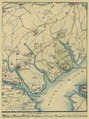
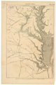
 Chesapeake Bay from its head to Potomac River, LOC 99447098.jpg 11,758 × 9,432; 14.04 MB
-
 Chesapeake Bay from its head to Potomac River, LOC 99447098.tif 11,758 × 9,432; 317.29 MB
-
 China and Japan LOC 2006700180.jpg 9,434 × 7,432; 12.04 MB
-
 China and Japan LOC 2006700180.tif 9,434 × 7,432; 200.6 MB
-
 Christian Johansen Amrum Karte 1861.jpg 2,105 × 3,120; 5.69 MB
-

-

-
 Civil War, 1861-1862 LOC 91684691.jpg 2,160 × 1,686; 525 KB
-
 Civil War, 1861-1862 LOC 91684691.tif 2,160 × 1,686; 10.42 MB
-
 Colton's China. LOC 2006629382.tif 6,904 × 5,795; 114.47 MB
-

-

-

-
 Colton's Topographical map of Missouri, Kentucky & Tennessee. LOC 98685226.jpg 10,336 × 6,717; 12.81 MB
-
 Colton's Topographical map of Missouri, Kentucky & Tennessee. LOC 98685226.tif 10,336 × 6,717; 198.63 MB
-

-
 Crete-Johnston-1861.png 1,830 × 907; 2.93 MB
-
 Csango and Székely settlements in the United Principalities, 1861.svg 9,632 × 7,971; 351 KB
-
 Detailed plan of Andersonville Prison Camp.jpg 1,874 × 2,939; 1.05 MB
-
 District of Columbia and the seat of war on the Potomac. LOC 88694227.jpg 4,047 × 2,689; 2.29 MB
-
 District of Columbia and the seat of war on the Potomac. LOC 88694227.tif 4,047 × 2,689; 31.14 MB
-
 Europa 1861-es.svg 1,340 × 1,363; 1.03 MB
-
 Europa 1861.svg 1,340 × 1,363; 565 KB
-

-

-
 Finca Casa-Puerta, abajo a la derecha, plano de Castro, 1861 (cropped).jpg 1,243 × 977; 239 KB
-
 Fort Anderson, Paducah, Ky. LOC 2008627280.jpg 10,936 × 14,762; 15.69 MB
-
 Fort Anderson, Paducah, Ky. LOC 2008627280.tif 10,936 × 14,762; 461.88 MB
-
 Fort Pickens map 1861.png 2,349 × 2,181; 3.45 MB
-
 Fort Sumter LOC 95682627.jpg 10,099 × 4,796; 8.91 MB
-
 Fort Sumter LOC 95682627.tif 10,099 × 4,796; 138.57 MB
-
 Fort Sumter LOC 96683851.jpg 10,122 × 4,786; 8.93 MB
-
 Fort Sumter LOC 96683851.tif 10,122 × 4,786; 138.6 MB
-
 Fort Sumter LOC 98683680.jpg 10,122 × 4,771; 9.04 MB
-
 Fort Sumter LOC 98683680.tif 10,122 × 4,771; 138.16 MB
-
 Fort Sumter National Monument LOC 2007633751.jpg 10,130 × 4,767; 9.83 MB
-
 Fort Sumter National Monument LOC 2007633751.tif 10,130 × 4,767; 138.16 MB
-
 Fort Sumter National Monument LOC 2007633869.jpg 10,076 × 4,782; 9.05 MB
-
 Fort Sumter National Monument LOC 2007633869.tif 10,076 × 4,782; 137.85 MB
-
 Fort Sumter National Monument LOC 2008626738.jpg 10,153 × 4,786; 10.36 MB
-
 Fort Sumter National Monument LOC 2008626738.tif 10,153 × 4,786; 139.02 MB
-

-

-
 Fort Sumter National Monument, South Carolina LOC 2008621677.jpg 10,085 × 4,746; 8.15 MB
-
 Fort Sumter National Monument, South Carolina LOC 2008621677.tif 10,085 × 4,746; 136.94 MB
-
 Fort Sumter National Monument, South Carolina LOC 2008627711.jpg 5,968 × 3,432; 3.25 MB
-
 Fort Sumter National Monument, South Carolina LOC 2008627711.tif 5,968 × 3,432; 58.6 MB
-

-

-
 Frank Leslies war maps (5960834531).jpg 2,000 × 1,408; 2.58 MB
-
 Frank Leslies war maps (5960834845).jpg 2,000 × 1,427; 2.42 MB
-
 Frank Leslies war maps (5961393006).jpg 2,000 × 1,415; 2.53 MB
-
 Frank Leslies war maps (5961393320).jpg 2,000 × 1,429; 2.68 MB
-
-

-

-

-

-

-
 Georgia. LOC gvhs01.vhs00031.jpg 1,836 × 2,134; 506 KB
-
 Gloucester Point Fort, Richmond, 20 September 1861. LOC 2005625005.jpg 2,468 × 3,166; 749 KB
-
 Gloucester Point Fort, Richmond, 20 September 1861. LOC 2005625005.tif 2,468 × 3,166; 22.36 MB
-

-

-

-
 Hampton Roads, Virginia (4231293839).jpg 2,000 × 1,845; 3.14 MB
-
 Herald Despatch Premium Map of Logan County. LOC 2013593106.jpg 9,529 × 13,038; 18.92 MB
-
 Herald Despatch Premium Map of Logan County. LOC 2013593106.tif 9,529 × 13,038; 355.45 MB
-
 Highland Co. & notes at foot of North Mt. LOC 99446748.jpg 3,195 × 2,388; 941 KB
-
 Highland Co. & notes at foot of North Mt. LOC 99446748.tif 3,195 × 2,388; 21.83 MB
-

-

-
 Ivy City 1861.jpg 878 × 639; 341 KB
-

-
-
 Jouvet et Cie. Grece. Caucase et Crimee. 1882. (A).jpg 3,128 × 1,966; 1.83 MB
-
 Library site - (Capitol Hill, Washington D.C.). LOC 88690895.jpg 2,500 × 3,873; 764 KB
-
 Library site - (Capitol Hill, Washington D.C.). LOC 88690895.tif 2,500 × 3,873; 27.7 MB
-
 Lloyd's official map of Missouri LOC 99448361.jpg 10,014 × 8,112; 9.63 MB
-
 Lloyd's official map of Missouri LOC 99448361.tif 10,014 × 8,112; 232.41 MB
-
 Lloyd's official map of Missouri LOC 99448362.jpg 8,956 × 7,764; 10.85 MB
-
 Lloyd's official map of Missouri LOC 99448362.tif 8,956 × 7,764; 198.94 MB
-

-

-
 Lloyds military maps showing the principal places of interest (5961377248).jpg 1,513 × 2,000; 2.78 MB
-
 Louis-Alphonse de Mandrot, Terre Sainte (FL6879804 2368754).jpg 1,903 × 3,084; 3.06 MB
-

-
-
 Map of Chattanooga and vicinity, Tenn. LOC gvhs01.vhs00157.jpg 1,859 × 2,212; 676 KB
-
 Map of Chattanooga and vicinity, Tenn. LOC gvhs01.vhs00157.tif 1,859 × 2,212; 11.77 MB
-

-

-
 Map of Fortress Monroe and surroundings. LOC 99439161.jpg 2,354 × 3,204; 1.26 MB
-
 Map of Fortress Monroe and surroundings. LOC 99439161.tif 2,354 × 3,204; 21.58 MB
-
 Map of Jerusalem (FL6880189 2369613).jpg 2,280 × 2,731; 2.26 MB
-
 Map of Lucas County, Ohio, 1861.jpg 15,868 × 15,646; 51.74 MB
-
 Map of Monmouth County, New Jersey - from actual surveys LOC 2012593678.jpg 17,608 × 12,419; 27.86 MB
-
 Map of Monmouth County, New Jersey - from actual surveys LOC 2012593678.tif 17,608 × 12,419; 625.63 MB
-

-
-
 Map of northern military movements- between New York & St. Louis LOC 99447037.jpg 3,054 × 1,816; 1.26 MB
-
 Map of northern military movements- between New York & St. Louis LOC 99447037.tif 3,054 × 1,816; 15.87 MB
-

-

-

-

-

-
_;_-_outwork_no._1_;_outwork_no._2._LOC_lva0000110.jpg)
_Das_Siedlungsgebiet_der_Sorben_vom_7._bis_11._Jahrhundert_in_Mitteldeutschland.jpg)
_Das_Siedlungsgebiet_der_Sorben_im_19._Jahrhundert_in_der_Lausitz.jpg)
_1.472_Kartenskizzen_zur_Abgrenzung_der_Indianerst%C3%A4mme_entlang_des_Flusslaufes_des_Colorado_River.jpg)
_2.172_Karte_(Gesamtansicht).jpg)


_-_Geographicus_-_SeatofWar-schaus-1861.jpg)


.png)


.jpg)


.jpg)

.jpg)
.jpg)
.jpg)


_;_-_Battery_no._2_(Marion_Hill)._LOC_lva0000109.jpg)
_-_total_14_85-100_acres._LOC_lva0000118.jpg)

_-_total_contents_10_73-100_acres._LOC_lva0000112.jpg)


._LOC_lva0000116.jpg)
_-_total_contents_8_91-100_acres._LOC_lva0000117.jpg)


.jpg)
_Ga.,_with_5_mile_distance_lines_in_circles_round_Beaufort,_and_R.R._connections,_roads,_etc._etc._LOC_99448811.jpg)


.jpg)
.jpg)


.jpg)


_map_of_Gettysburg_battle_field_in_4_sheets,_being_portions_of_sheets_2_and_3_lying_S._%26_S.W._of_the_town_of_Gettysburg._LOC_99446453.jpg)
.jpg)


,_France_-_Geographicus_-_Corsica-levasseur-1861.jpg)
_-_Geographicus_-_Gironde-levasseur-1861.jpg)
.jpg)
.jpg)
.jpg)
.jpg)


.jpg)
.jpg)


.jpg)
.jpg)
._LOC_88690895.jpg)


.jpg)
.jpg)


.jpg)


_Union_picket_lines,_March_186(1)._LOC_gvhs01.vhs00002.jpg)


