Category:1850s maps of Maryland
Jump to navigation
Jump to search
States of the United States: Alabama · Alaska · Arizona · Arkansas · California · Colorado · Connecticut · Delaware · Florida · Georgia · Illinois · Indiana · Iowa · Kansas · Kentucky · Louisiana · Maine · Maryland · Massachusetts · Michigan · Minnesota · Mississippi · Missouri · Montana · Nebraska · Nevada · New Hampshire · New Jersey · New Mexico · New York · North Carolina · North Dakota · Ohio · Oklahoma · Oregon · Pennsylvania · Rhode Island · South Carolina · South Dakota · Tennessee · Texas · Utah · Vermont · Virginia · Washington · Wisconsin · Wyoming – Washington, D.C.
Puerto Rico
Puerto Rico
Subcategories
This category has the following 3 subcategories, out of 3 total.
- 1850 maps of Maryland (4 F)
- 1853 maps of Maryland (1 F)
- 1856 maps of Maryland (2 F)
Media in category "1850s maps of Maryland"
The following 14 files are in this category, out of 14 total.
-

-

-

-

-

-
 A map of Harford Co., Maryland, 1858. LOC 2002624034.jpg 12,528 × 15,648; 26.71 MB
-
 A map of Harford Co., Maryland, 1858. LOC 2002624034.tif 12,528 × 15,648; 560.87 MB
-
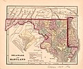
 Delaware and Maryland. LOC 2017593561.jpg 5,689 × 4,710; 4.58 MB
-
 Delaware and Maryland. LOC 2017593564.jpg 9,528 × 5,107; 7.51 MB
-
 Delaware and Maryland. LOC 2017593569.jpg 2,128 × 1,770; 690 KB
-

-
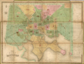 Lucas Baltimore 1852 Cityplan.png 984 × 754; 398 KB
-
 Map of wedge maryland pennsylvania delaware 1850 survey corps of engineers.png 5,220 × 3,102; 33 MB
-
 St. Michaels area 1858.png 690 × 594; 1 MB


.jpg)


_-_Geographicus_-_ChesapeakeBay3part-uscs-1857.jpg)