Category:1850s maps of Maine
Jump to navigation
Jump to search
States of the United States: Alabama · Alaska · Arizona · Arkansas · California · Colorado · Connecticut · Delaware · Florida · Georgia · Illinois · Indiana · Iowa · Kansas · Kentucky · Louisiana · Maine · Maryland · Massachusetts · Michigan · Minnesota · Mississippi · Missouri · Montana · Nebraska · Nevada · New Hampshire · New Jersey · New Mexico · New York · North Carolina · North Dakota · Ohio · Oklahoma · Oregon · Pennsylvania · Rhode Island · South Carolina · South Dakota · Tennessee · Texas · Utah · Vermont · Virginia · Washington · Wisconsin · Wyoming – Washington, D.C.
Puerto Rico
Puerto Rico
Media in category "1850s maps of Maine"
The following 8 files are in this category, out of 8 total.
-
 (Land ownership map of the town of Fryeburg, Maine). LOC 78695998.jpg 10,184 × 13,234; 17.74 MB
-
 10 of 'History of New England. vol. 1-4' (11054440816).jpg 2,672 × 1,545; 1.05 MB
-
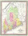 1850 Mitchell Map of Maine - Geographicus - Maine-mitchell-1850.jpg 3,166 × 4,000; 2.68 MB
-
 1855 Colton Map of Maine - Geographicus - Maine-colton-1855.jpg 3,304 × 4,000; 4 MB
-

-
 1857 Colton Map of Maine - Geographicus - Maine-colton-1857.jpg 2,780 × 3,500; 2.87 MB
-

-
 Map of the city of Belfast, Waldo Co., Maine LOC 2007626398.jpg 13,275 × 15,000; 23.24 MB
._LOC_78695998.jpg)
.jpg)


_-_Geographicus_-_PortlandMainetoRacePoint-uscs-1857.jpg)
