Category:1800s maps of France
Jump to navigation
Jump to search
Countries of Europe: Armenia‡ · Austria · Azerbaijan‡ · Belarus · Belgium · Bosnia and Herzegovina · Bulgaria · Croatia · Cyprus‡ · Denmark · Estonia · Finland · France‡ · Georgia‡ · Germany · Greece · Hungary · Republic of Ireland · Italy · Latvia · Lithuania · Netherlands‡ · Norway · Poland · Portugal‡ · Romania · Russia‡ · Serbia · Slovenia · Spain‡ · Sweden · Switzerland · Turkey‡ · Ukraine · United Kingdom
Limited recognition: Abkhazia‡
‡: partly located in Europe
Limited recognition: Abkhazia‡
‡: partly located in Europe
Subcategories
This category has the following 7 subcategories, out of 7 total.
- 1802 maps of France (4 F)
- 1809 maps of France (3 F)
'
Media in category "1800s maps of France"
The following 8 files are in this category, out of 8 total.
-
 1800 Carte du département des Alpes-Maritimes.png 874 × 601; 1.03 MB
-
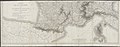
 Atlas elementaire portatif 1807 (139436410).jpg 14,424 × 10,572; 179.96 MB
-
 Atlas elementaire portatif 1807 (139436744).jpg 14,350 × 10,561; 182.36 MB
-
 Atlas elementaire portatif 1807 (139436946).jpg 27,141 × 10,547; 368.5 MB
-
 Atlas elementaire portatif 1807 (139437248).jpg 27,655 × 10,529; 368.87 MB
-
 Plan de Napoléonville.jpg 1,108 × 710; 468 KB
-
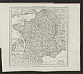
 Atlas moderne portatif 1804 (84186402).jpg 9,591 × 8,376; 9.21 MB
-
 Atlas moderne portatif 1804 (84186641).jpg 8,721 × 7,800; 9.34 MB

.jpg)
.jpg)

.jpg)
.jpg)
.jpg)
.jpg)