Category:1800s maps of Croatia
Jump to navigation
Jump to search
Countries of Europe: Armenia‡ · Austria · Azerbaijan‡ · Belarus · Belgium · Bosnia and Herzegovina · Bulgaria · Croatia · Cyprus‡ · Denmark · Estonia · Finland · France‡ · Georgia‡ · Germany · Greece · Hungary · Republic of Ireland · Italy · Latvia · Lithuania · Netherlands‡ · Norway · Poland · Portugal‡ · Romania · Russia‡ · Serbia · Slovenia · Spain‡ · Sweden · Switzerland · Turkey‡ · Ukraine · United Kingdom
Limited recognition: Abkhazia‡
‡: partly located in Europe
Limited recognition: Abkhazia‡
‡: partly located in Europe
Media in category "1800s maps of Croatia"
The following 3 files are in this category, out of 3 total.
-

-
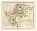 1803 map of Crotia by Karl Joseph Kipferling.jpg 15,846 × 13,464; 24.59 MB
-
 Provinces Illyriennes Servie et Bosnie.jpg 2,354 × 1,749; 2.31 MB


