Category:1740s maps of the Balkans
Jump to navigation
Jump to search
English: This category is intended to collect maps from the 1740s that show multiple Balkan countries in one map frame.
| 18th-century maps of the Balkans: ← 1700s 1710s 1720s 1730s 1740s 1750s 1760s 1770s 1780s 1790s → |
Subcategories
This category has the following 6 subcategories, out of 6 total.
B
- 1740s maps of Bulgaria (3 F)
C
- 1740s maps of Croatia (3 F)
G
- 1740s maps of Greece (5 F)
R
- 1740s maps of Romania (1 F)
S
- 1740s maps of Serbia (3 F)
Media in category "1740s maps of the Balkans"
The following 8 files are in this category, out of 8 total.
-

-
 Ca. 1740 map of the Balkans centered on Serbia and Bosnia by Etienne Briffaut.jpg 2,718 × 1,900; 1.61 MB
-
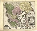 Graecia nova et mare Aegeum (c.1740).jpg 2,400 × 2,028; 1.22 MB
-

-
 1741 map of the Turkish Empire in Europe by Harenberg.jpg 9,118 × 7,930; 12.45 MB
-
 Banduri, Covens et Mortier and Lisle. Imperii Orientalis et Circumjacentium Regionum.1742.jpg 9,910 × 7,104; 12.41 MB
-
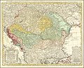 1744 map of the Balkan peninsula centered on the Kingdom of Hungary by Johann Matthias Hase.jpg 14,837 × 12,082; 42.54 MB
-


.jpg)


