Category:1690s maps of the Balkans
Jump to navigation
Jump to search
English: This category is intended to collect maps from the 1690s that show multiple Balkan countries in one map frame.
| 17th-century maps of the Balkans: ← 1600s 1610s 1620s 1640s 1650s 1660s 1670s 1680s 1690s → |
Subcategories
This category has the following 3 subcategories, out of 3 total.
Media in category "1690s maps of the Balkans"
The following 5 files are in this category, out of 5 total.
-
 Kärnten BV044689307.jpg 11,710 × 8,587; 11.21 MB
-
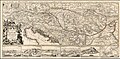
 1692 map of the Turkish Empire in Europe by Hubert Jaillot.jpg 7,472 × 4,865; 6.48 MB
-
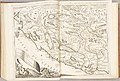 Atlante Veneto Volume 1 130.jpg 9,820 × 6,606; 7.84 MB
-
 1693 Map - Le Cours du Danube Depuis sa Source jusqu'a ses Embouchures.jpg 9,774 × 4,773; 12.45 MB
-


.jpg)