Category:1730s maps of the world
Jump to navigation
Jump to search
| 18th-century maps of the world: ← 1700s 1710s 1720s 1730s 1740s 1750s 1760s 1770s 1780s 1790s → |
English: This category is supposed to hold world maps created in the 1730s.
Subcategories
This category has only the following subcategory.
Media in category "1730s maps of the world"
The following 21 files are in this category, out of 21 total.
-
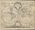 1730 map of the world by Guillaume de L'Isle.tif 7,183 × 6,027; 247.74 MB
-

-

-
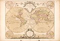
 1730 double hemisphere map of the world by Matthaus Seutter.jpg 14,124 × 12,221; 43.98 MB
-
-
-
 Géographie Buffier-mappe-monde.jpg 9,768 × 7,678; 6.1 MB
-

-
-
 Map of the World by Augustae Vindelicor and Matthaeus Seutter.jpg 9,828 × 8,517; 15.69 MB
-
 Mappe-monde - Norman B. Leventhal Map Center at the BPL.jpg 2,000 × 1,642; 3.86 MB
-

-

-

-
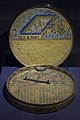
 Ottoman qiblanuma 1738 CE, Turkish and Islamic Arts Museum Istanbul.jpg 3,024 × 4,032; 4.22 MB
-

-

-

-

-
 The world according to Mercator's projection or Edw Wright's RMG F0054.tiff 5,324 × 3,337; 50.83 MB
-
 Turkish and Islamic Museum 0951.jpg 1,065 × 1,600; 366 KB


.jpg)
.jpg)

,_1738_(1151_egira)_01.jpg)
,_1738_(1151_egira)_02.jpg)
,_1738_(1151_egira)_03.jpg)
,_1738_(1151_egira)_04.jpg)

_by_Herman_Moll._Original_from_The_Beinecke_Rare_Book_%26_Manuscript_Library._Digitally_enhanced_by_rawpixel._(50623604851).jpg)