Category:1690s maps of England
Jump to navigation
Jump to search
Subcategories
This category has the following 3 subcategories, out of 3 total.
- 1690 maps of England (4 F)
- 1692 maps of England (1 F)
- 1695 maps of England (43 F)
Media in category "1690s maps of England"
The following 6 files are in this category, out of 6 total.
-
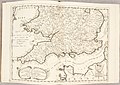
 Atlante Veneto Volume 2 008.jpg 10,344 × 7,209; 7.36 MB
-
 Atlante Veneto Volume 2 009.jpg 10,345 × 7,312; 7.62 MB
-
 Cornwall (detail) by Joel Gascoyne.jpg 2,806 × 1,967; 1.85 MB
-

-

-
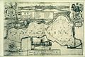 Bodleian Libraries, A Map of PortMeadow , 169499.jpg 1,000 × 675; 176 KB


_by_Joel_Gascoyne.jpg)
.jpg)

