Category:1640s maps of England
Jump to navigation
Jump to search
Subcategories
This category has the following 3 subcategories, out of 3 total.
- 1644 maps of England (6 F)
L
- 1640s maps of London (5 F)
Media in category "1640s maps of England"
The following 8 files are in this category, out of 8 total.
-
 Anglia Regnum - btv1b532254677 (2 of 3).jpg 5,758 × 4,619; 5.6 MB
-
 Print, map (BM 1868,0808.3229 1).jpg 2,500 × 1,981; 1.46 MB
-
 Anglia Regnum - btv1b530562587 (1 of 2).jpg 6,016 × 4,768; 4.94 MB
-
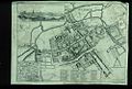 Bodleian Libraries, Oxforde.jpg 1,000 × 675; 158 KB
-
 Map of the Ancholme Valley (c. 1640).jpg 4,569 × 1,712; 5.44 MB
-
 Print, broadside, map (BM 1872,0113.381).jpg 2,500 × 2,048; 1.42 MB
-

-
 Vectis Insula Anglice the Isle of Wight - btv1b53056302v (1 of 2).jpg 6,784 × 2,936; 2.52 MB
.jpg)
.jpg)
.jpg)

.jpg)
.jpg)
.jpg)
.jpg)