Category:1675 maps
Jump to navigation
Jump to search
| ← · 1670 · 1671 · 1672 · 1673 · 1674 · 1675 · 1676 · 1677 · 1678 · 1679 · → |
Deutsch: Karten mit Bezug zum Jahr 1675
English: Maps related to the year 1675
Español: Mapas relativos al año 1675
Français : Cartes concernant l’an 1675
Русский: Карты 1675 года
Subcategories
This category has the following 6 subcategories, out of 6 total.
Media in category "1675 maps"
The following 23 files are in this category, out of 23 total.
-
-
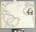
 A mapp of New England (8346430425).jpg 800 × 631; 140 KB
-
 A mapp of the citie and port of Tripoli in Barbary RMG F8067.tiff 4,696 × 3,819; 51.31 MB
-

-
 Athanasius Kircher, Descriptio Regionis Edeniae (FL33122138 2368684).jpg 6,361 × 8,762; 79.43 MB
-
-

-
 Comitatus Burgundiae ou la Franche Comté (8341892779).jpg 800 × 652; 147 KB
-
 Die Ebbe und Fluth auss einer flaschen Landt Karten furgestelt RMG F0052.tiff 5,223 × 3,449; 51.54 MB
-

-
 John Seller, A chart of the Tartarian sea (FL36380777 2622183).jpg 13,329 × 10,656; 198.15 MB
-
 John Seller, A chart of the western part of the Mediterranean Sea (FL13730407 3365036).jpg 9,004 × 7,366; 96.35 MB
-
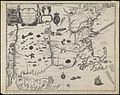
 Marith Tabula geographica Archiepiscopatus Salisburgensis.jpg 3,469 × 2,715; 1.79 MB
-
 Middle-East map Seller.jpg 2,248 × 1,824; 458 KB
-
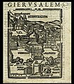 Noe Bianco, Hierusalem (FL6878228 2367961).jpg 2,000 × 2,261; 1.93 MB
-
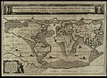
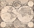 Novissima totius terrarum orbis tabula LOC 2017585802.jpg 6,536 × 5,403; 7.55 MB
-
 Novissima totius terrarum orbis tabula LOC 2017585802.tif 6,536 × 5,403; 101.03 MB
-
 Novissima totius terrarum orbis tabula RMG F8055.tiff 4,824 × 3,634; 50.16 MB
-

-
 Stebenhaber-Karte von 1675.jpg 1,030 × 688; 991 KB
-
 The mapp of the land of Feroe containing XVII inhabited islands RMG F0066.tiff 4,218 × 6,454; 77.89 MB
-
 UBBasel Map 1675 Kartenslg Mappe 248-54 Russia Nova Zemla.tiff 10,692 × 8,346, 2 pages; 255.33 MB
-
 Vincenzo Coronelli, La Transilvania (FL35075170 2537749).jpg 16,193 × 11,835; 269.53 MB
.jpg)
.jpg)
.jpg)
.jpg)
.jpg)
.jpg)
.jpg)


.jpg)

.jpg)

.jpg)
.jpg)