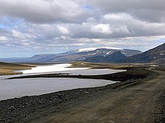
Langjökull
Jump to navigation
Jump to search
Deutsch: Langjökull ist der zweitgrößte isländische Gletscherschild nach dem Vatnajökull und befindet sich im westlichen Hochland von Island. Mindestens zwei aktive Vulkansysteme liegen unter dem Gletscherschild, der Teil des Westlichen Vulkangürtels von Island ist.
English: Langjökull is the second biggest ice cap of Iceland behind Vatnajökull and located in the west of the country. At least two active volcanic systems are to be found under Langjökull which is part of the Western Volcanic Zone of Iceland.
Español: Langjökull es, tras el Vatnajökull, el segundo de los glaciares por tamaño de Islandia (1.021 km2 en el pasado, ahora 925). Se encuentra al oeste del interior islandés o Tierras Altas de Islandia y puede verse claramente desde Haukadalur.
Esperanto: Langjökull estas kutime priparolanta kiel la dua plej grandarea glaĉero de Islando kun 925 km2. Tamen, ekde 1840 ĝi malkreskas, kaj malkreskas pli rapide ol la simile granda Hofsjökull, kaj nuntempe iliaj areoj similas. Troviĝas almenaŭ du vulkanaj sistemoj sub la glaĉero.
Français : Langjökull est une des calottes glaciaires les plus grandes de l'Islande. Au moins deux systèmes volcaniques se trouvent sous Langjökull qui fait partie de la Zone Volcanique de l'Ouest en Islande.
Italiano: Langjökull: Langjökull, con un'estensione di 1.021 km², è il secondo ghiacciaio islandese, dopo Vatnajökull. È situato nell'ovest dell'interno dell'Islanda e può essere visto facilmente da Haukadalur.
Nederlands: Langjökull: De Langjökull is de op één na grootste gletsjer op IJsland na de Vatnajökull. De Langjökull is gelegen in het westen van het IJslandse binnenland.
Norsk bokmål: Langjökull er den nest største isbreen på Island, omtrent 950 km² stor. Den ligger på Islands høyland, vest for Hofsjökull og øst for Borgarfjörður og Eiríksjökull. Langjökull's høyeste punkt er i 1355 moh. og den ligger over to vulkaner.
Norsk nynorsk: Langjökull er den nest største isbreen på Island etter Vatnajökull og har eit areal på 950 km². Han ligg vest i dei indre områda av Island, eller Det islandske høglandet og ein kan tydeleg sjå han frå Haukadalur. Breen ligg over to vulkanar.
Português: Langjökull, que em islandês significa geleira longa é a segunda maior geleira localizada no centro oeste da Islândia (depois de Vatnajökull).
Maps
[edit]-
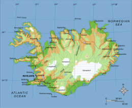
Map of Iceland with Langjökull indicated
Satellite pictures
[edit]-
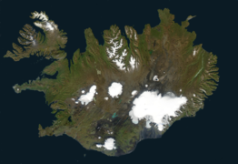
Iceland with Langjökull
-
Langjökull to the west of Hofsjökull
Views
[edit]-
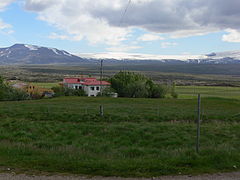
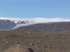
Seen from Húsafell in the west
-
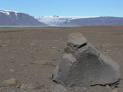
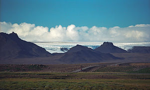
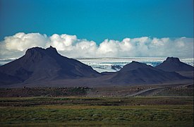
Seen from the Hringvegur (National Road No.1)
Glacial lakes of Langjökull
[edit]-
Hvítárvatn
-
Hagavatn with outlet glacier Eystri-Hagafellsjökull
-
Hagavatn
Volcanism of Langjökull
[edit]Volcanic mountain range of subglacial origin: Jarlhettur
[edit]Central volcano of the Northern Langjökull volcanic system: Hveravellir
[edit]-
High temperature area at Hveravellir
-
Small geyser
-
Sinter terraces at Hveravellir
-
Central volcano Hveravellir
-
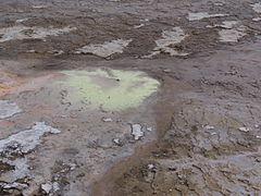
Sulfurous spring
-
Öskurhöll
-
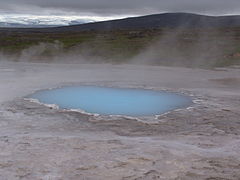
Hot spring at Hveravellir
-
Hiking trail at Hveravellir
-
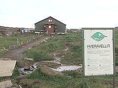
Hveravellir hut
-
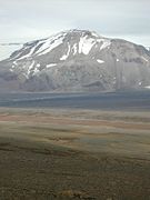
Prestahnúkur
-
Þórisjökull, once part of Langjökull, today an independent glacier
-
Þórisjökull, a subglacial volcano and former part of Langjökull, is still part of Prestahnúkur volcanic system
-
Hrúðurkarlar, craters of the southern Langjökull system
Lava field of the southern Langjökull volcanic system: Hallmundarhraun (9th century)
[edit]The lava field lies near Húsafell in West Iceland.
-
Barnafoss in the Hallmundarhraun
-
Hallmundarhraun from Gílsbakki farm
-
Hallmundarhraun with the remnant of a Tertiairy central volcano and the hyaloclastic ridge Strútur
-
Lava tube in the Hallmundarhraun: Surtshellir
-
Near the waterfalls of Hraunfossar
-
Waterfalls in the lavas: Hraunfossar
Perhaps part of the southern Langjökull volcanic system: Geysir Geothermal Field
[edit]-
Geysir Geothermal Field, a high temperature area not far from Langjökull
-
The geyser Strokkur
-
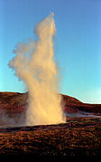
Strokkur
-
The Great Geysir and Strokkur erupting simultanously
An important waterfall in the vicinity of Langjökull: Gullfoss
[edit]The river feeding this waterfall, Hvítá (Árnessýsla), has its source in the glacial lake Hvítárvatn with Langjökull.
Highland roads near Langjökull
[edit]The F550 or Kaldidalur passes by the western side of Langjökull from Þingvellir to Húsafell (the first part as road 52 / Uxahryggur) whereas the F35 or Kjalvegur / Kjölur road follows the eastern side of the ice cap from Gullfoss (waterfall) up to Blönduós in Northwest Iceland; the Kjölur passes by Hveravellir.
Kaldidalur
[edit]-
First part of the road: Uxarhryggur
-
Kaldidalur highland road (F550)
-
Halfway rest stop near Beinakerlingin
-
Langjökull seen from Kaldidalur
-
Kaldidalur
Kjölur
[edit]-
Kjölur road with Bláfell
-
Langjökull to the left
-
Jarlhettur in the background
-
Highland with Kjölur
-
Map of Kjölur road
