File:WPA Land use survey map for the City of Los Angeles, book 5 (Santa Monica Mountains from Girard to Van Nuys District), sheet 17 (727).jpg
Jump to navigation
Jump to search

Size of this preview: 784 × 600 pixels. Other resolutions: 314 × 240 pixels | 628 × 480 pixels | 1,004 × 768 pixels | 1,280 × 979 pixels | 2,560 × 1,958 pixels | 3,536 × 2,704 pixels.
Original file (3,536 × 2,704 pixels, file size: 2.42 MB, MIME type: image/jpeg)
Captions
Captions
Add a one-line explanation of what this file represents
Summary
[edit],_sheet_17_(727).jpg&action=edit§ion=1)
| Description |
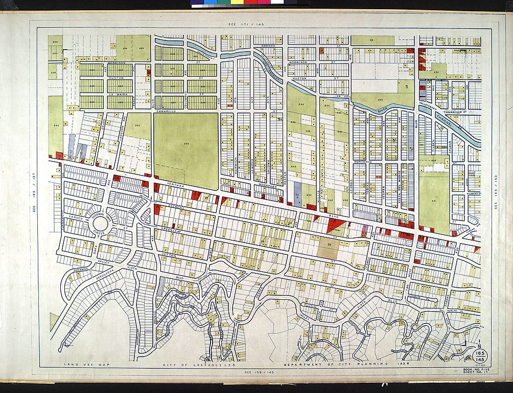
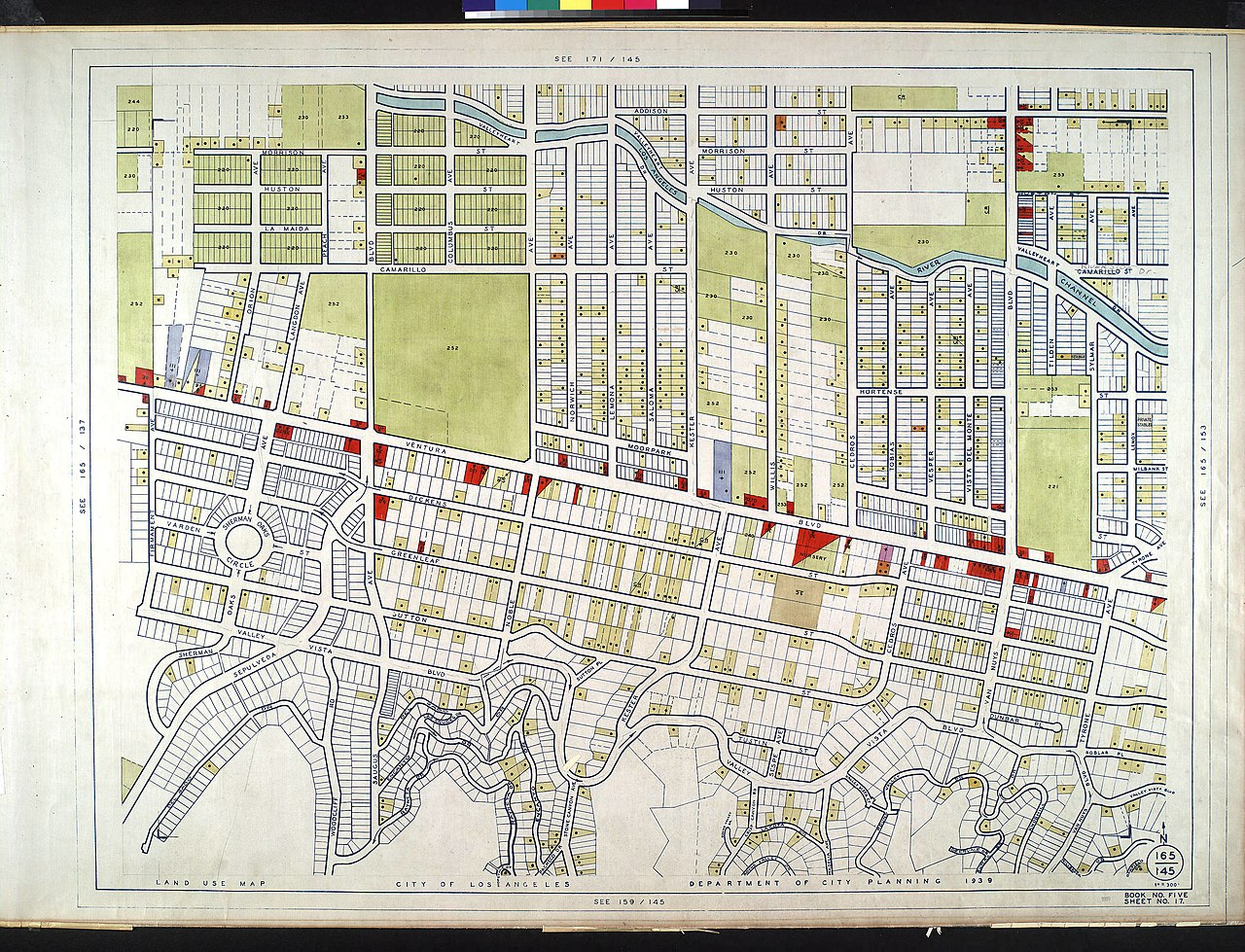
English: WPA Land use survey map for the City of Los Angeles, book 5 (Santa Monica Mountains from Girard to Van Nuys District), sheet 17
|
| Date | |
| Source | http://digitallibrary.usc.edu/cdm/ref/collection/p15799coll120/id/731 |
| Author | City of Los Angeles. Department of City Planning |
Licensing
[edit],_sheet_17_(727).jpg&action=edit§ion=2)
This image is a work of a Works Progress Administration employee, taken or made as part of that person's official duties. As a work of the U.S. federal government, the image is in the public domain (17 U.S.C. §§ 101 and 105).
|
 |
File history
Click on a date/time to view the file as it appeared at that time.
| Date/Time | Thumbnail | Dimensions | User | Comment | |
|---|---|---|---|---|---|
| current | 09:47, 11 February 2014 | | 3,536 × 2,704 (2.42 MB) | Fæ (talk | contribs) | == {{int:filedesc}} == {{Information |description={{en|1=<br> :''WPA Land use survey map for the City of Los Angeles, book 5 (Santa Monica Mountains from Girard to Van Nuys District), sheet 17 :WPA Land use survey map for the City of Los Angeles, book... |
You cannot overwrite this file.
File usage on Commons
There are no pages that use this file.
,_sheet_17_(727).jpg&oldid=517712365)