Category:WPA Land use survey maps for the City of Los Angeles, 1933-1939
Jump to navigation
Jump to search
Media in category "WPA Land use survey maps for the City of Los Angeles, 1933-1939"
The following 200 files are in this category, out of 378 total.
(previous page) (next page)-

-

-

-

-

-

-

-

-

-

-

-

-

-

-

-

-

-

-

-

-

-

-

-

-

-

-

-

-

-

-

-

-

-

-

-

-

-

-

-

-

-

-

-

-

-

-

-

-

-

-

-

-

-

-

-

-

-

-

-

-

-

-

-

-

-

-

-

-

-

-

-

-

-
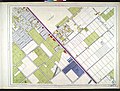
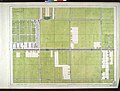
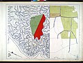
 WPA Land use survey map for the City of Los Angeles, book 2 (Tujunga), sheet 1 (130).jpg 7,072 × 5,392; 5.16 MB
-

-
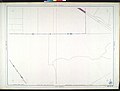
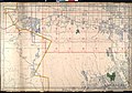
 WPA Land use survey map for the City of Los Angeles, book 2 (Tujunga), sheet 11 (185).jpg 3,528 × 2,696; 1.68 MB
-
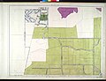
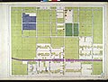
 WPA Land use survey map for the City of Los Angeles, book 2 (Tujunga), sheet 12 (190).jpg 3,528 × 2,688; 1.93 MB
-

-
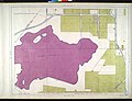
 WPA Land use survey map for the City of Los Angeles, book 2 (Tujunga), sheet 14 (200).jpg 3,528 × 2,688; 2.04 MB
-
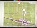
 WPA Land use survey map for the City of Los Angeles, book 2 (Tujunga), sheet 15 (205).jpg 3,528 × 2,688; 1.77 MB
-
 WPA Land use survey map for the City of Los Angeles, book 2 (Tujunga), sheet 16 (210).jpg 3,528 × 2,688; 1.51 MB
-
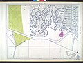
 WPA Land use survey map for the City of Los Angeles, book 2 (Tujunga), sheet 17 (215).jpg 3,528 × 2,688; 1.39 MB
-
 WPA Land use survey map for the City of Los Angeles, book 2 (Tujunga), sheet 18 (225).jpg 3,528 × 2,688; 2.21 MB
-
 WPA Land use survey map for the City of Los Angeles, book 2 (Tujunga), sheet 19 (230).jpg 3,528 × 2,688; 1.98 MB
-
 WPA Land use survey map for the City of Los Angeles, book 2 (Tujunga), sheet 2 (135).jpg 3,536 × 2,696; 1.4 MB
-
 WPA Land use survey map for the City of Los Angeles, book 2 (Tujunga), sheet 20 (235).jpg 3,536 × 2,688; 1.94 MB
-
 WPA Land use survey map for the City of Los Angeles, book 2 (Tujunga), sheet 21 (240).jpg 3,536 × 2,688; 2.16 MB
-
 WPA Land use survey map for the City of Los Angeles, book 2 (Tujunga), sheet 22 (245).jpg 3,536 × 2,688; 1.41 MB
-

-
 WPA Land use survey map for the City of Los Angeles, book 2 (Tujunga), sheet 24 (255).jpg 3,536 × 2,688; 1.01 MB
-
 WPA Land use survey map for the City of Los Angeles, book 2 (Tujunga), sheet 25 (260).jpg 3,536 × 2,688; 1.29 MB
-
 WPA Land use survey map for the City of Los Angeles, book 2 (Tujunga), sheet 26 (265).jpg 3,536 × 2,688; 1.74 MB
-
 WPA Land use survey map for the City of Los Angeles, book 2 (Tujunga), sheet 27 (270).jpg 3,536 × 2,688; 2.03 MB
-
 WPA Land use survey map for the City of Los Angeles, book 2 (Tujunga), sheet 28 (280).jpg 3,536 × 2,688; 1.68 MB
-

-
 WPA Land use survey map for the City of Los Angeles, book 2 (Tujunga), sheet 3 (140).jpg 3,536 × 2,696; 1.85 MB
-
 WPA Land use survey map for the City of Los Angeles, book 2 (Tujunga), sheet 3 (141).jpg 3,536 × 2,696; 1.7 MB
-
 WPA Land use survey map for the City of Los Angeles, book 2 (Tujunga), sheet 3 (142).jpg 3,536 × 2,696; 2.06 MB
-
 WPA Land use survey map for the City of Los Angeles, book 2 (Tujunga), sheet 3 (143).jpg 7,072 × 5,392; 7.33 MB
-

-
-
 WPA Land use survey map for the City of Los Angeles, book 2 (Tujunga), sheet 4 (145).jpg 3,536 × 2,696; 1.53 MB
-
 WPA Land use survey map for the City of Los Angeles, book 2 (Tujunga), sheet 5 (150).jpg 3,536 × 2,696; 1.04 MB
-
 WPA Land use survey map for the City of Los Angeles, book 2 (Tujunga), sheet 6 (155).jpg 3,536 × 2,696; 936 KB
-
 WPA Land use survey map for the City of Los Angeles, book 2 (Tujunga), sheet 7 (160).jpg 3,536 × 2,696; 1.05 MB
-
 WPA Land use survey map for the City of Los Angeles, book 2 (Tujunga), sheet 8 (170).jpg 3,528 × 2,696; 1.93 MB
-
 WPA Land use survey map for the City of Los Angeles, book 2 (Tujunga), sheet 9 (175).jpg 3,528 × 2,696; 1.74 MB
-

-
-

-

-

-

-

-

-

-

-

-

-

-
-

-

-

-

-
-

-

-

-

-

-

-

-

-
-

-

-

-

-

-
-

-

-

-

-

-

-

-

-

-

-

-

-

-

-

-

-

-

-

-

-

-

-

-

-

-

-

-

-

-

-

-

-

-

-

-

-

-

-

-

-

-

-

-

-

-

-
-
-

-

-

-

-

-
-

-

-

-

-

),_sheet_25_(1439).jpg)
,_sheet_16_(382).jpg)
,_sheet_1_(0).jpg)
,_sheet_10_(5).jpg)
,_sheet_11_(10).jpg)
,_sheet_12_(15).jpg)
,_sheet_13_(20).jpg)
,_sheet_14_(25).jpg)
,_sheet_15_(30).jpg)
,_sheet_16_(35).jpg)
,_sheet_17_(40).jpg)
,_sheet_18_(45).jpg)
,_sheet_18_(46).jpg)
,_sheet_18_(47).jpg)
,_sheet_18_(48).jpg)
,_sheet_19_(50).jpg)
,_sheet_2_(55).jpg)
,_sheet_20_(60).jpg)
,_sheet_21_(65).jpg)
,_sheet_22_(70).jpg)
,_sheet_23_(75).jpg)
,_sheet_24_(80).jpg)
,_sheet_25_(85).jpg)
,_sheet_26_(90).jpg)
,_sheet_27_(95).jpg)
,_sheet_28_(100).jpg)
,_sheet_29_(105).jpg)
,_sheet_3_(110).jpg)
,_sheet_30_(115).jpg)
,_sheet_31_(120).jpg)
,_sheet_32_(125).jpg)
,_sheet_4_(165).jpg)
,_sheet_5_(220).jpg)
,_sheet_6_(275).jpg)
,_sheet_7_(330).jpg)
,_sheet_8_(385).jpg)
,_sheet_9_(440).jpg)
,_sheet_1_(1492).jpg)
,_sheet_10_(1537).jpg)
,_sheet_11_(1542).jpg)
,_sheet_12_(1547).jpg)
,_sheet_13_(1552).jpg)
,_sheet_14_(1557).jpg)
,_sheet_15_(1562).jpg)
,_sheet_16_(1567).jpg)
,_sheet_17_(1572).jpg)
,_sheet_18_(1577).jpg)
,_sheet_19_(1582).jpg)
,_sheet_2_(1497).jpg)
,_sheet_20_(1587).jpg)
,_sheet_21_(1592).jpg)
,_sheet_22_(1597).jpg)
,_sheet_23_(1602).jpg)
,_sheet_24_(1607).jpg)
,_sheet_25_(1612).jpg)
,_sheet_26_(1617).jpg)
,_sheet_27_(1622).jpg)
,_sheet_28_(1627).jpg)
,_sheet_29_(1632).jpg)
,_sheet_3_(1502).jpg)
,_sheet_30_(1637).jpg)
,_sheet_31_(1642).jpg)
,_sheet_32_(1647).jpg)
,_sheet_33_(1652).jpg)
,_sheet_4_(1507).jpg)
,_sheet_5_(1512).jpg)
,_sheet_6_(1517).jpg)
,_sheet_7_(1522).jpg)
,_sheet_8_(1527).jpg)
,_sheet_9_(1532).jpg)
,_sheet_9_(1533).jpg)
,_sheet_9_(1534).jpg)
,_sheet_9_(1535).jpg)
,_sheet_1_(130).jpg)
,_sheet_10_(180).jpg)
,_sheet_11_(185).jpg)
,_sheet_12_(190).jpg)
,_sheet_13_(195).jpg)
,_sheet_14_(200).jpg)
,_sheet_15_(205).jpg)
,_sheet_16_(210).jpg)
,_sheet_17_(215).jpg)
,_sheet_18_(225).jpg)
,_sheet_19_(230).jpg)
,_sheet_2_(135).jpg)
,_sheet_20_(235).jpg)
,_sheet_21_(240).jpg)
,_sheet_22_(245).jpg)
,_sheet_23_(250).jpg)
,_sheet_24_(255).jpg)
,_sheet_25_(260).jpg)
,_sheet_26_(265).jpg)
,_sheet_27_(270).jpg)
,_sheet_28_(280).jpg)
,_sheet_29_(285).jpg)
,_sheet_3_(140).jpg)
,_sheet_3_(141).jpg)
,_sheet_3_(142).jpg)
,_sheet_3_(143).jpg)
,_sheet_30_(290).jpg)
,_sheet_31_(295).jpg)
,_sheet_4_(145).jpg)
,_sheet_5_(150).jpg)
,_sheet_6_(155).jpg)
,_sheet_7_(160).jpg)
,_sheet_8_(170).jpg)
,_sheet_9_(175).jpg)
,_sheet_1_(300).jpg)
,_sheet_10_(350).jpg)
,_sheet_11_(355).jpg)
,_sheet_12_(360).jpg)
,_sheet_13_(365).jpg)
,_sheet_14_(370).jpg)
,_sheet_15_(375).jpg)
,_sheet_16_(380).jpg)
,_sheet_16_(381).jpg)
,_sheet_16_(383).jpg)
,_sheet_17_(390).jpg)
,_sheet_18_(395).jpg)
,_sheet_19_(400).jpg)
,_sheet_2_(305).jpg)
,_sheet_20_(405).jpg)
,_sheet_21_(410).jpg)
,_sheet_22_(415).jpg)
,_sheet_23_(420).jpg)
,_sheet_24_(425).jpg)
,_sheet_25_(430).jpg)
,_sheet_26_(435).jpg)
,_sheet_27_(445).jpg)
,_sheet_28_(450).jpg)
,_sheet_29_(455).jpg)
,_sheet_3_(310).jpg)
,_sheet_30_(460).jpg)
,_sheet_31_(465).jpg)
,_sheet_32_(470).jpg)
,_sheet_33_(475).jpg)
,_sheet_34_(480).jpg)
,_sheet_35_(485).jpg)
,_sheet_36_(490).jpg)
,_sheet_4_(315).jpg)
,_sheet_5_(320).jpg)
,_sheet_6_(325).jpg)
,_sheet_7_(335).jpg)
,_sheet_8_(340).jpg)
,_sheet_9_(345).jpg)
,_sheet_1_(495).jpg)
,_sheet_10_(531).jpg)
,_sheet_11_(535).jpg)
,_sheet_12_(539).jpg)
,_sheet_13_(543).jpg)
,_sheet_14_(547).jpg)
,_sheet_15_(551).jpg)
,_sheet_16_(555).jpg)
,_sheet_17_(559).jpg)
,_sheet_18_(563).jpg)
,_sheet_19_(567).jpg)
,_sheet_2_(499).jpg)
,_sheet_20_(571).jpg)
,_sheet_21_(575).jpg)
,_sheet_22_(579).jpg)
,_sheet_23_(583).jpg)
,_sheet_24_(587).jpg)
,_sheet_25_(591).jpg)
,_sheet_26_(595).jpg)
,_sheet_27_(599).jpg)
,_sheet_28_(603).jpg)
,_sheet_29_(607).jpg)
,_sheet_3_(503).jpg)
,_sheet_30_(611).jpg)
,_sheet_31_(615).jpg)
,_sheet_32_(619).jpg)
,_sheet_33_(623).jpg)
,_sheet_34_(627).jpg)
,_sheet_35_(631).jpg)
,_sheet_36_(635).jpg)
,_sheet_37_(639).jpg)
,_sheet_38_(643).jpg)
,_sheet_4_(507).jpg)
,_sheet_5_(511).jpg)
,_sheet_6_(515).jpg)
,_sheet_7_(519).jpg)
,_sheet_8_(523).jpg)
,_sheet_9_(527).jpg)
,_sheet_9_(528).jpg)
,_sheet_9_(529).jpg)
,_sheet_1_(647).jpg)
,_sheet_10_(692).jpg)
,_sheet_11_(697).jpg)
,_sheet_12_(702).jpg)
,_sheet_13_(707).jpg)
,_sheet_14_(712).jpg)
,_sheet_15_(717).jpg)
,_sheet_15_(718).jpg)
,_sheet_15_(719).jpg)
,_sheet_15_(720).jpg)
,_sheet_16_(722).jpg)
,_sheet_17_(727).jpg)
,_sheet_18_(732).jpg)
,_sheet_19_(737).jpg)
,_sheet_2_(652).jpg)