Category:Maps of the San Fernando Valley
Jump to navigation
Jump to search
English: Maps of the San Fernando Valley — located in western Los Angeles County, California.
- Most of the Valley's communities and neighborhoods are also within the City of Los Angeles.
Wikimedia category | |||||
| Upload media | |||||
| Instance of | |||||
|---|---|---|---|---|---|
| Category combines topics | |||||
| Category contains | |||||
| San Fernando Valley | |||||
urbanized valley in Los Angeles County, California, United States  San Fernando Valley looking northeast; from the Top of Topanga Overlook Park above Woodland Hills in foreground The southeast San Fernando Valley from Mulholland Drive  Läge på Los Angeles-slätten. | |||||
| Instance of | |||||
| Location | Los Angeles County, California, Pacific States Region | ||||
| Mountain range | |||||
| Population |
| ||||
| Elevation above sea level |
| ||||
 | |||||
Media in category "Maps of the San Fernando Valley"
The following 101 files are in this category, out of 101 total.
-
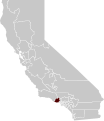
 Location map San Fernando Valley.png 690 × 655; 469 KB
-
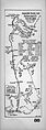
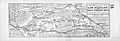
 San Fernando Valley all Hall Map 1880.png 1,055 × 661; 1.3 MB
-
 Stage Route Rancho Encino to Santa Susana Pass Hall Map 1880.png 1,900 × 1,833; 5.5 MB
-
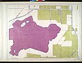
 Rancho Providencia Hall Map 1880.png 1,139 × 1,277; 2.37 MB
-
 1880map San Fernando Valley SE.jpg 2,441 × 1,544; 990 KB
-
 Automobile touring route from Los Angeles to Placerita Canyon, 1912 (AAA-SM-004615).jpg 2,191 × 6,152; 2.49 MB
-

-
 Automobile road map from Los Angeles to Topanga Canon and return, 1915 (AAA-SM-004587).jpg 6,237 × 2,198; 2.55 MB
-
 Automobile road map from Los Angeles to San Fernando Valley, 1917 (AAA-SM-000310).jpg 5,952 × 2,046; 2.25 MB
-
 Automobile road map from Los Angeles to San Fernando Valley, 1917 (AAA-SM-000310v).jpg 2,195 × 6,244; 2.31 MB
-

-

-
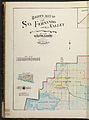
 Baist's real estate atlas of surveys of Los Angeles, California, 1921 (31382).jpg 4,535 × 6,206; 2.99 MB
-
 Baist's real estate atlas of surveys of Los Angeles, California, 1921 (31386).jpg 4,599 × 6,182; 2.42 MB
-
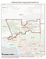
 California US Congressional District 25 (since 2013).tif 2,016 × 998; 2.69 MB
-
 CA 25 certified.pdf 1,275 × 1,650; 1.07 MB
-
 CA 28 certified.pdf 1,275 × 1,650; 834 KB
-
 California US Congressional District 28 (since 2013).tif 2,016 × 996; 3.04 MB
-
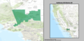
 California 29th Congressional District.png 517 × 607; 129 KB
-
 California US Congressional District 29 (since 2013).tif 2,016 × 998; 3.06 MB
-
 California US Congressional District 30 (since 2013).tif 2,016 × 998; 3.05 MB
-
 CA 30 certified.pdf 1,275 × 1,650; 801 KB
-
 LA County Incorporated Areas Burbank highlighted.svg 950 × 780; 261 KB
-
 LA County Incorporated Areas Calabasas highlighted.svg 950 × 780; 261 KB
-
 LA County Incorporated Areas Glendale highlighted.svg 950 × 780; 261 KB
-
 LA County Incorporated Areas Hidden Hills highlighted.svg 950 × 780; 262 KB
-
 LA County Incorporated Areas San Fernando highlighted.svg 950 × 780; 262 KB
-
 LA County Incorporated Areas Universal City highlighted.svg 950 × 780; 262 KB
-

-
 February 1971 San Fernando earthquake intensity USGS.jpg 612 × 711; 163 KB
-
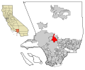
 Location map North Hills, Los Angeles.png 2,000 × 1,620; 4.02 MB
-
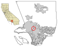
 Location map North Hills, Los Angeles.svg 1,610 × 1,304; 28.96 MB
-
 Los Angeles Times map of neighborhoods in San Fernando Valley, California.png 1,601 × 923; 753 KB
-
-

-
 Providencialandwaterdevelopment.jpg 800 × 675; 286 KB
-
 California SD-27 (2011).svg 1,450 × 1,680; 55 KB
-
-

-

-

-

-
-

-

-
-

-

-

-

-
-

-

-

-

-

-

-

-

-

-

-

-

-

-
-

-

-

-

-

-

-

-
-

-

-

-

-

-
-

-

-

-

-

-
-

-
-

-

-

-
-
-

-

-

-

-

-

-

-
 CA-27th.png 777 × 449; 40 KB
-
 CA-28th.png 776 × 449; 42 KB


.jpg)
.jpg)


.svg)
,_sheet_16_(382).jpg)
,_sheet_16_(381).jpg)
,_sheet_16_(383).jpg)
,_sheet_1_(300).jpg)
,_sheet_2_(305).jpg)
,_sheet_3_(310).jpg)
,_sheet_4_(315).jpg)
,_sheet_5_(320).jpg)
,_sheet_6_(325).jpg)
,_sheet_7_(335).jpg)
,_sheet_8_(340).jpg)
,_sheet_9_(345).jpg)
,_sheet_10_(350).jpg)
,_sheet_11_(355).jpg)
,_sheet_12_(360).jpg)
,_sheet_13_(365).jpg)
,_sheet_14_(370).jpg)
,_sheet_15_(375).jpg)
,_sheet_16_(380).jpg)
,_sheet_17_(390).jpg)
,_sheet_18_(395).jpg)
,_sheet_19_(400).jpg)
,_sheet_20_(405).jpg)
,_sheet_21_(410).jpg)
,_sheet_22_(415).jpg)
,_sheet_23_(420).jpg)
,_sheet_24_(425).jpg)
,_sheet_25_(430).jpg)
,_sheet_26_(435).jpg)
,_sheet_27_(445).jpg)
,_sheet_28_(450).jpg)
,_sheet_29_(455).jpg)
,_sheet_30_(460).jpg)
,_sheet_31_(465).jpg)
,_sheet_32_(470).jpg)
,_sheet_33_(475).jpg)
,_sheet_34_(480).jpg)
,_sheet_35_(485).jpg)
,_sheet_36_(490).jpg)
,_sheet_15_(719).jpg)
,_sheet_15_(720).jpg)
,_sheet_15_(718).jpg)
,_sheet_1_(647).jpg)
,_sheet_2_(652).jpg)
,_sheet_3_(657).jpg)
,_sheet_4_(662).jpg)
,_sheet_5_(667).jpg)
,_sheet_6_(672).jpg)
,_sheet_7_(677).jpg)
,_sheet_8_(682).jpg)
,_sheet_9_(687).jpg)
,_sheet_10_(692).jpg)
,_sheet_11_(697).jpg)
,_sheet_12_(702).jpg)
,_sheet_13_(707).jpg)
,_sheet_14_(712).jpg)
,_sheet_15_(717).jpg)
,_sheet_16_(722).jpg)
,_sheet_17_(727).jpg)
,_sheet_18_(732).jpg)
,_sheet_19_(737).jpg)


.jpg)
.jpg)
.jpg)
.jpg)
.jpg)
.jpg)
.jpg)
.jpg)
.jpg)
.jpg)