File:Wörth (Donauinsel) Joseph Walcher 1791 map-2.jpg
Jump to navigation
Jump to search

Size of this preview: 800 × 580 pixels. Other resolutions: 320 × 232 pixels | 640 × 464 pixels | 1,024 × 743 pixels | 1,280 × 928 pixels | 1,925 × 1,396 pixels.
Original file (1,925 × 1,396 pixels, file size: 2.81 MB, MIME type: image/jpeg)
Captions
Captions
Add a one-line explanation of what this file represents
Summary
[edit]| Description |
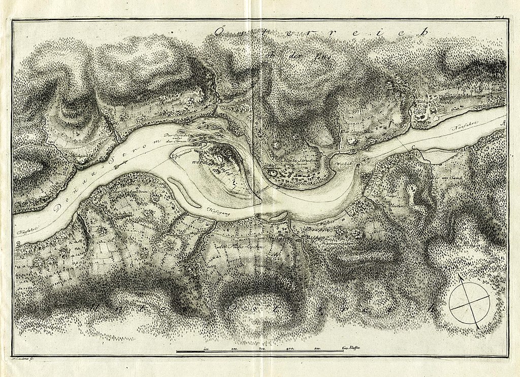
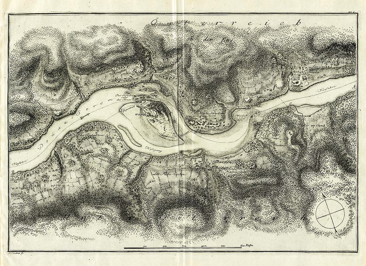
Deutsch: Karte der Donauinsel Wörth, mit Hausstein, Strudel, Wirbel und Umgebung |
|||||||||||||||||||||||
| Date | ||||||||||||||||||||||||
| Source |
Aus der Monographie: Joseph Walcher: Nachrichten von den bis auf das Jahr 1791 an dem Donau-Strudel zur Sicherheit der Schiffahrt fortgesetzten Arbeiten nebst Anhang von der physikalischen Beschaffenheit des Donau-Wirbels. Wien, Kurzbeck 1791, Anhang. http://digital.slub-dresden.de/werkansicht/dlf/26676/47/ |
|||||||||||||||||||||||
| Author |
|
|||||||||||||||||||||||
| Other versions | ||||||||||||||||||||||||

_Joseph_Walcher_1791_map-2.jpg&action=edit§ion=1)
_Joseph_Walcher_1791_map.jpg)
| Object location | | View this and other nearby images on: OpenStreetMap |
|---|
_Joseph_Walcher_1791_map-2.jpg¶ms=048.230556_N_0014.886944_E_globe:Earth_class:object_type:object_region:AT-3_&language=en)
Licensing
[edit]_Joseph_Walcher_1791_map-2.jpg&action=edit§ion=2)
|
This work is in the public domain in its country of origin and other countries and areas where the copyright term is the author's life plus 100 years or fewer. | |
| This file has been identified as being free of known restrictions under copyright law, including all related and neighboring rights. | |
File history
Click on a date/time to view the file as it appeared at that time.
| Date/Time | Thumbnail | Dimensions | User | Comment | |
|---|---|---|---|---|---|
| current | 06:52, 17 August 2015 | | 1,925 × 1,396 (2.81 MB) | Thgoiter (talk | contribs) | Cropped 4 % horizontally and 13 % vertically using CropTool with lossless mode. |
| 08:59, 11 August 2015 |  | 2,000 × 1,601 (2.64 MB) | Pölkkyposkisolisti (talk | contribs) | {{Information |Description= |Source= |Date= |Author= |Permission= |other_versions= }} | |
| 08:04, 11 August 2015 |  | 707 × 562 (382 KB) | Pölkkyposkisolisti (talk | contribs) | == {{int:filedesc}} == {{Information |Description ={{de|1=Karte der Donauinsel Wörth, mit Hausstein, Strudel, Wirbel und Umgebung}} |Source =http://digital.slub-dresden.de/werkansicht/dlf/26676/47/ <br /> auch https://4381strudengau.files.w... |
You cannot overwrite this file.
File usage on Commons
The following page uses this file:
File usage on other wikis
The following other wikis use this file:
- Usage on de.wikipedia.org
_Joseph_Walcher_1791_map-2.jpg&oldid=731343044)