Category:Old maps of Upper Austria
Jump to navigation
Jump to search
States of Austria:  Burgenland ·
  Carinthia ·
  Lower Austria ·
  Salzburg ·
  Styria ·
  Tyrol ·
  Upper Austria ·
  Vienna ·
  Vorarlberg
Use the appropriate category for maps showing all or a large part of Upper Austria. See subcategories for smaller areas:
| If the map shows | Category to use |
|---|---|
| Upper Austria on a recently created map | Category:Maps of Upper Austria or its subcategories |
| Upper Austria on a map created more than 70 years ago | Category:Old maps of Upper Austria or its subcategories |
| the history of Upper Austria on a recently created map | Category:Maps of the history of Upper Austria or its subcategories |
| the history of Upper Austria on a map created more than 70 years ago | Category:Old maps of the history of Upper Austria or its subcategories |
Deutsch: Karten von Oberösterreich, deren Urheberrecht abgelaufen ist (über 70 Jahre alt).
English: Maps of Upper Austria older than 70 years (copyright expired).
Subcategories
This category has the following 5 subcategories, out of 5 total.
Media in category "Old maps of Upper Austria"
The following 35 files are in this category, out of 35 total.
-
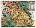 Hirschvogel Map Austria.jpg 1,414 × 1,100; 736 KB
-
 "Austria Archiducatus - auctore Wolfgango Lazio" (22071095668).jpg 3,223 × 2,981; 2.43 MB
-
 Austria Lazius 1662 Atlas Blaeuw.jpg 11,220 × 7,918; 85.1 MB
-

-
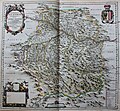
 Austriae archiducatus pars superior - CBT 5877964.jpg 5,854 × 4,761; 9.39 MB
-
 Charte Ober-Oesterreich (Merian).jpg 1,336 × 1,410; 552 KB
-
 Topographia Austriacarum (Merian) 014.jpg 2,000 × 1,690; 532 KB
-
 Windhag Herrschafft (Merian).jpg 1,638 × 1,152; 663 KB
-
 Wörth (Donauinsel) map 1777 map.jpg 8,512 × 6,409; 13.88 MB
-
 Historische Innviertler Karte (1779).jpg 1,562 × 1,333; 1.33 MB
-
 Wörth (Donauinsel) Joseph Walcher 1791 map-2.jpg 1,925 × 1,396; 2.81 MB
-
 Wörth (Donauinsel) Joseph Walcher 1791 map.jpg 1,927 × 1,348; 737 KB
-
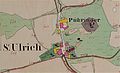 Urmappe Sankt Ulrich.jpg 3,037 × 1,853; 520 KB
-
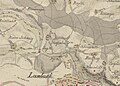
 1812 Kartierung Lambach 2.jpg 1,293 × 904; 321 KB
-
 1812 Kartierung Lambach.jpg 996 × 710; 199 KB
-
 Urmappe Perkheim.jpg 829 × 357; 62 KB
-
 Budweis - 32-49.jpg 3,319 × 4,968; 3.66 MB
-
 Linz - 32-48.jpg 3,395 × 4,945; 3.78 MB
-
 Passau - 31-49.jpg 3,309 × 4,953; 3.64 MB
-

-

-
 Spezialkarte 4749 Tittmoning 1939.jpg 8,210 × 5,810; 26.32 MB
-
-

-
 Bürmoos - Wahamoor - 2020 08 19-5b.jpg 2,785 × 3,606; 2.07 MB
-
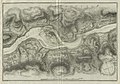
 Enns und Steyr. NYPL1226528.tiff 5,251 × 4,472; 67.2 MB
-
 Franziszeischer Kataster, Ort Mondsee, ca. 1823 bis 1830.jpg 1,812 × 2,340; 2.61 MB
-
 Kirchdorf. NYPL1226554.tiff 5,339 × 4,384; 53.35 MB
-
 Meyers b12 s0481a.jpg 2,048 × 1,610; 1,014 KB
-
 Meyer‘s Zeitungsatlas 047 – Erz-Herzogthum Oesterreich- Ob der Enns.jpg 7,372 × 6,210; 12.64 MB
-
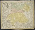
 Neueste Karte des Erzherzogthums Oesterreich Ob und Unter der Enns.jpg 12,290 × 8,123; 16.92 MB
-
 Meyers b14 s0246a.jpg 800 × 1,077; 391 KB
-
 St. Pölten - 33-48.jpg 3,401 × 4,934; 4.88 MB
-
 Urmappe Ort Gemering.jpg 1,263 × 861; 842 KB
-
 Fuhrer durch Ischl und Umgebung 1897 (125899436).jpg 4,685 × 3,781; 4.5 MB

.jpg)

.3.(3).jpg)

.jpg)
_014.jpg)
.jpg)
_map_1777_map.jpg)
.jpg)
_Joseph_Walcher_1791_map-2.jpg)
_Joseph_Walcher_1791_map.jpg)


_(14592329019).jpg)
_(14755985776).jpg)


_(14778900605).jpg)


.jpg)