Category:1791 maps
Jump to navigation
Jump to search
| ← · 1790 · 1791 · 1792 · 1793 · 1794 · 1795 · 1796 · 1797 · 1798 · 1799 · → |
Deutsch: Karten mit Bezug zum Jahr 1791
English: Maps related to the year 1791
Español: Mapas relativos al año 1791
Français : Cartes concernant l’an 1791
Русский: Карты 1791 года
Subcategories
This category has the following 5 subcategories, out of 5 total.
Media in category "1791 maps"
The following 88 files are in this category, out of 88 total.
-
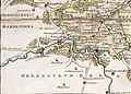
 1791 Grafschaft Mark, Elfringhausen.jpg 1,149 × 756; 395 KB
-
 1791 Hattingen, Elfringhausen.jpg 1,158 × 736; 386 KB
-

-

-
 A map of Surinam RMG F0402.tiff 7,886 × 5,520; 124.54 MB
-
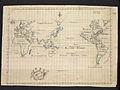 A Mercators chart (2675598532).jpg 2,000 × 1,500; 2.05 MB
-

-

-
 A sketch of the Straits of the Dardanelles RMG K1100.jpg 1,280 × 824; 669 KB
-
 Bancroft's Works History of the Northwest Coast vol 1 (1884) (14764618305).jpg 2,024 × 3,296; 1.43 MB
-
 Bonne - Carte hydro-geo-graphique des Indes Orientales.jpg 10,451 × 7,599; 15.59 MB
-
 Bonne - Isle de France (Detail).jpg 1,045 × 1,231; 388 KB
-
-

-
 Britannia (FL147408404 3422555).jpg 2,764 × 4,095; 15.4 MB
-

-

-
 Carte des 12 Tribus D'Israel (FL37129657 3911666).jpg 3,291 × 2,432; 5.43 MB
-

-

-

-
 Das Herzgothum Krain 1791.jpg 2,612 × 1,730; 617 KB
-
 Das Herzogthum Krain 1791.jpg 6,589 × 5,214; 12.64 MB
-
 Die gefürsteten Grafschaften Görz und Gradisca mit der Hauptmannschaft Tulmino 1791.jpg 10,042 × 6,881; 8.03 MB
-
 Dotted line map of Washington, D.C., 1791, before Aug. 19th. LOC 88694203.jpg 12,632 × 8,198; 13.2 MB
-
 Dotted line map of Washington, D.C., 1791, before Aug. 19th. LOC 88694203.tif 12,632 × 8,198; 296.28 MB
-
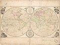
 East Indies from the best authorites (4232062898).jpg 2,000 × 1,596; 2.87 MB
-
 France location map-Departements 1791.svg 2,000 × 1,922; 568 KB
-
 Geosteter Ortsgrundriss von Heilbronn-Kirchhausen 1791.jpg 3,000 × 1,976; 867 KB
-
-
 Grafschaft Mark 1791 Friedrich C Mueller.jpg 2,033 × 1,800; 1.32 MB
-
 Grafschaft mark 1791 mueller.jpg 2,102 × 1,683; 4.78 MB
-
 Inner Krain mit der windischen Mark und dem Triester Gebiethe 1791.jpg 2,541 × 2,312; 594 KB
-
 Inner Krain mit der windischen Mark und dem triester Gebiethes 1791.jpg 9,909 × 6,835; 7.18 MB
-
-
 Kaartje van t Hertogdom Crain 1791.jpg 3,257 × 2,546; 1.84 MB
-
 Map of Alexandria, Virginia LOC 90680880.jpg 3,948 × 4,866; 2.53 MB
-
 Map of Alexandria, Virginia LOC 90680880.tif 3,948 × 4,866; 54.96 MB
-
 Map of Germany and Switzerland in 1791 by Reilly 092.jpg 1,137 × 1,056; 532 KB
-
 Map of Germany and Switzerland in 1791 by Reilly 092b.jpg 643 × 568; 144 KB
-
 Map of Greenland in 1791 by Reilly 077.jpg 2,079 × 1,700; 1.94 MB
-
 Map of Northern and Eastern Europe in 1791 by Reilly 0004.jpg 1,565 × 1,057; 691 KB
-
 Map of Northern Europe in 1791 by Reilly 067.jpg 904 × 1,152; 458 KB
-

-

-

-

-

-
 Mappa da Villa de Reis de Santo Amaro.jpg 4,078 × 6,430; 915 KB
-
 Ober Krain 1791.jpg 9,434 × 6,836; 6.83 MB
-
 Part of the Province of Virginia. LOC 74693199.jpg 5,664 × 4,156; 3.23 MB
-
 Part of the Province of Virginia. LOC 74693199.tif 5,664 × 4,156; 67.35 MB
-

-

-

-

-

-

-

-

-

-

-

-
-

-

-

-

-

-
 Plano del Puerto de la Havana LOC 91680723.jpg 7,903 × 5,625; 3.61 MB
-
 Plano del Puerto de la Havana LOC 91680723.tif 7,903 × 5,625; 127.19 MB
-

-

-

-

-
 Prague Castle map 1791 closer.jpg 414 × 546; 289 KB
-
 Prague Castle map 1791.jpg 755 × 1,144; 1.26 MB
-
 Ptolemy India.jpg 3,840 × 2,256; 1.7 MB
-
 Redrice1791.jpg 1,842 × 2,223; 941 KB
-
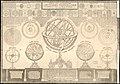
 Reilly 150 HAAB.jpg 929 × 844; 861 KB
-
 Schröter selenotopographische fragmente beispiel karten.png 800 × 1,015; 360 KB
-
 Survey map of part of S.W. and S.E. Washington D.C.. LOC 88694212.jpg 21,766 × 6,571; 10.71 MB
-
 Survey map of part of S.W. and S.E. Washington D.C.. LOC 88694212.tif 21,766 × 6,571; 409.2 MB
-

-

-
 Unter Krain 1791.jpg 2,419 × 2,170; 499 KB
-
 Wörth (Donauinsel) Joseph Walcher 1791 map-2.jpg 1,925 × 1,396; 2.81 MB
-
 Wörth (Donauinsel) Joseph Walcher 1791 map.jpg 1,927 × 1,348; 737 KB


_as_surveyed_by_Andrew_Ellicott_in_1791-2_and_published_in_Paris,_France,_in_1815_LOC_88694209.jpg)
.jpg)


_(14764618305).jpg)

.jpg)

.jpg)

.jpg)


.jpg)


,_Baltimore,_Philadelphia,_New_York,_Newport,_Rhode_LOC_2010589243.jpg)


_United_States_-_projected_agreeable_to_the_direction_of_the_President_of_the_United_States,_in_pursuance_of_an_act_of_LOC_88694194.jpg)
_United_States_-_projected_agreeable_to_the_direction_of_the_President_of_the_United_States,_in_pursuance_of_an_act_of_LOC_88694195.jpg)
_United_States_-_projected_agreeable_to_the_direction_of_the_President_of_the_United_States,_in_pursuance_of_an_act_of_LOC_88694196.jpg)
_United_States_-_projected_agreeable_to_the_direction_of_the_President_of_the_United_States,_in_pursuance_of_an_act_of_LOC_88694197.jpg)
_United_States_-_projected_agreeable_to_the_direction_of_the_President_of_the_United_States,_in_pursuance_of_an_act_of_LOC_88694198.jpg)
_United_States_-_projected_agreeable_to_the_direction_of_the_President_of_the_United_States,_in_pursuance_of_an_act_of_LOC_88694201.jpg)
_United_States_-_projected_agreeable_to_the_direction_of_the_President_of_the_United_States,_in_pursuance_of_an_act_of_LOC_88694205.jpg)
_United_States_-_projected_agreeable_to_the_direction_of_the_President_of_the_United_States,_in_pursuance_of_an_act_of_LOC_88694380.jpg)


_LOC_88690916.jpg)

_Joseph_Walcher_1791_map-2.jpg)
_Joseph_Walcher_1791_map.jpg)