File:Tsushima and Korea straits-ja.svg
Jump to navigation
Jump to search

Size of this PNG preview of this SVG file: 800 × 564 pixels. Other resolutions: 320 × 226 pixels | 640 × 451 pixels | 1,024 × 722 pixels | 1,280 × 903 pixels | 2,560 × 1,805 pixels | 899 × 634 pixels.
Original file (SVG file, nominally 899 × 634 pixels, file size: 156 KB)
Captions
Captions
Add a one-line explanation of what this file represents
| Description |
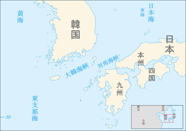
日本語: 対馬海峡と大韓海峽の地図
한국어: 対馬海峡과大韓海峽의地圖/쓰시마해과대한해협의지도
中文:地图的対馬海峡和朝鲜海峡 |
| Date | (UTC) |
| Source | |
| Author |
|
| This is a retouched picture, which means that it has been digitally altered from its original version. The original can be viewed here: Tsushima and Korea straits-fr.svg:
|
I, the copyright holder of this work, hereby publish it under the following licenses:
This file is licensed under the Creative Commons Attribution-Share Alike 2.5 Generic, 2.0 Generic and 1.0 Generic license.
- You are free:
- to share – to copy, distribute and transmit the work
- to remix – to adapt the work
- Under the following conditions:
- attribution – You must give appropriate credit, provide a link to the license, and indicate if changes were made. You may do so in any reasonable manner, but not in any way that suggests the licensor endorses you or your use.
- share alike – If you remix, transform, or build upon the material, you must distribute your contributions under the same or compatible license as the original.
| This file is licensed under the Creative Commons Attribution-Share Alike 3.0 Unported license. | ||
| ||
| This licensing tag was added to this file as part of the GFDL licensing update. |

|
Permission is granted to copy, distribute and/or modify this document under the terms of the GNU Free Documentation License, Version 1.2 or any later version published by the Free Software Foundation; with no Invariant Sections, no Front-Cover Texts, and no Back-Cover Texts. A copy of the license is included in the section entitled GNU Free Documentation License. |
You may select the license of your choice.
Original upload log
[edit]
This image is a derivative work of the following images:
- File:Tsushima_and_Korea_straits-fr.svg licensed with Cc-by-sa-2.5,2.0,1.0, Cc-by-sa-3.0-migrated, GFDL
- 2009-01-31T11:24:08Z Valentim 899x634 (107907 Bytes) Name of Sea added ("Sea of Japan")
- 2007-09-29T14:29:30Z Historicair 899x634 (106990 Bytes)
- 2007-09-29T14:27:32Z Historicair 114x29 (106952 Bytes) {{Information |Description={{fr|Carte des détroits de Corée et de Tsushima}} {{en|Map of Tsushima and Korea straits}} |Source=Own work |Date=29/09/2007 |Author=~~~~ |Permission={{self2|GFDL|cc-by-sa-2.5,2.0,1.0}} |other_ver
Uploaded with derivativeFX
File history
Click on a date/time to view the file as it appeared at that time.
| Date/Time | Thumbnail | Dimensions | User | Comment | |
|---|---|---|---|---|---|
| current | 06:06, 14 February 2014 | | 899 × 634 (156 KB) | Homo lupus (talk | contribs) | This is a Japanese map |
| 23:14, 16 April 2012 |  | 899 × 634 (147 KB) | Mongol (talk | contribs) | East China Sea's Chinese name is corrected. | |
| 00:06, 17 January 2012 |  | 899 × 634 (156 KB) | Homo lupus (talk | contribs) | 縦書き | |
| 18:37, 19 December 2011 |  | 899 × 634 (109 KB) | Homo lupus (talk | contribs) | 新版 | |
| 08:27, 2 June 2010 |  | 899 × 634 (108 KB) | Homo lupus (talk | contribs) | {{Information |Description={{ja|1=対馬海峡と大韓海峽の地図}} {{ko|1=対馬海峡과大韓海峽의地圖/쓰시마해과대한해협의지도}} {{zh|1=地图的対馬海峡和朝鲜海峡}} |Source=*[[:File:Tsushima_and_Korea_straits-fr.svg| |
You cannot overwrite this file.
File usage on Commons
There are no pages that use this file.
File usage on other wikis
The following other wikis use this file:
- Usage on wuu.wikipedia.org