Category:Japanese-language SVG maps
Jump to navigation
Jump to search
These maps should have a name ending with -ja.
Subcategories
This category has only the following subcategory.
Media in category "Japanese-language SVG maps"
The following 68 files are in this category, out of 68 total.
-
 2016 20대 총선 지역구 ja.svg 1,477 × 1,443; 586 KB
-
 Anaximander world map-ja.svg 1,063 × 1,063; 41 KB
-
 AVE map.svg 884 × 884; 343 KB
-
 Basque dialects-ja.svg 678 × 486; 81 KB
-
 Caucasus-ethnic ja.svg 984 × 1,144; 259 KB
-
 Caucasus-political ja.svg 972 × 922; 370 KB
-
 Eesti maakonnad 2006 ja.svg 884 × 636; 435 KB
-
 Espírito Santo Municipalities in Japanese.svg 541 × 789; 484 KB
-
 Georgia, Ossetia, Russia and Abkhazia (ja).svg 676 × 400; 115 KB
-
 Guangzhou Shenzhen Hongkong Express Rail Link ja.svg 890 × 850; 271 KB
-
 HeiankyouMapJapanese.svg 512 × 591; 1.27 MB
-
 Helsinki Metro and commuter rail map ja.svg 840 × 599; 131 KB
-
 Hokusatsuoudan road map.svg 796 × 1,006; 186 KB
-
 Idiomasmap-japanese.svg 1,600 × 1,600; 178 KB
-
 Japan climate classification sim.svg 1,024 × 1,024; 168 KB
-
 Japanese House of Representatives Proportional Representation Blocks.svg 1,400 × 1,600; 778 KB
-
 JapanGE20014 (ja).svg 659 × 1,232; 92 KB
-
 Kagoshima city 1934.svg 480 × 688; 76 KB
-
 Kagoshima city 1950.svg 480 × 688; 76 KB
-
 Kagoshima city 2004.svg 480 × 688; 64 KB
-
 Kagoshima city map 1889.svg 480 × 688; 90 KB
-
 Maji Maji rebellion - ja.svg 696 × 720; 914 KB
-
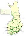 Major railway lines in Finland ja.svg 600 × 773; 52 KB
-
 Map of Honshu-Shikoku Bridge Project (ja).svg 1,170 × 966; 301 KB
-
 Map of sinitic languages full-ja.svg 2,219 × 1,759; 184 KB
-
 Map of sinitic languages-ja.svg 441 × 940; 906 KB
-
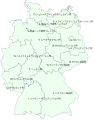
 Map provinces Netherlands-ja.svg 743 × 881; 550 KB
-
 Ming Empire cca 1580 (ja).svg 2,304 × 2,344; 2.18 MB
-
 Mount Fuji 20170330 (Japanese).svg 992 × 567; 2 KB
-
 National Parks in Japan.svg 420 × 480; 800 KB
-
 October 2023 Gaza−Israel conflict.svg 3,763 × 3,258; 8.42 MB
-
 Oosaka jr kinoko area.svg 1,603 × 1,114; 43 KB
-
 Orient Express 88 in Japan 1 ja.svg 1,500 × 1,600; 165 KB
-
 Orient Express 88 in Japan 2 ja.svg 1,500 × 1,600; 172 KB
-
 Orient Express 88 in Japan 3 ja.svg 1,500 × 1,600; 171 KB
-
 Orient Express 88 in Japan 4 ja.svg 1,500 × 1,600; 170 KB
-
 Orient Express 88 in Japan 5 ja.svg 1,500 × 1,600; 173 KB
-
 Orient Express 88 Paris-Tokyo.svg 1,900 × 1,000; 216 KB
-
 PAGASA Philippine Area of Responsibility - ja.svg 919 × 919; 614 KB
-
 Plates tect2 ja.svg 800 × 546; 320 KB
-

-
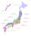
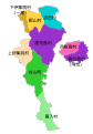
 Regions and Prefectures of Japan (ja).svg 2,480 × 3,175; 117 KB
-
 ROC Administrative and Claims-ja.svg 847 × 674; 727 KB
-
 Rutas shido shogun-han.svg 760 × 794; 132 KB
-
 Sendai City major streets Bansui-dori.svg 695 × 737; 93 KB
-
 Sendai City major streets Ekimae-dori.svg 695 × 737; 94 KB
-
 Sendai City major streets Higashi-Nibancho-dori.svg 695 × 737; 94 KB
-
 Sendai City major streets Itsutsubashi-dori.svg 652 × 691; 94 KB
-
 Sendai City major streets Nishikoen-dori.svg 652 × 691; 94 KB
-
 Sendai City major streets-Aoba-dori.svg 695 × 737; 94 KB
-
 Sendai City major streets-Jozenji-dori.svg 695 × 737; 94 KB
-
 Sendai City major streets-Kitamemachi-dori.svg 695 × 737; 94 KB
-
 Sendai City major streets-Minamimachi-dori.svg 695 × 737; 95 KB
-
 Sendai City major streets.svg 695 × 737; 136 KB
-
 Seoul subway linemap ja.svg 5,724 × 6,516; 203 KB
-
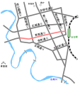
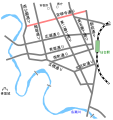
 Skyliner route Narita Sky Access ja.svg 809 × 481; 384 KB
-
 Snider-Pellegrini Wegener fossil map-ja.svg 571 × 441; 44 KB
-
 Staat.svg 637 × 803; 113 KB
-
 Takeshima map ja.svg 748 × 683; 76 KB
-
 Takeshima Map Ja.svg 1,350 × 1,350; 114 KB
-
 Tokyo Metropolitan Expressway map-ja.svg 6,048 × 8,688; 144 KB
-
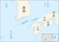 Tsushima and Korea straits-ja.svg 899 × 634; 156 KB
-
 United Nations geographical subregions ja.svg 2,754 × 1,398; 1.18 MB
-
 White Nile and Blue Nile-ja.svg 365 × 480; 743 KB
-
 World regional languages map-ja.svg 625 × 378; 2.4 MB
-
 Writing directions of the world ru.svg 1,684 × 1,055; 436 KB
-
 Writing directions of the world.svg 1,684 × 1,055; 307 KB
-
 本庄村字.svg 2,500 × 1,500; 1.09 MB


.svg)


.svg)


.svg)


.svg)
.svg)


.svg)


