File:Trench Map, Foret D'Apremont - DPLA - 5cdfc21feb939c6d13998bd9906e9281 (page 2).pdf
Jump to navigation
Jump to search

Size of this JPG preview of this PDF file: 674 × 600 pixels. Other resolutions: 270 × 240 pixels | 539 × 480 pixels | 863 × 768 pixels | 1,151 × 1,024 pixels | 2,301 × 2,048 pixels | 4,750 × 4,227 pixels.
Original file (4,750 × 4,227 pixels, file size: 7.69 MB, MIME type: application/pdf)
Captions
Captions
Add a one-line explanation of what this file represents
Summary
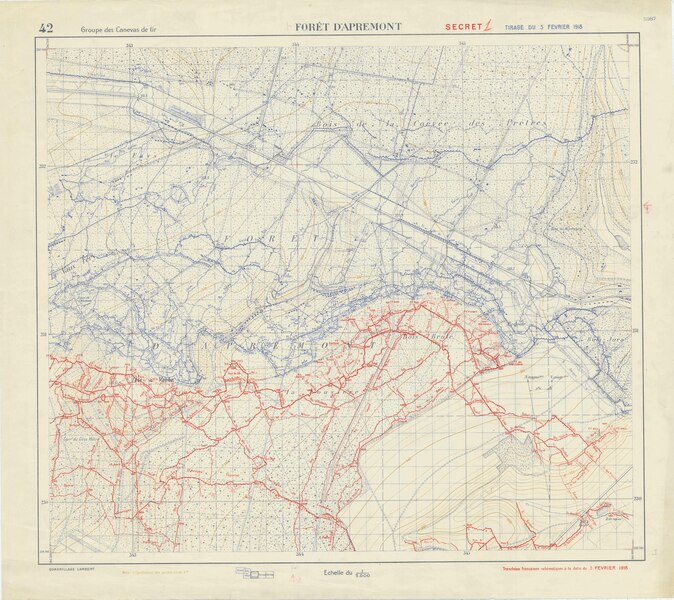
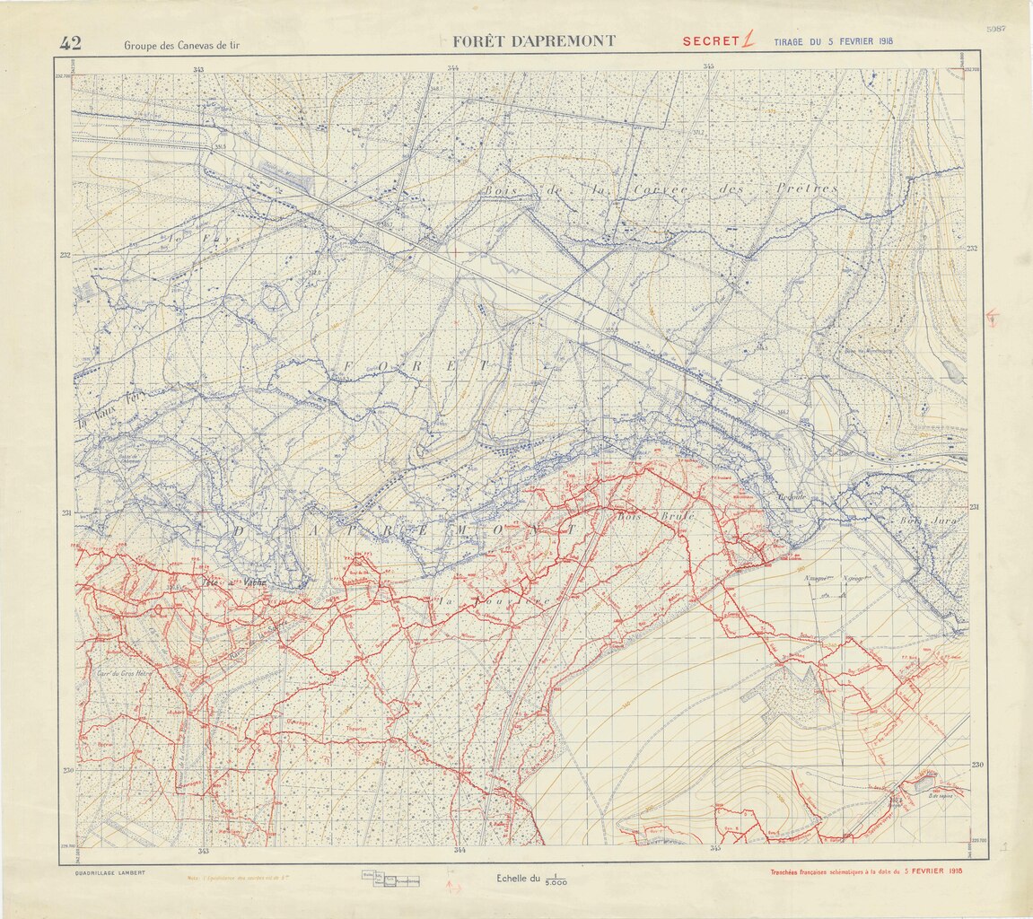
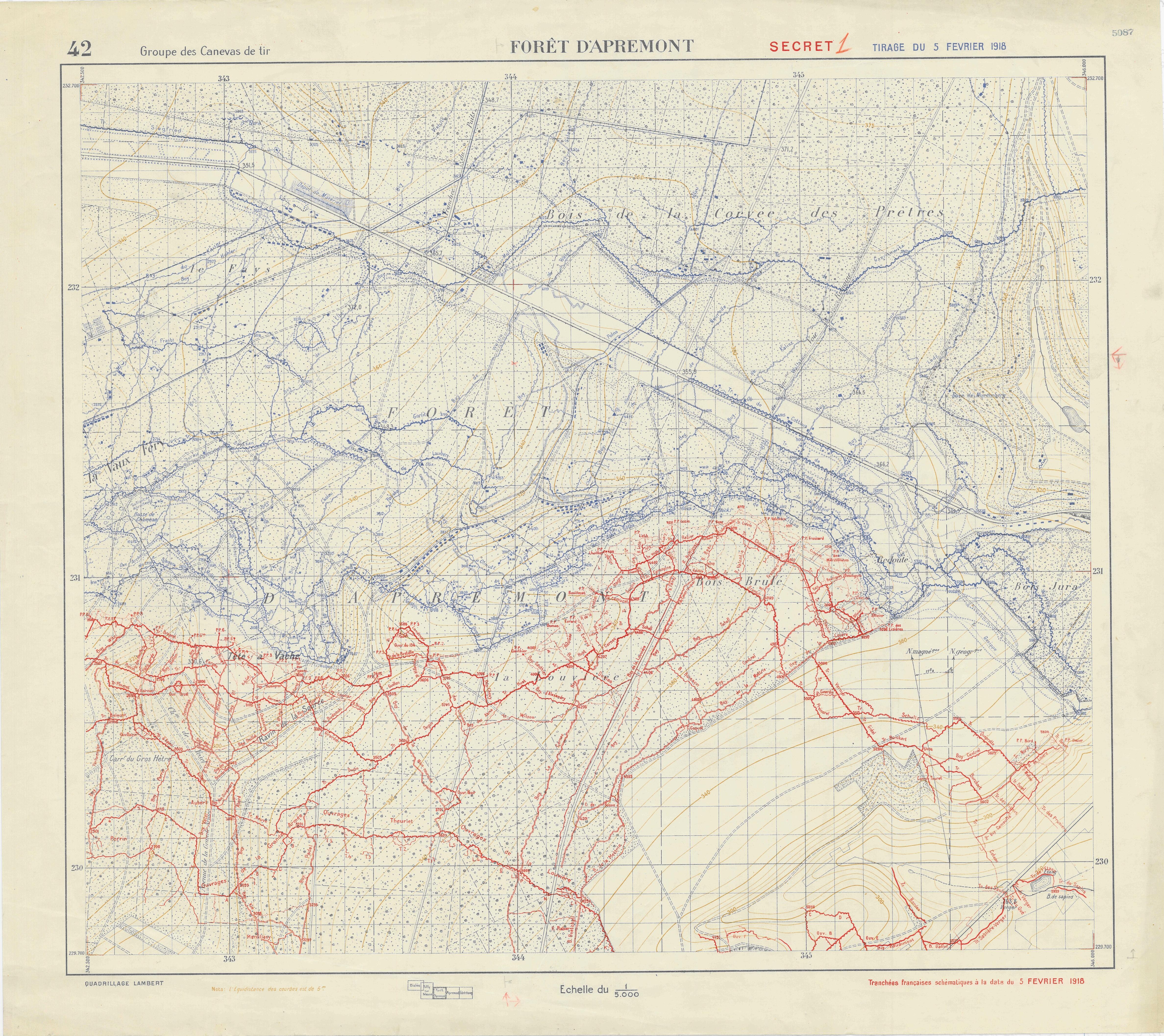
[edit]| Trench Map, Foret D'Apremont
( |
||||||||||||||
|---|---|---|---|---|---|---|---|---|---|---|---|---|---|---|
| Creator | War Department. American Expeditionary Forces. Office of the Assistant Chief of Staff Second Section (G-2). Topographical, Map Supply, and Sound and Flash Ranging Division. 2/16/1918-6/1919 | |||||||||||||
| Title |
Trench Map, Foret D'Apremont |
|||||||||||||
| Date | 5 February 1918 | |||||||||||||
| Collection |
|
|||||||||||||
| Source/Photographer |
|
|||||||||||||
| Permission (Reusing this file) |
|
|||||||||||||
| Standardized rights statement |
|
|||||||||||||


File history
Click on a date/time to view the file as it appeared at that time.
| Date/Time | Thumbnail | Dimensions | User | Comment | |
|---|---|---|---|---|---|
| current | 18:18, 9 November 2022 |  | 4,750 × 4,227 (7.69 MB) | DPLA bot (talk | contribs) | Uploading DPLA ID 5cdfc21feb939c6d13998bd9906e9281 |
You cannot overwrite this file.
File usage on Commons
The following page uses this file: