File:Swisstopo Dufourkarte BLATT XII. FREYBURG BERN LT TK 012 1860.tiff

Original file (11,680 × 8,600 pixels, file size: 95.82 MB, MIME type: image/tiff)
Captions
Captions
Summary
[edit]| Warning | The original file is very high-resolution. It might not load properly or could cause your browser to freeze when opened at full size. |
|---|
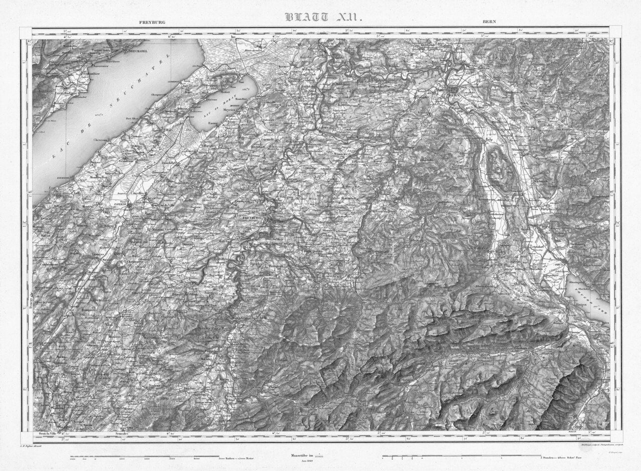
| Title |
Deutsch: Blatt XII. Freyburg, [Fribourg] Bern der Topographischen Karte der Schweiz, LT TK 012 1860 |
|||||||||||||||||||||||
| Description |
English: Sheet XII. Freyburg [Fribourg], Bern of Topographische Karte der Schweiz (Dufour Map).
Deutsch: Blatt XII. Freyburg [Fribourg], Bern der Topographischen Karte der Schweiz, auch Dufourkarte genannt. Dieses älteste amtliche Kartenwerk der Schweiz wurde unter der Leitung von Guillaume Henri Dufour erstellt.
Français : Feuille XII. Freyburg [Fribourg], Bern de la Carte Dufour. |
|||||||||||||||||||||||
| Map legend |
Deutsch: Zeichen und Abkürzungen |
|||||||||||||||||||||||
| Adjacent sheets |
|
|||||||||||||||||||||||
| Sheet index | index map, gallery | |||||||||||||||||||||||
| Source |
|
|||||||||||||||||||||||
| Creator | ||||||||||||||||||||||||
| Permission (Reusing this file) |
|
|||||||||||||||||||||||
| Geotemporal data | ||||||||||||||||||||||||
| Date depicted | ||||||||||||||||||||||||
| Map location | Fribourg, Bern | |||||||||||||||||||||||
| Spatial reference system | Bonne'sche Projektion | |||||||||||||||||||||||
| Scale | 1:100,000 | |||||||||||||||||||||||
| Heading |
 |
|||||||||||||||||||||||
| Georeferencing | If inappropriate please set warp_status = skip to hide. | |||||||||||||||||||||||
| Bibliographic data | ||||||||||||||||||||||||
| Part of the series | Erstausgabe Topographische Karte der Schweiz | |||||||||||||||||||||||
| Map sheet | 12 | |||||||||||||||||||||||
| Language | German | |||||||||||||||||||||||
| Publisher | ||||||||||||||||||||||||
| Archival data | ||||||||||||||||||||||||
| Collection |
Bundesamt für Landestopografie swisstopo, Kartensammlung
|
|||||||||||||||||||||||
| Accession number |
LT TK 012 1860 |
|||||||||||||||||||||||
| Dimensions | height: 61 cm (24 in); width: 83 cm (32.6 in) | |||||||||||||||||||||||


.jpg)
Licensing
[edit]The data made publicly available by swisstopo may be used, distributed and made accessible. Furthermore, they may be enriched and processed and also used commercially. A reference to the source is mandatory. In the case of digital or analogue representations and publications, as well as in the case of dissemination, one of the following source references must be attached in any case:
Terms of use for free geodata and geoservices (OGD) from swisstopo
|
.svg) |
File history
Click on a date/time to view the file as it appeared at that time.
| Date/Time | Thumbnail | Dimensions | User | Comment | |
|---|---|---|---|---|---|
| current | 07:34, 14 June 2023 |  | 11,680 × 8,600 (95.82 MB) | Swisstopo historic (talk | contribs) | {{Map |title=Blatt XII. Freyburg, [Fribourg] Bern der Topographischen Karte der Schweiz, LK TK 012 1860 |description=Blatt XII. Freyburg [Fribourg], Bern der Topographischen Karte der Schweiz, auch Dufourkarte genannt. Dieses älteste amtliche Kartenwerk der Schweiz wurde unter der Leitung von Guillaume Henri Dufour erstellt. {{Cultural property of regional significance in Switzerland|996}} |author=Guillaume-Henri Dufour; Heinrich Müllhaupt; Henri Koegel; J. Stempelmann, [[Eidg... |
You cannot overwrite this file.
File usage on Commons
The following 14 pages use this file:
- Maps of Switzerland
- User talk:André Costa (WMSE)/Template:Map
- File:Freyburg (von Swisstopo Dufourkarte BLATT XII, LT TK 012 1860).tiff
- File:Lac de Morat, 1860 (from Swisstopo Dufourkarte BLATT XII, LT TK 012 1860).tiff
- File:Swiss national map, 36 Saane-Sarine.jpg
- File:Swisstopo Dufourkarte BLATT VII. PORRENTRUY SOLOTHURN LT TK 007 1845.tiff
- File:Swisstopo Dufourkarte BLATT XI. PONTARLIER YVERDON LT TK 011 1849.tiff
- File:Swisstopo Dufourkarte BLATT XII. FREYBURG BERN LK TK 012 1860.tif (file redirect)
- File:Swisstopo Dufourkarte BLATT XIII INTERLACHEN SARNEN STANZ LT TK 013 1864.tiff
- File:Swisstopo Dufourkarte BLATT XVII VEVEY SION LT TK 017 1844.tiff
- File:Uebersicht der Blätter des Topographischen Atlasses der Schweiz (von Swisstopo Dufourkarte BLATT XXI, LT TK 021 1848).tiff
- Template:Map/Examples
- Template:Neighboring sheets Swisstopo Dufourkarte
- Template:Sheets Swisstopo Dufourkarte
File usage on other wikis
The following other wikis use this file:
- Usage on de.wikipedia.org