File:Sveriges Krig 2.12 front.tif
Jump to navigation
Jump to search

Size of this JPG preview of this TIF file: 800 × 365 pixels. Other resolutions: 320 × 146 pixels | 640 × 292 pixels | 1,024 × 468 pixels | 1,280 × 585 pixels | 2,560 × 1,169 pixels | 20,221 × 9,236 pixels.
Original file (20,221 × 9,236 pixels, file size: 358.94 MB, MIME type: image/tiff)
Captions
Captions
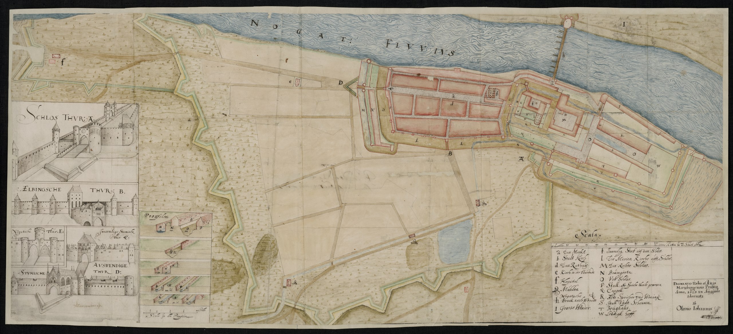
Situational map of the Malbork castle
Summary
[edit]| Warning | The original file is very high-resolution. It might not load properly or could cause your browser to freeze when opened at full size. |
|---|
| Description |
English: Situational map and architectural/design drawings of the Malbork castle.
Svenska: Situationsplan och arkitektur/designritningar av borgen i Malbork |
|||||||||||||||||||||||||||||
| Date | ||||||||||||||||||||||||||||||
| Source |
https://sok.riksarkivet.se/arkiv/CPk6s4MF9qMoRiLdhDy0G1
|
|||||||||||||||||||||||||||||
| Creator |
Olof Hansson Örnehufvud |
|||||||||||||||||||||||||||||
| Geotemporal data | ||||||||||||||||||||||||||||||
| Bounding box |
|
|||||||||||||||||||||||||||||
| Georeferencing | ||||||||||||||||||||||||||||||


Licensing
[edit]|
This work is in the public domain in its country of origin and other countries and areas where the copyright term is the author's life plus 70 years or fewer. | |
| This file has been identified as being free of known restrictions under copyright law, including all related and neighboring rights. | |
File history
Click on a date/time to view the file as it appeared at that time.
| Date/Time | Thumbnail | Dimensions | User | Comment | |
|---|---|---|---|---|---|
| current | 12:15, 9 November 2021 |  | 20,221 × 9,236 (358.94 MB) | Nils Weinander (Riksarkivet Sverige) (talk | contribs) | c:User:Rillke/bigChunkedUpload.js: Cleared incorrect EXIF data |
| 13:44, 2 November 2021 |  | 20,221 × 9,236 (534.35 MB) | Nils Weinander (Riksarkivet Sverige) (talk | contribs) | Uploaded a work by Olof Hansson Örnehufvud from https://sok.riksarkivet.se/arkiv/CPk6s4MF9qMoRiLdhDy0G1 with UploadWizard |
You cannot overwrite this file.
File usage on Commons
The following page uses this file:
File usage on other wikis
The following other wikis use this file:
- Usage on en.wikipedia.org
- Usage on sv.wikipedia.org
- Usage on uz.wikipedia.org
- Usage on www.wikidata.org