Category:Maps in the National Archives of Sweden
Jump to navigation
Jump to search
English: Maps held by the National Archives of Sweden
Svenska: Kartor i Riksarkivet
Subcategories
This category has the following 5 subcategories, out of 5 total.
A
- Atlas of Friedrich Getkant (14 F)
- Atlas of Heinrich Thomé (20 F)
- Atlas of Leonardo de Ferrari (30 F)
M
- Maps from Wiblingen Atlas (149 F)
Media in category "Maps in the National Archives of Sweden"
The following 200 files are in this category, out of 287 total.
(previous page) (next page)-
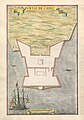 0003 Puntal De Cadiz (cropped).jpg 4,304 × 6,147; 3.45 MB
-
 0005 RenquentroDeMontijo.jpg 10,225 × 6,987; 5.19 MB
-
 0006 Lugar Del Almendral.jpg 10,239 × 7,026; 5.13 MB
-
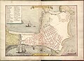
 0007 Planta De Oliva.jpg 10,279 × 7,013; 4.37 MB
-
 0008 Planta De Telena.jpg 10,345 × 7,040; 4.53 MB
-
 0009 Planta De La Ciudad De Xeres De Los Cavalleros.jpg 10,359 × 6,973; 4.99 MB
-
 0010 San Gian.jpg 10,345 × 7,000; 5.46 MB
-
 0011 Planta De La Ciudad De Tavilla.jpg 8,190 × 5,789; 7.13 MB
-
 0012 Planta De Castro Marin.jpg 10,372 × 6,986; 5.76 MB
-
 0013 Planta De Lagos.jpg 10,452 × 6,960; 5.06 MB
-
 17th century hand drawn map of Ayamonte.jpg 10,266 × 7,014; 5.4 MB
-
 17th century hand drawn map of Cadiz, Spain.jpg 10,159 × 6,920; 5.23 MB
-
 17th century hand drawn map of Planta De Cadis. Cadiz, Spanien.jpg 9,360 × 6,795; 5.15 MB
-
 18th century map of Arboga, Sweden.jpg 3,984 × 3,107; 780 KB
-
 18th century map of Askersund.jpg 4,083 × 3,107; 757 KB
-
 18th century map of Borås.jpg 3,810 × 3,012; 654 KB
-
 18th century map of Eksjö, Sweden.jpg 3,774 × 3,320; 772 KB
-
 18th century map of Enköping, Sweden.jpg 3,750 × 3,176; 674 KB
-
 18th century map of Eskilstuna, Sweden.jpg 4,327 × 3,441; 847 KB
-
 18th century map of Falkenberg, Sweden.jpg 3,657 × 3,311; 668 KB
-
 18th century map of Falköping, Sweden.jpg 3,847 × 2,686; 557 KB
-
 18th century map of Falsterbo, Sweden.jpg 3,224 × 3,265; 579 KB
-
 18th century map of Filipstad, Sweden.jpg 4,316 × 3,181; 713 KB
-
 18th century map of Gränna, Sweden.jpg 3,853 × 3,117; 672 KB
-
 18th century map of Gävle, Sweden.jpg 4,333 × 3,357; 1.21 MB
-
 18th century map of Halmstad, Sweden.jpg 3,976 × 3,145; 659 KB
-
 18th century map of Hedemora, Sweden.jpg 4,065 × 3,428; 821 KB
-
 18th century map of Hjo, Sweden.jpg 3,922 × 2,997; 653 KB
-
 18th century map of Hudiksvall, Sweden.jpg 3,928 × 3,081; 753 KB
-
 18th century map of Härnösand, Sweden.jpg 4,144 × 3,368; 898 KB
-
 18th century map of Jönköping, Sweden.jpg 4,415 × 2,916; 797 KB
-
 18th century map of Kalmar, Sweden.jpg 4,259 × 3,240; 905 KB
-
 18th century map of Karlshamn, Sweden.jpg 3,892 × 3,276; 841 KB
-
 18th century map of Karlstad, Sweden.jpg 4,131 × 3,119; 788 KB
-
 18th century map of Kristianstad, Sweden.jpg 2,916 × 4,050; 708 KB
-
 18th century map of Kristinehamn, Sweden.jpg 4,170 × 3,396; 845 KB
-
 18th century map of Kungsbacka, Sweden.jpg 4,107 × 3,121; 675 KB
-
 18th century map of Kungälv, Sweden.jpg 4,049 × 3,190; 790 KB
-
 18th century map of Köping, Sweden.jpg 4,008 × 3,417; 823 KB
-
 18th century map of Landskrona, Sweden.jpg 3,995 × 3,332; 826 KB
-
 18th century map of Lidköping, Sweden.jpg 3,959 × 3,261; 768 KB
-
 18th century map of Lindesberg, Sweden.jpg 3,960 × 3,142; 775 KB
-
 18th century map of Linköping, Sweden.jpg 4,157 × 3,513; 847 KB
-
 18th century map of Luleå, Sweden.jpg 3,804 × 2,999; 640 KB
-
 18th century map of Lund, Sweden.jpg 4,109 × 3,361; 1.1 MB
-
 18th century map of Malmköping, Sweden.jpg 3,977 × 3,213; 720 KB
-
 18th century map of Malmö, Sweden.jpg 6,508 × 4,161; 1.84 MB
-
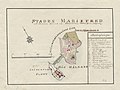 18th century map of Mariefred, Sweden.jpg 4,152 × 3,128; 733 KB
-
 18th century map of Mariestad, Sweden.jpg 3,685 × 3,000; 587 KB
-
 18th century map of Marstrand, Sweden.jpg 3,913 × 5,122; 1.27 MB
-
 18th century map of Nora, Sweden.jpg 3,745 × 3,287; 696 KB
-
 18th century map of Norrköping, Sweden.jpg 5,692 × 4,012; 1.65 MB
-
 18th century map of Norrtälje, Sweden.jpg 4,229 × 2,997; 698 KB
-
 18th century map of Nyköping, Sweden.jpg 4,313 × 3,644; 1.02 MB
-
 18th century map of Piteå, Sweden.jpg 4,006 × 3,048; 666 KB
-
 18th century map of Sala, Sweden.jpg 3,970 × 3,252; 715 KB
-
 18th century map of Simrishamn, Sweden.jpg 4,554 × 3,732; 994 KB
-
 18th century map of Skanör, Sweden.jpg 3,808 × 3,248; 766 KB
-
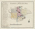
 18th century map of Skara, Sweden.jpg 3,868 × 3,200; 682 KB
-
 18th century map of Skänninge, Sweden.jpg 4,104 × 3,359; 867 KB
-
 18th century map of Skövde, Sweden.jpg 3,588 × 3,121; 603 KB
-
 18th century map of Strängnäs, Sweden.jpg 3,797 × 3,057; 725 KB
-
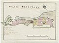
 18th century map of Strömstad, Sweden.jpg 4,457 × 3,109; 764 KB
-
 18th century map of Sundsvall, Sweden.jpg 4,229 × 3,153; 805 KB
-
 18th century map of Säter, Sweden.jpg 4,028 × 3,155; 754 KB
-
 18th century map of Söderhamn, Sweden.jpg 3,845 × 3,141; 810 KB
-
 18th century map of Söderköping, Sweden.jpg 4,040 × 3,275; 879 KB
-
 18th century map of Södertälje, Sweden.jpg 3,927 × 3,061; 697 KB
-
 18th century map of Sölvesborg, Sweden.jpg 3,329 × 2,590; 493 KB
-
 18th century map of Torshälla, Sweden.jpg 3,747 × 2,974; 684 KB
-
 18th century map of Trosa, Sweden.jpg 3,819 × 2,866; 619 KB
-
 18th century map of Uddevalla, Sweden.jpg 3,953 × 3,405; 777 KB
-
 18th century map of Ulricehamn, Sweden.jpg 4,240 × 3,237; 723 KB
-
 18th century map of Umeå, Sweden.jpg 3,829 × 3,083; 638 KB
-
 18th century map of Uppsala, Sweden.jpg 3,250 × 4,153; 1.06 MB
-
 18th century map of Vadstena, Sweden.jpg 4,292 × 3,188; 848 KB
-
 18th century map of Varberg, Sweden.jpg 3,765 × 2,952; 587 KB
-
 18th century map of Vaxholm, Sweden.jpg 3,189 × 2,469; 512 KB
-
 18th century map of Vimmerby, Sweden.jpg 3,924 × 2,543; 526 KB
-
 18th century map of Visby, Sweden.jpg 4,008 × 3,251; 1.02 MB
-
 18th century map of Vänersborg, Sweden.jpg 3,744 × 3,081; 723 KB
-
 18th century map of Västervik, Sweden.jpg 3,745 × 3,009; 759 KB
-
 18th century map of Västerås, Sweden.jpg 4,152 × 3,334; 966 KB
-
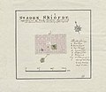
 18th century map of Ystad, Sweden.jpg 4,128 × 2,927; 846 KB
-
 18th century map of Ängelholm, Sweden.jpg 3,982 × 3,082; 734 KB
-
 18th century map of Åmål, Sweden.jpg 3,670 × 3,046; 633 KB
-
 18th century map of Örebro, Sweden.jpg 3,068 × 4,584; 949 KB
-
 18th century map of Östersund, Sweden.jpg 3,616 × 3,032; 717 KB
-
 18th century map of Östhammar, Sweden.jpg 3,832 × 2,996; 647 KB
-
 Abriss des Torgowschen Lagers Anno 1637.jpg 4,419 × 5,571; 1.24 MB
-
 AlvsborgsSlott1657.jpg 2,748 × 1,748; 701 KB
-
 Anklam 1639.jpg 6,169 × 4,579; 3.28 MB
-
 Anklam 1659.jpg 5,817 × 4,313; 4.42 MB
-
 Bakałarava-Filipaŭ-Pierarośla. Бакаларава-Філіпаў-Пераросьля (1655).jpg 2,056 × 1,921; 296 KB
-
 BattleofGadebusch.jpg 1,024 × 703; 152 KB
-
 Befestigungsplan - Kelheim - um 1632.jpg 4,761 × 3,813; 4.26 MB
-
 Befestigungsplan - Pappenheim - 1632.jpg 8,293 × 4,831; 10.14 MB
-
 Befestigungsplan - Regensburg - 1630.jpg 8,647 × 5,153; 7.24 MB
-
 Bieraście. Берасьце (J. Bonelli, 1657).jpg 5,485 × 4,515; 4.91 MB
-
 BillingenRya1809.jpg 2,835 × 2,134; 908 KB
-
 Bohus1678-3.jpg 2,361 × 2,480; 750 KB
-
 Bohus1726.jpg 2,480 × 1,867; 524 KB
-
 Bohus1771-1.jpg 1,830 × 2,480; 745 KB
-
 Bohuslän1729.jpg 6,470 × 5,610; 6.26 MB
-
 Butzow 1692.jpg 4,719 × 3,790; 1.64 MB
-
 Charta huru dhe Danske lembnade Helsingborgh när dhe uthmarcherade effter Fredzsluthet.jpg 7,249 × 4,658; 2.65 MB
-

-
 Charta öfver Svea och Göta Riken med Finland och Norland.jpg 5,791 × 6,739; 9.05 MB
-
 Charta öfwer byggnaden på gamle repare banen nr 127.jpg 1,067 × 1,436; 114 KB
-
 Charta öfwer Fälads Marken till Helsingborg, kopia 1786.jpg 7,391 × 9,259; 6.06 MB
-
 Charta öfwer Situationen Omkring Helsingborgs Stad.jpg 14,620 × 16,652; 11.67 MB
-
 Charta öfwer Wästerbottns Höfdingedöme och dertil hörande Lappmarker.jpg 12,346 × 7,640; 3.91 MB
-
 Crimean Journey of Catherine the Great.jpg 6,323 × 4,915; 5.74 MB
-
 Delineatio General's Camprorum Desertorum vulgo Ukraina. Cum adjacentibus Provinciis.png 1,878 × 1,424; 5.03 MB
-
 Demmin 1758.jpg 6,161 × 4,802; 4.57 MB
-
-
 Drysviaty plan 17-18 cc.jpg 7,573 × 3,708; 2.72 MB
-
 Eda skans map 1813.jpg 3,273 × 2,459; 860 KB
-
 Entwerffung 0414.028.007 front.tif 10,058 × 7,274; 141.02 MB
-
 Folkärna socken 1652.jpg 3,402 × 4,388; 1.04 MB
-
 Fort Christina.jpg 2,907 × 2,365; 1,008 KB
-
 Fortress of Mainau is captured by the Swedes in 1647.png 2,098 × 1,242; 1.67 MB
-
 Franzburg 1761.jpg 3,756 × 2,433; 1.66 MB
-
 Fredrikshald1660.jpg 3,277 × 2,466; 1.36 MB
-
 Gamla stan 1626 förslag.jpg 1,560 × 968; 1.06 MB
-
 Gbg1719-1.jpg 3,508 × 2,606; 1.11 MB
-
 Gbg1719-2.jpg 3,508 × 2,181; 572 KB
-
 Gbgdefenceworks1733.jpg 2,835 × 2,044; 1.09 MB
-
 GbgSkans1782-01.jpg 1,984 × 1,679; 608 KB
-
 Gegraphisch Charta öfwer Skåne.jpg 9,608 × 6,612; 4.8 MB
-
 Geografisk karta över landsvägarna genom Halland.jpg 6,824 × 5,248; 2.23 MB
-
 Geografisk karta över landsvägarna genom Kronobergs län.jpg 6,421 × 4,874; 3.04 MB
-
 Geographisch Charta af Sudermannia Borealis eller Gripsholms Lähn.jpg 8,046 × 5,746; 4.33 MB
-
 Geographisk Charta Öfver Uleåborgs Lähn, uti Finland.jpg 9,912 × 14,031; 6.88 MB
-
 Geographisk Charta öfwer Landswägarne igenom Elfsborgs Lähn och Dahl.jpg 8,786 × 6,674; 5.61 MB
-
 Geographisk Charta öfwer Landswägarne igenom Skaraborgs Lähn.jpg 8,862 × 6,766; 5.79 MB
-

-
 Geometrisk Afrijtningh, Delineation och Uthrächningh öfwer Holms Byens Ägor uthi Umeå Sochn.jpg 9,510 × 15,733; 10.91 MB
-
-
 Geometrisk karta över Kungl Maj-ts gamla amiralitetsskeppsvarv.jpg 4,800 × 7,680; 2.56 MB
-
 Geometriska avritningar av Älfsborgs ladugårds ägor.jpg 11,080 × 12,560; 14.38 MB
-
 Goteborg1646.jpg 2,480 × 2,455; 1,008 KB
-
 Goteborg1795.jpg 4,961 × 3,756; 2.99 MB
-
 Gravura das muralhas de Lagos no Seculo XVI (A) - Arquivo Militar Sueco.jpg 15,640 × 8,699; 9.61 MB
-
 Gravura das muralhas de Lagos no Seculo XVI (B) - Arquivo Militar Sueco.jpg 15,640 × 8,728; 9.24 MB
-
 Greifenhagen.jpg 4,678 × 3,748; 1.06 MB
-
 Grundritning till kyrkan och klocktornet vid Gamla Varvet.jpg 6,373 × 4,741; 1.94 MB
-
 Grundritning över Gamla Amiralitetsvarvet.jpg 8,560 × 9,877; 6.39 MB
-
 Gustavia 1796.jpg 5,837 × 8,970; 3 MB
-
 Gustavia 1799.jpg 5,994 × 8,812; 3.78 MB
-
 Gustavia försvar 1.jpg 7,437 × 4,891; 1.53 MB
-
 Gustavia försvar 2.jpg 6,411 × 5,056; 1.64 MB
-
 Gustavia försvar 3.jpg 5,048 × 3,744; 725 KB
-
 Göteborg. Planer. Geometrisk karta över området mellan gamla varvet och Gamla Älvsborg.jpg 6,810 × 5,866; 2.03 MB
-

-
 Gützkow 1761.jpg 5,238 × 5,913; 4.46 MB
-
 Helsingborg 1645, förslag till befästningar.jpg 5,876 × 4,597; 2.89 MB
-
 Helsingborg med dess Situation aftagit uthi Augusti Månadh åhr 1666.jpg 8,699 × 6,009; 4.6 MB
-

-
 Historical map of Bakhmut in Ukraine.jpg 8,323 × 6,317; 3.51 MB
-
 Historical map of Baku (cropped).jpg 7,859 × 5,379; 2.69 MB
-
 Historical map of Baku.jpg 7,859 × 5,796; 2.93 MB
-
 Historical map of Rasht (cropped).jpg 8,132 × 5,623; 3.66 MB
-
 Historical map of Rasht.jpg 8,139 × 6,117; 3.82 MB
-
 Horadnia. Горадня (1655).jpg 6,900 × 5,496; 1.94 MB
-

-
 Härnösand 1648.jpg 1,648 × 1,251; 449 KB
-
 Inloppet till Göteborg.jpg 10,420 × 6,800; 5.34 MB
-
 Jarmen 1760.jpg 7,275 × 5,954; 4.45 MB
-
 Jämtland, Härjedalen, Medelpad, Ångermanland samt Åsele lappmark, generalkartor.jpg 10,537 × 11,853; 15.87 MB
-
 Jönköping 1620.jpg 6,632 × 3,838; 2.69 MB
-
 KarboleSkans1.jpg 2,536 × 2,196; 742 KB
-
 Karl9Gbg01.jpg 2,835 × 1,943; 713 KB
-
 KarlsBatteri01.jpg 1,998 × 2,835; 221 KB
-
 Karlsborg1819.jpg 1,796 × 1,748; 955 KB
-
 Karlsborg1836.jpg 2,480 × 1,853; 749 KB
-
 Karlsborg1848.jpg 2,480 × 1,576; 796 KB
-
 Karlsborg1881.jpg 2,145 × 3,425; 1.74 MB
-
 Karta öfver Kemi Lappmark.jpg 3,271 × 5,396; 5.79 MB
-
 Karta öfver Situationerne kring Göteborg och Bohus.jpg 7,686 × 9,894; 6.55 MB
-
 Karta över de jämtländska lapparnas huvudsakliga betesområden.jpg 14,996 × 10,426; 17.49 MB
-
 Karta över Enare träsk i Lappmarken, norra Finland. 1700-tal.jpg 5,559 × 7,223; 1.83 MB
-
 Karta över Grunnebohed 1889.jpg 8,691 × 6,904; 2.88 MB
-
 Karta över Hanau, Tyskland.jpg 6,850 × 5,940; 5.17 MB
-
 Karta över Helsingborg 1877, Robert Söderqvist.jpg 7,877 × 5,265; 4.01 MB
-
 Karta över Konung Oscars Hamn.jpg 2,965 × 2,586; 1.25 MB
-
 Karta över Kronoamiralitetsvarvet i Örgryte socken, Sävedals härad. H. Hallberger 1818.jpg 6,915 × 8,892; 3.66 MB
-
 Karta över kyrkogård vid Tornehamn från 1901.jpg 5,897 × 4,549; 1.07 MB
-
 Karta över Lycksele (Umeå) lappmark från 1671.jpg 6,456 × 17,090; 21.69 MB
-
 Karte von Löcknitz 1759.jpg 995 × 1,248; 114 KB
-
 Karte von Löcknitz 1760.jpg 993 × 788; 80 KB
-
 Karte von Löcknitz und Umgebung.jpg 516 × 509; 40 KB
-
 Klein Zicker Schanze 1806.jpg 3,576 × 5,555; 1.05 MB
-
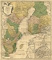
 Kolonier i Amerika.jpg 6,297 × 2,366; 1.68 MB
-
 Kungsladugard1.jpg 4,647 × 3,509; 1.97 MB
-
 Kurlandyja-Žamojć. Курляндыя-Жамойць (1667).jpg 5,232 × 3,649; 2.67 MB
-
 Königstein-01.jpg 6,039 × 6,679; 3.11 MB
-
 Landskrona 1680.jpg 10,285 × 11,575; 6.62 MB
-
 Lithauen oder Weis Reussen.jpg 1,689 × 1,120; 1.12 MB
-
 Litva. Літва (XVII).jpg 6,755 × 3,518; 1.78 MB
.jpg)


.jpg)


.jpg)


_-_Arquivo_Militar_Sueco.jpg)
_-_Arquivo_Militar_Sueco.jpg)


.jpg)

.jpg)

.jpg)


.jpg)


.jpg)
_lappmark_fr%C3%A5n_1671.jpg)