File:Small Sandy Inlet, Clachtoll Bay - geograph.org.uk - 238195.jpg
Jump to navigation
Jump to search
No higher resolution available.
Small_Sandy_Inlet,_Clachtoll_Bay_-_geograph.org.uk_-_238195.jpg (640 × 480 pixels, file size: 90 KB, MIME type: image/jpeg)
Captions
Captions
Add a one-line explanation of what this file represents
Summary
[edit]
| Description |
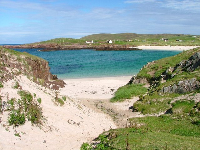
English: Small Sandy Inlet, Clachtoll Bay. Just inside the square but marking a geological boundary. To the left are the red Torridonian Sandstone rocks. To the right and possibly outside the square are grey rocks of Lewisian Gneiss. Please correct me if I have this wrong. |
| Date | |
| Source | From geograph.org.uk |
| Author | Mick Garratt |
| Attribution (required by the license) | Mick Garratt / Small Sandy Inlet, Clachtoll Bay / |
| Camera location | | View this and other nearby images on: OpenStreetMap |
|---|
_heading:0.00&language=en)
| Object location | | View this and other nearby images on: OpenStreetMap |
|---|
_heading:0.00&language=en)
Licensing
[edit]

|
This image was taken from the Geograph project collection. See this photograph's page on the Geograph website for the photographer's contact details. The copyright on this image is owned by Mick Garratt and is licensed for reuse under the Creative Commons Attribution-ShareAlike 2.0 license.
|
This file is licensed under the Creative Commons Attribution-Share Alike 2.0 Generic license.
Attribution: Mick Garratt
- You are free:
- to share – to copy, distribute and transmit the work
- to remix – to adapt the work
- Under the following conditions:
- attribution – You must give appropriate credit, provide a link to the license, and indicate if changes were made. You may do so in any reasonable manner, but not in any way that suggests the licensor endorses you or your use.
- share alike – If you remix, transform, or build upon the material, you must distribute your contributions under the same or compatible license as the original.
File history
Click on a date/time to view the file as it appeared at that time.
| Date/Time | Thumbnail | Dimensions | User | Comment | |
|---|---|---|---|---|---|
| current | 02:15, 1 February 2010 | | 640 × 480 (90 KB) | GeographBot (talk | contribs) | == {{int:filedesc}} == {{Information |description={{en|1=Small Sandy Inlet, Clachtoll Bay. Just inside the square but marking a geological boundary. To the left are the red Torridonian Sandstone rocks. To the right and possibly outside the square are grey |
You cannot overwrite this file.
File usage on Commons
There are no pages that use this file.