Category:Clachtoll
Jump to navigation
Jump to search
English: Clachtoll is a remote coastal fishing and crofting village, situated on the Bay of Clachtoll, on the western edge of Scotland, in the Assynt district, in Lairg, Sutherland, Scottish Highlands and is in the Scottish council area of Highland.
Nederlands: Clachtoll ( Schots-Gaelisch: Clach Toll) is een plaats in de Schotse Hooglanden in het historisch graafschap Sutherland in de buurt van Stoer.

human settlement in Highland, Scotland, UK  | |||||
| Upload media | |||||
| Instance of | |||||
|---|---|---|---|---|---|
| Location |
| ||||
 | |||||
Media in category "Clachtoll"
The following 67 files are in this category, out of 67 total.
-

-

-
 A' Chlach Thuill - geograph.org.uk - 228501.jpg 640 × 384; 74 KB
-
 A' Chlach Thuill - geograph.org.uk - 5779527.jpg 4,320 × 2,663; 2.13 MB
-
 A' Chlach Thuill - geograph.org.uk - 6209345.jpg 640 × 360; 111 KB
-
 An Dun broch interior - geograph.org.uk - 5779474.jpg 4,320 × 3,240; 3.8 MB
-
 An Dun entrance - geograph.org.uk - 5779485.jpg 3,239 × 4,319; 2.88 MB
-

-
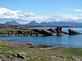
 Bay of Clachtoll - geograph.org.uk - 2037637.jpg 3,296 × 2,472; 1.97 MB
-
 Bay of Clachtoll - geograph.org.uk - 5779493.jpg 4,223 × 3,167; 2.29 MB
-
 Beach at Clachtoll - geograph.org.uk - 1241891.jpg 640 × 480; 38 KB
-
 Beach at Clachtoll - geograph.org.uk - 2037621.jpg 3,296 × 2,472; 1.96 MB
-
 Beach at Clachtoll - geograph.org.uk - 4883282.jpg 1,600 × 1,067; 346 KB
-
 Beach at Clachtoll - geograph.org.uk - 5779500.jpg 4,162 × 2,184; 1.54 MB
-
 Boardwalk to the beach - geograph.org.uk - 5904500.jpg 640 × 480; 250 KB
-
 Clachtoll - geograph.org.uk - 1392399.jpg 640 × 480; 73 KB
-
 Clachtoll - geograph.org.uk - 1462286.jpg 640 × 480; 67 KB
-
 Clachtoll - geograph.org.uk - 3568394.jpg 640 × 480; 72 KB
-
 Clachtoll Bay - geograph.org.uk - 2860372.jpg 2,112 × 2,816; 2.67 MB
-
 Clachtoll beach - geograph.org.uk - 1462267.jpg 640 × 480; 62 KB
-
 Clachtoll Beach - geograph.org.uk - 3603940.jpg 640 × 480; 75 KB
-
 Clachtoll blue waters - geograph.org.uk - 2860366.jpg 2,112 × 2,816; 3.05 MB
-
 Clachtoll with Loch an Aigeil - geograph.org.uk - 1392414.jpg 640 × 480; 60 KB
-
 Erratic boulder at the sea edge - geograph.org.uk - 1462303.jpg 640 × 480; 78 KB
-
 Fine beaches on a fine day - geograph.org.uk - 5779506.jpg 4,320 × 3,240; 3.41 MB
-
 Gate to beach at Clachtoll - geograph.org.uk - 910555.jpg 525 × 388; 46 KB
-
 Icehouse and bag-net anchors, Clachtoll - geograph.org.uk - 2371601.jpg 800 × 600; 125 KB
-
 Lonely house hiding near Clachtoll - geograph.org.uk - 1025192.jpg 640 × 480; 82 KB
-
 Old Mill, Port Alltan na Bradhan - geograph.org.uk - 229355.jpg 640 × 480; 326 KB
-
 Old salmon hut, Clachtoll - geograph.org.uk - 1462277.jpg 640 × 480; 77 KB
-
 Remains of Runrigs, Clachtoll - geograph.org.uk - 238192.jpg 640 × 384; 71 KB
-
 Rocks and algae at Clachtoll - geograph.org.uk - 2037641.jpg 3,296 × 2,472; 1.92 MB
-
 Rocks and canoeists - geograph.org.uk - 2003074.jpg 960 × 643; 164 KB
-

-
 Small beach south of Clachtoll - geograph.org.uk - 5779536.jpg 4,320 × 3,240; 3.03 MB
-
 Small Sandy Inlet, Clachtoll Bay - geograph.org.uk - 238195.jpg 640 × 480; 90 KB
-
 Split Rock at Clachtoll - geograph.org.uk - 1022644.jpg 640 × 480; 77 KB
-
 Stormy and rainy day in Clachtoll - geograph.org.uk - 1025210.jpg 640 × 480; 59 KB
-
 The headland at Clachtoll bay - geograph.org.uk - 2860379.jpg 2,112 × 2,816; 2.18 MB
-
 The Road, Alongside Loch na Ordain - geograph.org.uk - 240416.jpg 480 × 640; 78 KB
-

-
 Tidal rock in the Bay of Clachtoll - geograph.org.uk - 5904506.jpg 640 × 480; 241 KB
-
 139 Clachtoll - geograph.org.uk - 14367.jpg 506 × 338; 23 KB
-
 Am Bearag, The Salmon Bothy - geograph.org.uk - 228548.jpg 640 × 384; 60 KB
-
 Beach at Clachtoll - geograph.org.uk - 1462293.jpg 640 × 480; 68 KB
-
 Beach at Port Alltan na Bradhan - geograph.org.uk - 239759.jpg 480 × 640; 98 KB
-
 Beach, Port Alltan na Bradhan - geograph.org.uk - 229362.jpg 640 × 480; 188 KB
-
 Clachtoll - geograph.org.uk - 228880.jpg 640 × 384; 84 KB
-
 Clachtoll Bay, Low Tide - geograph.org.uk - 235074.jpg 640 × 480; 98 KB
-
 Corn Mill Site, Altan na Bradhan - geograph.org.uk - 229243.jpg 640 × 480; 133 KB
-
 Creag Clais nan Cruineachd - geograph.org.uk - 242971.jpg 640 × 384; 106 KB
-
 Croft at Pollan, Assynt, Sutherland - geograph.org.uk - 110943.jpg 640 × 426; 195 KB
-
 Hut, Footpath to Achmelvich - geograph.org.uk - 228893.jpg 640 × 480; 140 KB
-
 Loch an Leathaid Rainich - geograph.org.uk - 227606.jpg 640 × 384; 105 KB
-
 Loch an Ordain - geograph.org.uk - 227604.jpg 640 × 480; 96 KB
-
 Loch an Ordain - geograph.org.uk - 229260.jpg 480 × 640; 91 KB
-
 Loch Leathad nan Aighean - geograph.org.uk - 229255.jpg 640 × 384; 93 KB
-
 Loch na Creige Leithe - geograph.org.uk - 239761.jpg 640 × 480; 96 KB
-
 Peat Road, Clachtoll - geograph.org.uk - 62805.jpg 640 × 480; 131 KB
-
 Port Alltan na Bradhan - geograph.org.uk - 450379.jpg 640 × 427; 97 KB
-

-
 Rock climbing on slabs - geograph.org.uk - 218908.jpg 640 × 479; 109 KB
-
 Ruined Croft, A' Chlach Thuille - geograph.org.uk - 228878.jpg 640 × 480; 102 KB
-

-
 Split Rock - geograph.org.uk - 82430.jpg 640 × 480; 118 KB
-
 Stream by the mill - geograph.org.uk - 450376.jpg 640 × 427; 120 KB
-


