File:RAF Cowden Air Weapon Range - geograph.org.uk - 432811.jpg
Jump to navigation
Jump to search
No higher resolution available.
RAF_Cowden_Air_Weapon_Range_-_geograph.org.uk_-_432811.jpg (640 × 430 pixels, file size: 51 KB, MIME type: image/jpeg)
Captions
Captions
Add a one-line explanation of what this file represents
Summary
[edit]
| Description |
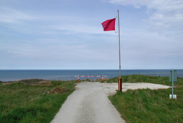
English: RAF Cowden Air Weapon Range, Cowden, East Riding of Yorkshire, England. Warning flag on the south side of the Air Weapon Range at RAF Cowden on the North Sea Coast. There's a tower marked on the map here, but rapid coastal erosion (perhaps combined with the effects of the bombing runs) probably caused it to fall into the sea. |
| Date | |
| Source | From geograph.org.uk |
| Author | Paul Glazzard |
| Permission (Reusing this file) |
Creative Commons Attribution Share-alike license 2.0 |
| Attribution (required by the license) | Paul Glazzard / RAF Cowden Air Weapon Range / |
| Camera location | | View this and other nearby images on: OpenStreetMap |
|---|
_heading:45.00&language=en)
| Object location | | View this and other nearby images on: OpenStreetMap |
|---|
_heading:45.00&language=en)
Licensing
[edit]

|
This image was taken from the Geograph project collection. See this photograph's page on the Geograph website for the photographer's contact details. The copyright on this image is owned by Paul Glazzard and is licensed for reuse under the Creative Commons Attribution-ShareAlike 2.0 license.
|
This file is licensed under the Creative Commons Attribution-Share Alike 2.0 Generic license.
Attribution: Paul Glazzard
- You are free:
- to share – to copy, distribute and transmit the work
- to remix – to adapt the work
- Under the following conditions:
- attribution – You must give appropriate credit, provide a link to the license, and indicate if changes were made. You may do so in any reasonable manner, but not in any way that suggests the licensor endorses you or your use.
- share alike – If you remix, transform, or build upon the material, you must distribute your contributions under the same or compatible license as the original.
File history
Click on a date/time to view the file as it appeared at that time.
| Date/Time | Thumbnail | Dimensions | User | Comment | |
|---|---|---|---|---|---|
| current | 08:44, 4 February 2011 | | 640 × 430 (51 KB) | GeographBot (talk | contribs) | == {{int:filedesc}} == {{Information |description={{en|1=RAF Cowden Air Weapon Range Warning flag on the south side of the Air Weapon Range at RAF Cowden on the North Sea Coast. There's a tower marked on the map here, but rapid coastal erosion (perhaps co |
You cannot overwrite this file.
File usage on Commons
The following page uses this file:
File usage on other wikis
The following other wikis use this file:
- Usage on en.wikipedia.org
- Usage on www.wikidata.org