Category:Flags in the East Riding of Yorkshire
Jump to navigation
Jump to search
Ceremonial counties of England: Bedfordshire · Berkshire · Buckinghamshire · Cambridgeshire · Cornwall · Cumbria · Devon · East Riding of Yorkshire · East Sussex · Essex · Gloucestershire · Greater London · Hampshire · Hertfordshire · Kent · Lancashire · Lincolnshire · Norfolk · North Yorkshire · Nottinghamshire · Oxfordshire · Somerset · South Yorkshire · Suffolk · Surrey · Warwickshire · West Midlands · West Sussex · West Yorkshire ·
City-counties: City of London
Former historic counties:
Other former counties:
City-counties: City of London
Former historic counties:
Other former counties:
Subcategories
This category has the following 5 subcategories, out of 5 total.
Media in category "Flags in the East Riding of Yorkshire"
The following 126 files are in this category, out of 126 total.
-
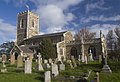
 27.5.16 1 Beverley Minster 12 (26735306314).jpg 4,000 × 6,016; 7.47 MB
-
 27.5.16 1 Beverley Minster 25 (27309492316).jpg 4,000 × 6,016; 7.66 MB
-
 27.5.16 1 Beverley Minster 26 (27067855360).jpg 6,016 × 4,000; 5.29 MB
-
 27.5.16 2 Beverley 2 (27068161890).jpg 6,016 × 4,000; 6.64 MB
-
 28-SFEC-HULL-20081114.JPG 3,264 × 2,448; 3.6 MB
-
 29-SFEC-HULL-20081114.JPG 3,264 × 2,448; 4.01 MB
-
 30-SFEC-HULL-20081114.JPG 3,264 × 2,448; 3.18 MB
-
 A Jaguar on Keldgate, Beverley (geograph 4476345).jpg 2,448 × 1,624; 1.63 MB
-
 A Jaguar on Keldgate, Beverley (geograph 4476349).jpg 2,448 × 1,624; 1.87 MB
-
 A model of the pier (geograph 1992519).jpg 800 × 600; 276 KB
-
 All Saint's Church, North Ferriby (geograph 5251341).jpg 799 × 1,200; 291 KB
-

-
 Beach landing, Withernsea (geograph 5513296).jpg 529 × 640; 138 KB
-
 Beach's Café on Seaside Road, Withernsea (geograph 5083240).jpg 1,200 × 799; 274 KB
-
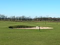 Beverley Westwood Golf Course - geograph.org.uk - 1733139.jpg 800 × 600; 96 KB
-

-
 Businesses on Dunswell Road (geograph 5236710).jpg 1,200 × 799; 305 KB
-
 Businesses on Dunswell Road (geograph 5236714).jpg 1,200 × 799; 287 KB
-
 Businesses on Main Street, Willerby (geograph 4479227).jpg 2,448 × 1,624; 1.13 MB
-
 Caravan park, Withernsea (geograph 1842464).jpg 503 × 640; 184 KB
-
 Caravan sales Hutton Cranswick.jpg 640 × 427; 256 KB
-
 Central Promenade, Withernsea (geograph 5082705).jpg 1,200 × 799; 289 KB
-
-
 Crossways Fish and Chips (geograph 6908101).jpg 1,024 × 683; 376 KB
-
 Dunswell Primary School (geograph 4349882).jpg 640 × 480; 70 KB
-
 East Riding Unfurling.jpg 640 × 491; 320 KB
-
 Elmtree House - geograph.org.uk - 403939.jpg 640 × 480; 99 KB
-
 Entrance to BAe Brough Plant - geograph.org.uk - 751166.jpg 640 × 456; 62 KB
-
 Entrance to BAE systems, Brough - geograph.org.uk - 1466148.jpg 640 × 444; 41 KB
-

-
 Entrance to Lakeminster Holiday Park - geograph.org.uk - 1527890.jpg 640 × 480; 74 KB
-
 Entrance to Tokenspire Industrial Estate (geograph 4349915).jpg 640 × 354; 39 KB
-
 Fish, chips and beer - geograph.org.uk - 1118427.jpg 640 × 333; 55 KB
-
 Garden Centre at Shiptonthorpe - geograph.org.uk - 9215.jpg 640 × 480; 65 KB
-
 Green Flags In A Field - geograph.org.uk - 261518.jpg 640 × 480; 100 KB
-
 Havenside Windmill, Patrington - geograph.org.uk - 186713.jpg 640 × 480; 90 KB
-
 Highgate, Beverley IMG 3760 - panoramio.jpg 1,300 × 866; 387 KB
-
 Houses on Shinewater Park, Kingswood, Hull (geograph 4357554).jpg 1,600 × 1,200; 581 KB
-
 Hull Animal Welfare Trust - geograph.org.uk - 1368123.jpg 640 × 459; 65 KB
-
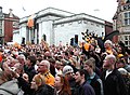
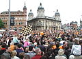
 Hull City in the Premier League - geograph.org.uk - 817744.jpg 640 × 490; 124 KB
-
 Hull City in the Premier League - geograph.org.uk - 817803.jpg 640 × 419; 96 KB
-
 Hull City in the Premier League - geograph.org.uk - 817812.jpg 640 × 470; 110 KB
-
 Hull City in the Premier League - geograph.org.uk - 817819.jpg 640 × 427; 106 KB
-
 Hull City supporters.jpg 640 × 459; 112 KB
-
 Inside Beverley Minster (15) - geograph.org.uk - 5597233.jpg 640 × 480; 86 KB
-
 Inside Beverley Minster (9) - geograph.org.uk - 5597226.jpg 480 × 640; 81 KB
-
 Inside St Patrick, Patrington (16) - geograph.org.uk - 5590842.jpg 480 × 640; 85 KB
-
 Junction in Skipsea (geograph 6908082).jpg 1,024 × 683; 391 KB
-
 Lime Avenue, off the Parkway - geograph.org.uk - 1774384.jpg 640 × 480; 59 KB
-
 Loftsome Bridge Coaching House - geograph.org.uk - 104074.jpg 640 × 480; 271 KB
-
 Looking up the Fairway - geograph.org.uk - 514567.jpg 640 × 480; 67 KB
-
 Lych Gate, All Saints Parish Church, Shiptonthorpe.jpg 480 × 640; 92 KB
-
 Main Street, Wetwang (geograph 4457484).jpg 640 × 427; 191 KB
-
 Main Street, Willerby (geograph 4479225).jpg 2,448 × 1,624; 1.1 MB
-
 Market hall and place, South Cave - geograph.org.uk - 590058.jpg 640 × 480; 96 KB
-
 Mill Lane at Skipsea Sands (geograph 6908094).jpg 1,024 × 683; 379 KB
-
 NBC East Yorkshire 747 @ Beverley Bar 04.jpg 3,232 × 2,424; 4.28 MB
-
 New Lighthouse Flamborough Head - geograph.org.uk - 771823.jpg 415 × 640; 63 KB
-

-
 Petrol Station A1079 Shiptonthorpe - geograph.org.uk - 236868.jpg 640 × 426; 118 KB
-
 Pier Towers, Withernsea (geograph 3110177).jpg 1,600 × 1,191; 286 KB
-
 Piggy Lane off Queen Street, Withernsea (geograph 3611289).jpg 1,024 × 768; 191 KB
-
 Princes Quay's Roof Flags - geograph.org.uk - 1061913.jpg 640 × 485; 83 KB
-
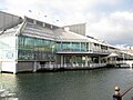
 Princes quay.jpg 1,029 × 539; 110 KB
-
 Princes's Quay, Kingston upon Hull - geograph.org.uk - 635607.jpg 640 × 497; 67 KB
-
 Queen Street - viewed from Hull Road (geograph 4595366).jpg 640 × 480; 77 KB
-
 Queen Street, Withernsea (geograph 5084037).jpg 1,200 × 799; 352 KB
-
 Queen Street, Withernsea (geograph 5084216).jpg 1,200 × 799; 341 KB
-
 RAF Cowden Air Weapon Range - geograph.org.uk - 432811.jpg 640 × 430; 51 KB
-
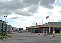
 RAF Holmpton Guardroom.jpg 640 × 480; 65 KB
-
 Raywell House - geograph.org.uk - 1185905.jpg 640 × 492; 79 KB
-
 Raywell House - panoramio.jpg 1,200 × 799; 569 KB
-
 Rowlandhall Lane, Newsholme (geograph 3937468).jpg 1,024 × 768; 105 KB
-
 Rugby club, Anlaby Common (geograph 6646105).jpg 1,024 × 1,024; 1.43 MB
-
 Seaside Road, Withernsea (geograph 5083231).jpg 1,200 × 799; 334 KB
-
 Service station on Beverley Road (A1174) (geograph 4351224).jpg 640 × 395; 41 KB
-
 Service Station, A1174 - geograph.org.uk - 1527916.jpg 640 × 480; 43 KB
-
 Shinewater Park, Kingswood, Hull (geograph 4357560).jpg 1,600 × 1,200; 436 KB
-
 Shops on Main Street (geograph 6127778).jpg 1,280 × 960; 766 KB
-
 Shops on Queen Street, Withernsea (geograph 3611239).jpg 1,024 × 768; 170 KB
-
 Shops on Queen Street, Withernsea (geograph 5084041).jpg 1,200 × 799; 331 KB
-
 Shops on Queen Street, Withernsea (geograph 5084044).jpg 1,200 × 799; 381 KB
-
 Shops on Queen Street, Withernsea (geograph 5084046).jpg 1,200 × 799; 346 KB
-
 Shops on Queen Street, Withernsea (geograph 5084211).jpg 1,200 × 799; 279 KB
-
 Snowy bunker, Springhead Park golf course, Hull (geograph 3380436).jpg 426 × 640; 212 KB
-
 South Cave Town Hall - geograph.org.uk - 1601851.jpg 480 × 640; 70 KB
-
 South Cave Town Hall - geograph.org.uk - 228991.jpg 640 × 525; 98 KB
-
 South Cave Town Hall Clock - geograph.org.uk - 1025614.jpg 640 × 474; 67 KB
-
 Springfield Way, Anlaby (geograph 5197284).jpg 1,600 × 1,065; 598 KB
-
 St Nicholas Church, Withernsea (geograph 1838426).jpg 640 × 438; 219 KB
-
 St. Peters Church, Woodmansey (geograph 6349399).jpg 800 × 600; 124 KB
-
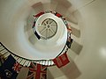 Steps inside the lighthouse - geograph.org.uk - 538841.jpg 640 × 480; 111 KB
-
 The Armoury and Registry.jpg 640 × 480; 132 KB
-
 The Barrel public house, Walkington (geograph 6360805).jpg 800 × 637; 140 KB
-
 The Barrel, Walkington (geograph 6468521).jpg 1,024 × 768; 1.19 MB
-
 The Black Swan, Wetwang - geograph.org.uk - 776258.jpg 640 × 427; 185 KB
-
 The caravan park above Ulrome sands - geograph.org.uk - 794897.jpg 640 × 480; 191 KB
-
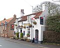
 The George and Dragon, Aldbrough - geograph.org.uk - 1206975.jpg 640 × 460; 258 KB
-
 The Green (geograph 6908104).jpg 1,024 × 683; 486 KB
-
 The Green Dragon Welton (geograph 4781169).jpg 4,604 × 3,450; 6.02 MB
-
 The Meridian Centre on Pier Road, Withernsea (geograph 3606996).jpg 1,024 × 768; 152 KB
-
 The Municipal Building, Withernsea (geograph 3611385).jpg 1,024 × 768; 165 KB
-
 The Pier Hotel, Seaside Road, Withernsea (geograph 5083244).jpg 1,200 × 799; 311 KB
-
 The Pier Hotel, Withernsea (geograph 6375017).jpg 640 × 439; 50 KB
-
 The Plant Centre on Piggy Lane, Withernsea (geograph 3611296).jpg 1,024 × 768; 167 KB
-
 The Sandcastle, Withernsea - geograph.org.uk - 983425.jpg 640 × 473; 73 KB
-
 The Town Hall, Hessle (geograph 4079640).jpg 1,600 × 1,064; 712 KB
-
 The Triton Inn, Sledmere - geograph.org.uk - 1374999.jpg 640 × 480; 78 KB
-
 Tour de Yorkshire bunting on Cartwright Lane (geograph 4464983).jpg 2,448 × 1,624; 1.36 MB
-
 Tour of Britain Stage 3 2023 Flag House.jpg 4,176 × 2,784; 3.42 MB
-
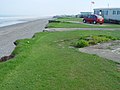
 Ulrome Sands looking south (geograph 7207220).jpg 5,054 × 3,617; 3.58 MB
-
 Upside down Union Flags No10 (geograph 2297983).jpg 800 × 600; 159 KB
-
 View towards the Grandstand (geograph 4299313).jpg 1,024 × 768; 158 KB
-
 Village Hall Walkington IMG 1634 - panoramio.jpg 1,400 × 801; 330 KB
-

-
 West End, Walkington (geograph 6468550).jpg 1,024 × 768; 1.26 MB
-
 Westwood, Beverley, Yorkshire (geograph 4721533).jpg 3,264 × 2,448; 2.98 MB
-
 Willerby Shopping Park (geograph 6127453).jpg 1,280 × 1,011; 1,017 KB
-
 Withernsea Bowling Club - geograph.org.uk - 215554.jpg 640 × 462; 95 KB
-
-
 Withernsea Golf Club (geograph 6365688).jpg 1,024 × 768; 148 KB
-
 Withernsea IMG 6475 - panoramio.jpg 1,000 × 666; 349 KB
-
 Withernsea Lighthouse - geograph.org.uk - 1257934.jpg 640 × 428; 62 KB
-
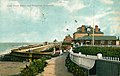
 Withernsea Pier - geograph.org.uk - 515380.jpg 640 × 495; 86 KB
-
 Withernsea Sands Holiday Park (geograph 2097623).jpg 800 × 600; 222 KB
-
 Wolfreton School.jpg 640 × 466; 77 KB
.jpg)
.jpg)
.jpg)
.jpg)


.jpg)
.jpg)
.jpg)
.jpg)

.jpg)
.jpg)


.jpg)
.jpg)
.jpg)
.jpg)

.jpg)
_(34143884534).jpg)
.jpg)
.jpg)


_-_geograph.org.uk_-_1552185.jpg)

.jpg)


.jpg)


_-_geograph.org.uk_-_5597233.jpg)
_-_geograph.org.uk_-_5597226.jpg)
_-_geograph.org.uk_-_5590842.jpg)
.jpg)


.jpg)
.jpg)

.jpg)


.jpg)
.jpg)


.jpg)
.jpg)
.jpg)


.jpg)
.jpg)
.jpg)
_(geograph_4351224).jpg)

.jpg)
.jpg)
.jpg)
.jpg)
.jpg)
.jpg)
.jpg)
.jpg)


.jpg)
.jpg)
.jpg)


.jpg)
.jpg)


.jpg)
.jpg)
.jpg)
.jpg)
.jpg)
.jpg)
.jpg)

.jpg)

.jpg)

.jpg)
.jpg)
.jpg)

_(30269206862).jpg)
.jpg)
.jpg)
.jpg)

_(28455531260).jpg)
.jpg)


.jpg)
