File:Punjab (Pakistan) Districts.svg
Jump to navigation
Jump to search

Size of this PNG preview of this SVG file: 505 × 599 pixels. Other resolutions: 202 × 240 pixels | 405 × 480 pixels | 647 × 768 pixels | 863 × 1,024 pixels | 1,726 × 2,048 pixels | 843 × 1,000 pixels.
Original file (SVG file, nominally 843 × 1,000 pixels, file size: 67 KB)
Captions
Captions
Add a one-line explanation of what this file represents
Summary
[edit]_Districts.svg&action=edit§ion=1)
| Description |
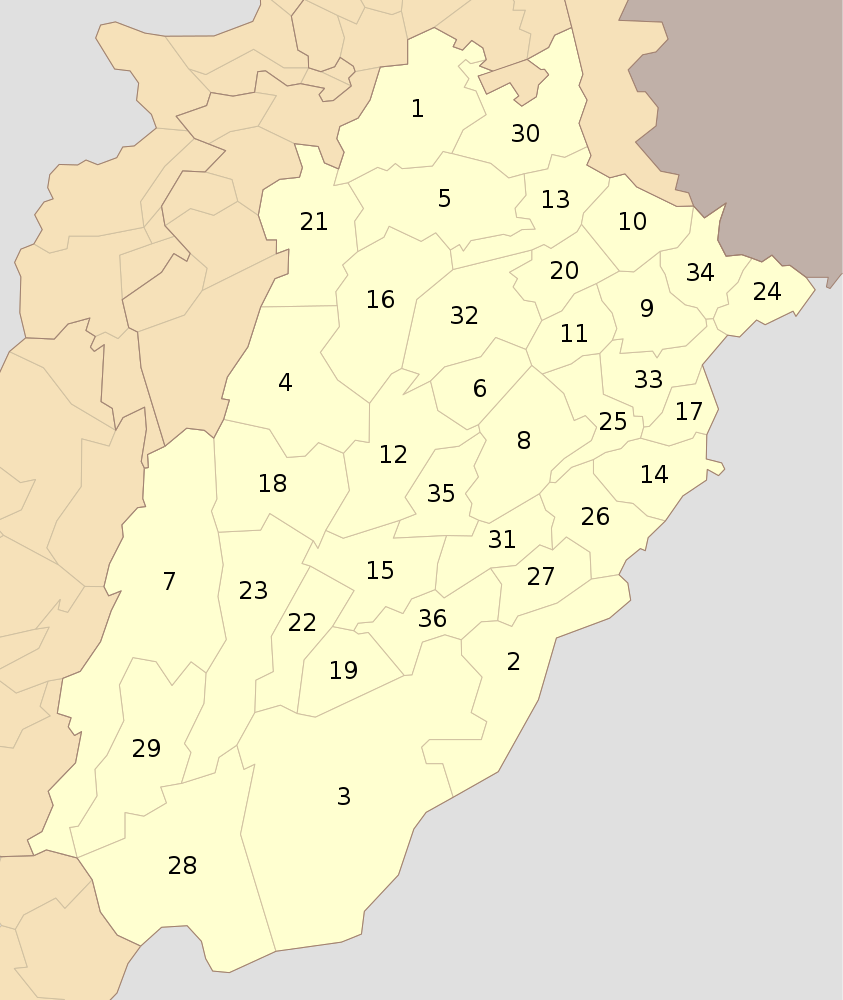
English: Districts of Punjab (Pakistan) as of Oct 2010 |
| Date | |
| Source | Own work |
| Author | Schajee |
| SVG development |
Licensing
[edit]_Districts.svg&action=edit§ion=2)
| I, the copyright holder of this work, release this work into the public domain. This applies worldwide. In some countries this may not be legally possible; if so: I grant anyone the right to use this work for any purpose, without any conditions, unless such conditions are required by law. |
File history
Click on a date/time to view the file as it appeared at that time.
| Date/Time | Thumbnail | Dimensions | User | Comment | |
|---|---|---|---|---|---|
| current | 14:04, 31 July 2016 | | 843 × 1,000 (67 KB) | Furfur (talk | contribs) | enlarged the numbers, such that they can be read in the preview |
| 21:37, 10 October 2010 |  | 843 × 1,000 (73 KB) | Schajee (talk | contribs) | {{Information |Description={{en|1=Districts of Punjab (Pakistan) as of Oct 2010}} |Source={{own}} |Author=Schajee |Date= |Permission= |other_versions= }} Category:Maps of Pakistan Category:Maps of Punjab |
You cannot overwrite this file.
File usage on Commons
There are no pages that use this file.
File usage on other wikis
The following other wikis use this file:
- Usage on be-tarask.wikipedia.org
- Usage on bn.wikipedia.org
- ব্যবহারকারী:Meghmollar2017/খেলাঘর/পাকিস্তানের জেলা
- লাহোর জেলা
- মিয়ানওয়ালী জেলা
- বাহাওয়ালনগর জেলা
- টেমপ্লেট:পাঞ্জাবের জেলা (পাকিস্তান)
- বাহাওয়ালপুর জেলা
- রহিম ইয়ার খান জেলা
- ডেরা গাজী খান জেলা
- লেয়াহ জেলা
- মুজাফফারগড় জেলা
- রাজনপুর জেলা
- চিনিওট জেলা
- ফয়সালাবাদ জেলা
- ঝং জেলা
- টোবা টেক সিং জেলা
- গুজরানওয়ালা জেলা
- গুজরাত জেলা
- হাফিজাবাদ জেলা
- মান্দি বাহাউদ্দিন জেলা
- নারোওয়াল জেলা
- শিয়ালকোট জেলা
- কসুর জেলা
- খানেওয়াল জেলা
- লোধরান জেলা
- মুলতান জেলা
- বিহারি জেলা
- এটক জেলা
- চকওয়াল জেলা
- ঝিলাম জেলা
- রাওয়ালপিন্ডি জেলা
- ভাক্কার জেলা
- খুশব জেলা
- সারগোদা জেলা
- সাহিওয়াল জেলা
- ওকারা জেলা
- পাকপাতান জেলা
- শেইখুপুরা জেলা
- নানকানা সাহিব জেলা
- Usage on de.wikipedia.org
- Usage on en.wikipedia.org
- Usage on en.wikivoyage.org
- Usage on fa.wikipedia.org
View more global usage of this file.
_Districts.svg)
_Districts.svg&oldid=490957278)