File:Provinces of France 1322-1789.png
Jump to navigation
Jump to search

Size of this preview: 584 × 600 pixels. Other resolutions: 234 × 240 pixels | 467 × 480 pixels | 748 × 768 pixels | 997 × 1,024 pixels | 2,388 × 2,452 pixels.
Original file (2,388 × 2,452 pixels, file size: 10.31 MB, MIME type: image/png)
Captions
Captions
Add a one-line explanation of what this file represents
Summary
[edit]| Description |
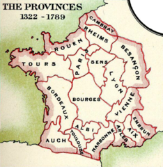
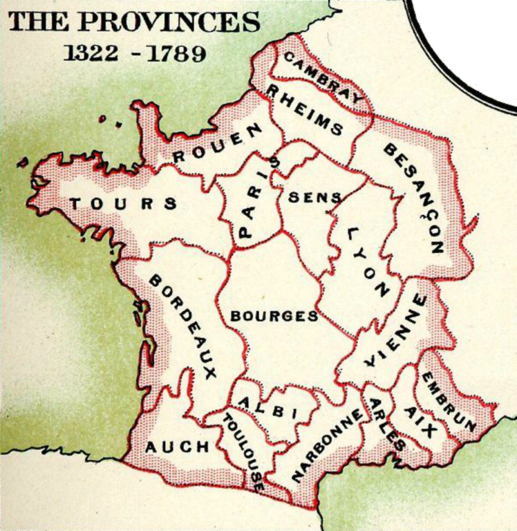
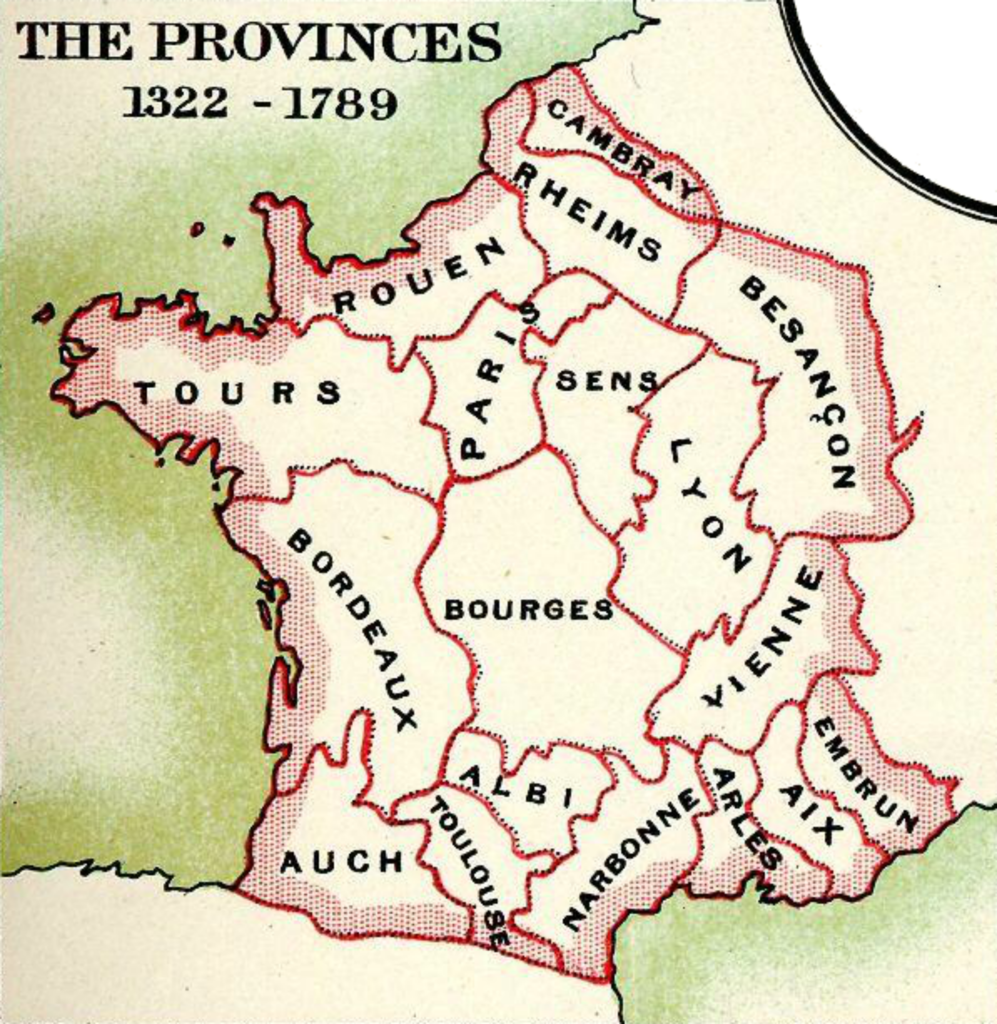
English: "The Provinces 1322-1789", from Plate 57 of Reginald Lane Poole's Historical Atlas of Modern Europe |
| Date | |
| Source | From File:Medieval Ecclesiastical Divisions of France.jpg. |
| Author | Reginald Lane Poole; LlywelynII |
| Other versions |
|

Licensing
[edit]
|
This work is in the public domain in its country of origin and other countries and areas where the copyright term is the author's life plus 70 years or fewer. This work is in the public domain in the United States because it was published (or registered with the U.S. Copyright Office) before January 1, 1929. | |
| This file has been identified as being free of known restrictions under copyright law, including all related and neighboring rights. | |
This work is based on a work in the public domain. It has been digitally enhanced and/or modified. This derivative work has been (or is hereby) released into the public domain by its author, LlywelynII. This applies worldwide.
In some countries this may not be legally possible; if so: |
File history
Click on a date/time to view the file as it appeared at that time.
| Date/Time | Thumbnail | Dimensions | User | Comment | |
|---|---|---|---|---|---|
| current | 20:53, 15 September 2016 | | 2,388 × 2,452 (10.31 MB) | LlywelynII (talk | contribs) | User created page with UploadWizard |
You cannot overwrite this file.
File usage on Commons
The following page uses this file:
Categories:
- 1902 maps of France
- English-language maps of France
- Historical Atlas of Modern Europe
- Maps of the kingdom of France
- Maps of 14th-century France
- Maps of 15th-century France
- Maps of 16th-century France
- France in the 17th century
- Maps of 18th-century France
- Roman Catholic ecclesiastical provinces
- Ecclesiastical maps