File:Ordnance Survey Quarter-inch sheet 4 Western Highlands, published 1967.jpg
Jump to navigation
Jump to search

Size of this preview: 651 × 600 pixels. Other resolutions: 261 × 240 pixels | 521 × 480 pixels | 834 × 768 pixels | 1,112 × 1,024 pixels | 2,223 × 2,048 pixels | 9,627 × 8,869 pixels.
Original file (9,627 × 8,869 pixels, file size: 8.85 MB, MIME type: image/jpeg)
Captions
Captions
Add a one-line explanation of what this file represents
Summary
[edit]
| Warning | The original file is very high-resolution. It might not load properly or could cause your browser to freeze when opened at full size. |
|---|
| Description |
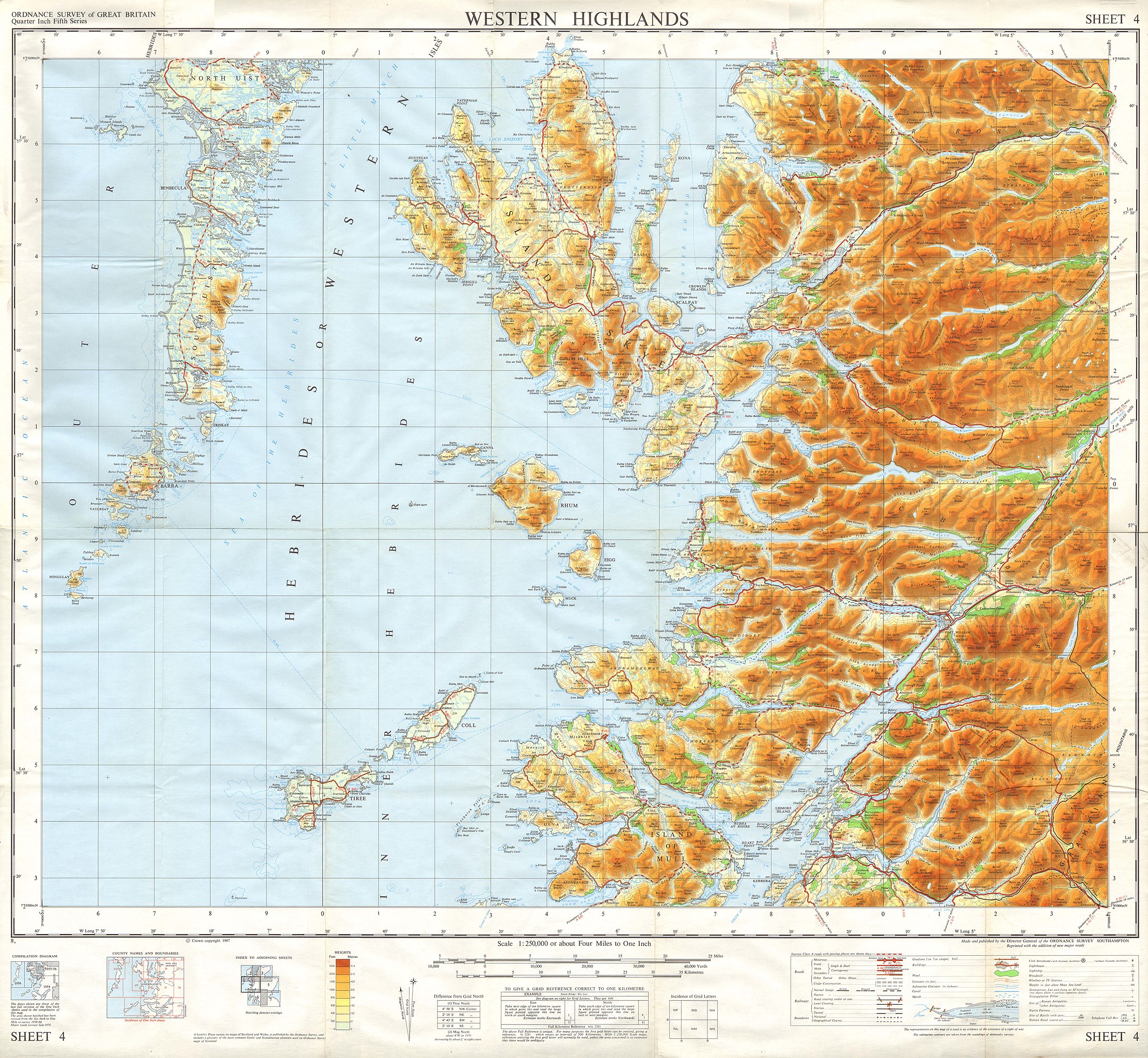
English: OS map of the Western Highlands of Scotland, at a scale of 1:250,000, including Skye, part of North Uist, and South Uist |
| Date | |
| Source | Scan of OS Sheet 4 Western Highlands |
| Author | Director General of the Ordnance Survey, Southampton, UK |
Licensing
[edit]
This work is an Ordnance Survey map over 50 years old, which is covered by Crown Copyright which in this case expires 50 years after publication. Ordnance Survey does however ask that they be credited and that the date of publication be given.
Any ancillary rights gained through the creation of the electronic version are granted as freely usable under any circumstances.
|
This work created by the United Kingdom Government is in the public domain.
This is because it is one of the following:
HMSO has declared that the expiry of Crown Copyrights applies worldwide (ref: HMSO Email Reply)
|
 |
File history
Click on a date/time to view the file as it appeared at that time.
| Date/Time | Thumbnail | Dimensions | User | Comment | |
|---|---|---|---|---|---|
| current | 19:19, 4 January 2018 | | 9,627 × 8,869 (8.85 MB) | Kognos (talk | contribs) | User created page with UploadWizard |
You cannot overwrite this file.
File usage on Commons
There are no pages that use this file.
Categories:
- 20th-century maps of Scotland
- Maps of the Hebrides
- Maps of the Isle of Skye
- Maps of the Small Isles, Lochaber
- Maps of the Isle of Mull
- North Uist
- South Uist
- Barra, Scotland
- Arisaig
- Shieldaig, Torridon
- Loch Torridon
- Maps of Ardnamurchan
- Loch Linnhe
- Lismore
- Oban
- Maps of Coll
- Maps of Tiree
- Benbecula
- 1967-12-31
- Ordnance Survey Quarter-Inch Fifth Series (1962- ) 1:250,000 (full sheets)