Category:Maps of the Isle of Mull
Jump to navigation
Jump to search
Media in category "Maps of the Isle of Mull"
The following 37 files are in this category, out of 37 total.
-
 Blaeu - Atlas of Scotland 1654 - MVLA INSVLA - The Isle of Mull.jpg 6,392 × 5,067; 6.38 MB
-

-
 Admiralty Chart No 1836 Plans on the west coast of Scotland, Published 1959.jpg 11,038 × 8,225; 21.74 MB
-
 Admiralty Chart No 2155 Sound and North West Coast of Mull, Published 1852.jpg 12,237 × 9,047; 14.58 MB
-
 Admiralty Chart No 2515 Scotland west coast Mull of Cantyre to Ardnamurchan, Published 1868.jpg 10,249 × 12,652; 15.3 MB
-
 Admiralty Chart No 2771 Loch Scridain, Surveyed 1859.jpg 11,333 × 7,579; 30.95 MB
-
 Admiralty Chart No 2813 Lochs Buie and Spelve, Published 1954.jpg 12,311 × 8,457; 34.64 MB
-
 Admiralty Chart No 2813 Lochs Buy and Spelve, Published 1862.jpg 9,997 × 6,712; 26.78 MB
-
 Admiralty Chart No 2832 Treshnish Point to the entrance of the Sound of Mull, Published 1864.jpg 16,317 × 12,057; 48.72 MB
-
 Admiralty Chart No 3015 Loch na Keal, Published 1909.jpg 15,794 × 10,898; 87.12 MB
-
-
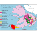 Geology of Mull.png 3,452 × 3,004; 934 KB
-

-
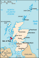 Isle of Mull.png 253 × 372; 34 KB
-
 Judd Geological Map Inner Hebrides 1878.jpg 2,822 × 4,745; 837 KB
-

-
 Mid 18th century map of Mull.JPG 3,088 × 2,056; 3.6 MB
-
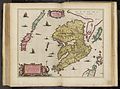 Mula Insula by Blaeu 1665.jpg 9,054 × 6,705; 9.33 MB
-
 Mull Inner Hebrides.svg 1,161 × 2,563; 4.35 MB
-
 Mull.PNG 199 × 218; 4 KB
-
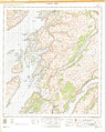
 Mull.topographic.nolabel.jpg 600 × 465; 64 KB
-
 Oban South and the Isles.svg 1,254 × 1,281; 362 KB
-
 Ordnance Survey One-Inch Sheet 45 Sound of Mull, Published 1956.jpg 8,241 × 9,882; 9.42 MB
-
 Ordnance Survey One-Inch Sheet 51 Iona & Colonsay, Published 1956.jpg 8,588 × 10,676; 14.25 MB
-
 Ordnance Survey One-inch Sheet 52 Loch Awe, Published 1956.jpg 8,604 × 10,703; 19.42 MB
-
 Ordnance Survey One-Inch Sheet 53 Sound of Mull, Published 1947.jpg 14,014 × 9,301; 13.15 MB
-
 Ordnance Survey One-Inch Sheet 59 Iona & Colonsay, Published 1927.jpg 9,872 × 14,660; 9.93 MB
-
 Ordnance Survey One-Inch Sheet 60 North Jura and Firth of Lorne, Published 1925.jpg 8,823 × 14,239; 11.94 MB
-
 Ordnance Survey Quarter-inch sheet 4 Western Highlands, published 1967.jpg 9,627 × 8,869; 8.85 MB
-
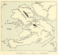
 PSM V20 D372 Plan of the dissected vulcano of mull inner hebrides.jpg 1,437 × 1,601; 378 KB
-
 Richey tertiary igneous complex Mull.jpg 2,955 × 2,830; 771 KB
-
 Richey tertiary plateau lavas Mull.jpg 2,668 × 2,846; 758 KB
-
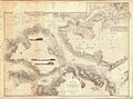
 The Isle of Mull &c. Part of Argyle Shire - By H. Moll - btv1b530564205.jpg 3,536 × 2,792; 1.57 MB
-
 The Quarterly journal of the Geological Society of London (12734300744).jpg 1,855 × 1,421; 672 KB
-
 The Quarterly journal of the Geological Society of London (1874) (14744760266).jpg 3,466 × 2,564; 1.22 MB
-
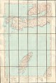
 The sound of Mull. Mackenzie 74400890.jpg 9,870 × 6,798; 12.08 MB
-
 The west side of the island Mull with the islands Tiri and Coll Mackenzie 74400891.jpg 9,639 × 6,961; 12.08 MB

.jpg)


.png)

.jpg)


.jpg)
_(14744760266).jpg)

