File:NPS yellowstone-norris-geyser-basin-geologic-map.jpg
Jump to navigation
Jump to search

Size of this preview: 510 × 599 pixels. Other resolutions: 204 × 240 pixels | 409 × 480 pixels | 654 × 768 pixels | 872 × 1,024 pixels | 1,744 × 2,048 pixels | 6,372 × 7,484 pixels.
Original file (6,372 × 7,484 pixels, file size: 6.73 MB, MIME type: image/jpeg)
Captions
Captions
Add a one-line explanation of what this file represents
Summary
[edit]
| Description |
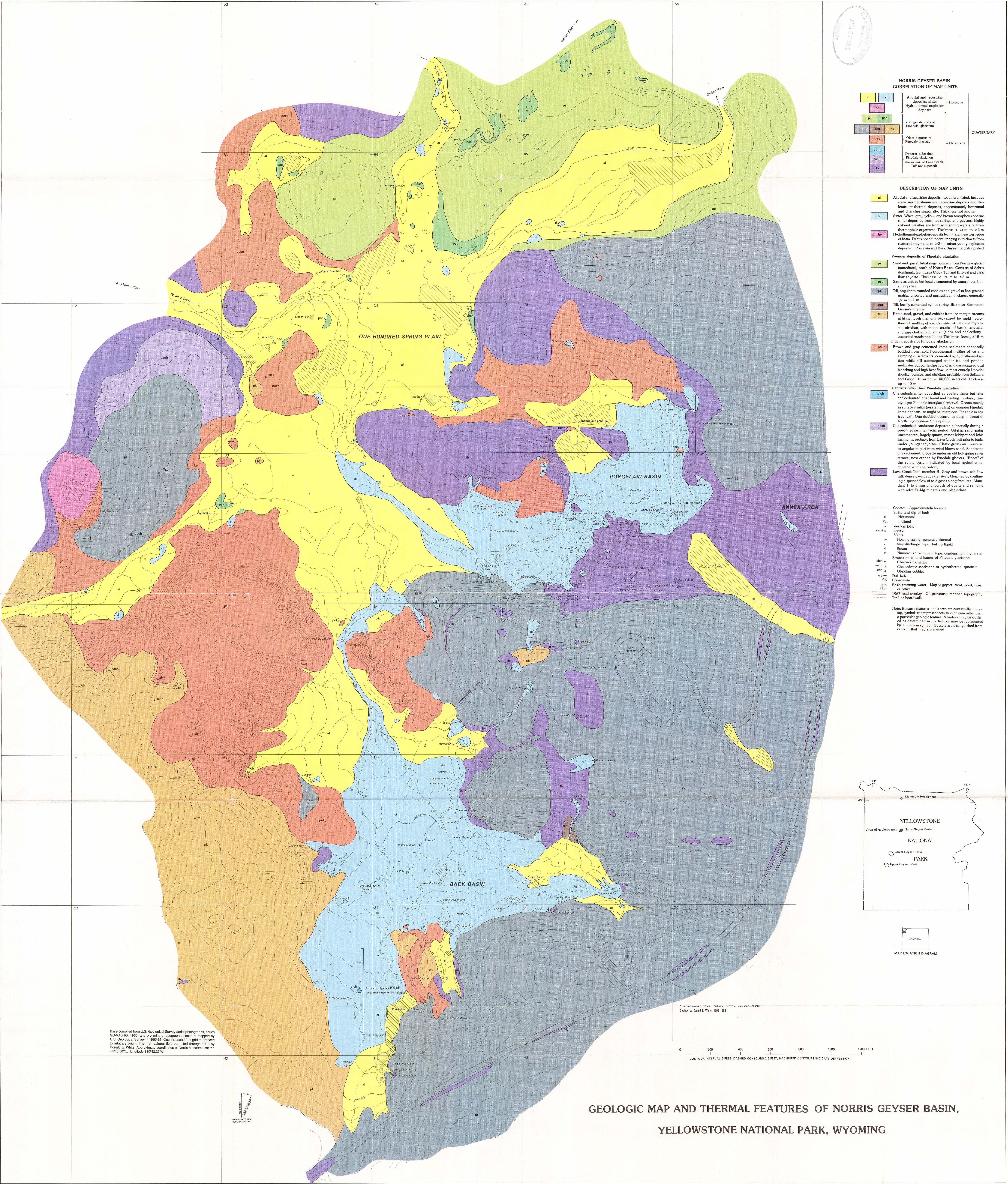
English: This Norris Geyser Basin geologic map shows the thermal deposits and locations of geysers and hot springs when the map was published in the 1980s – there may be some changes since then! |
| Date | |
| Source | U.S. National Park Service (http://npmaps.com/wp-content/uploads/yellowstone-norris-geyser-basin-geologic-map.jpg) |
| Author | U.S. National Park Service, restoration/cleanup by Matt Holly |
Licensing
[edit]
| This image or media file contains material based on a work of a National Park Service employee, created as part of that person's official duties. As a work of the U.S. federal government, such work is in the public domain in the United States. See the NPS website and NPS copyright policy for more information. |
File history
Click on a date/time to view the file as it appeared at that time.
| Date/Time | Thumbnail | Dimensions | User | Comment | |
|---|---|---|---|---|---|
| current | 10:12, 17 May 2017 | | 6,372 × 7,484 (6.73 MB) | RKBot (talk | contribs) | =={{int:filedesc}}== {{Information |description= {{en|1=This Norris Geyser Basin geologic map shows the thermal deposits and locations of geysers and hot springs when the map was published in the 1980s – there may be some changes since then!}} |date=... |
You cannot overwrite this file.
File usage on Commons
The following page uses this file: