File:NPS yellowstone-geologic-map.jpg
Jump to navigation
Jump to search

Size of this preview: 752 × 600 pixels. Other resolutions: 301 × 240 pixels | 602 × 480 pixels | 963 × 768 pixels | 1,280 × 1,021 pixels | 2,560 × 2,041 pixels | 6,892 × 5,496 pixels.
Original file (6,892 × 5,496 pixels, file size: 6.37 MB, MIME type: image/jpeg)
Captions
Captions
Add a one-line explanation of what this file represents
Summary
[edit]
| Description |
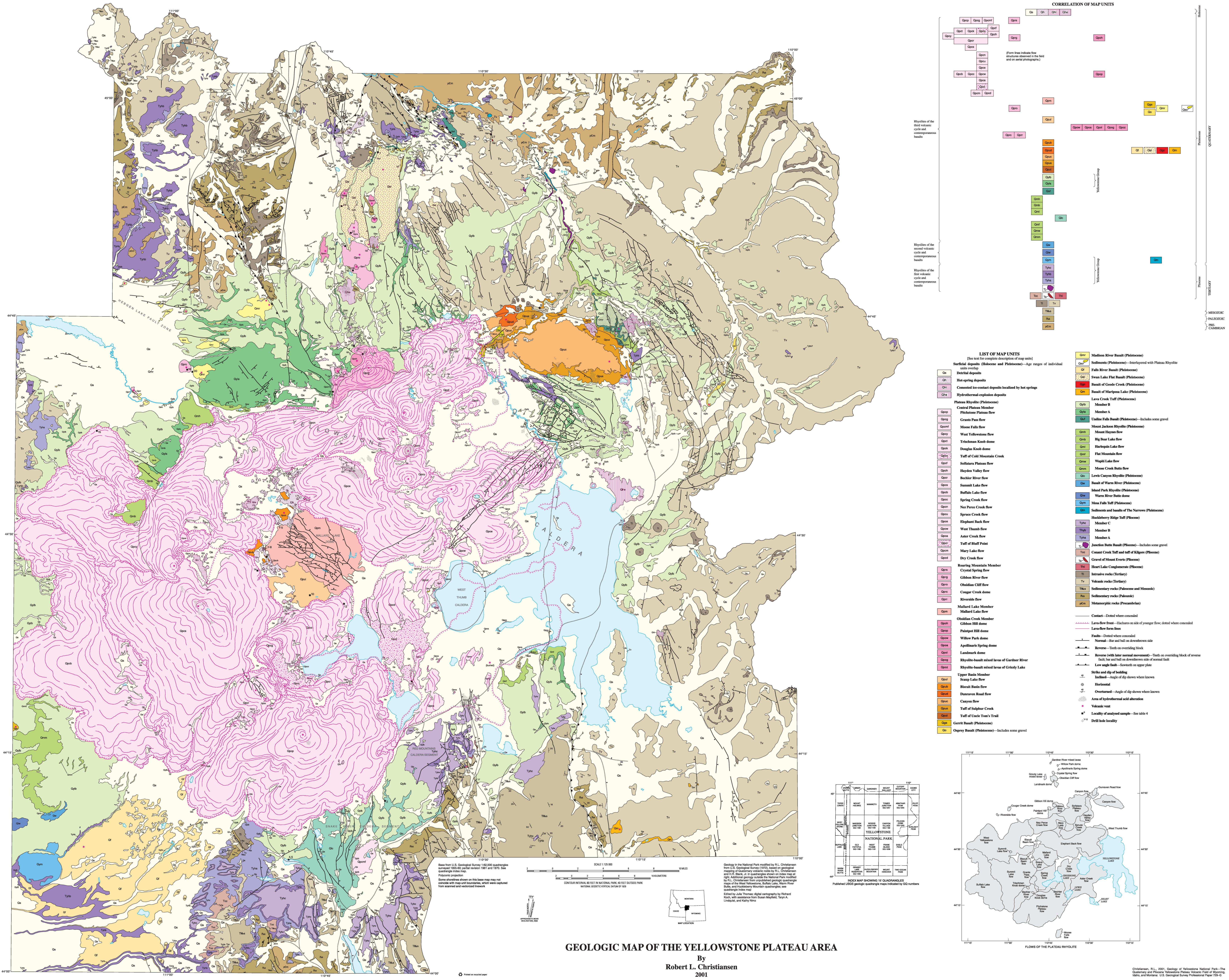
English: Yellowstone geologic map showing the huge variety of volcanic formations and thermal features throughout Yellowstone National Park. The caldera is especially noticeable. |
| Date | |
| Source | U.S. National Park Service (http://npmaps.com/wp-content/uploads/yellowstone-geologic-map.jpg) |
| Author | U.S. National Park Service, restoration/cleanup by Matt Holly |
Licensing
[edit]
| This image or media file contains material based on a work of a National Park Service employee, created as part of that person's official duties. As a work of the U.S. federal government, such work is in the public domain in the United States. See the NPS website and NPS copyright policy for more information. |
File history
Click on a date/time to view the file as it appeared at that time.
| Date/Time | Thumbnail | Dimensions | User | Comment | |
|---|---|---|---|---|---|
| current | 10:11, 17 May 2017 | | 6,892 × 5,496 (6.37 MB) | RKBot (talk | contribs) | =={{int:filedesc}}== {{Information |description= {{en|1=Yellowstone geologic map showing the huge variety of volcanic formations and thermal features throughout Yellowstone National Park. The caldera is especially noticeable.}} |date= 2017-01-21 |sourc... |
You cannot overwrite this file.
File usage on Commons
The following page uses this file:
Categories:
- Geological maps of Yellowstone National Park
- Stratigraphy of Yellowstone National Park
- Plateau Rhyolite
- Central Plateau Member, Plateau Rhyolite
- Roaring Mountain Member at Obsidian Cliff
- Mallard Lake Member, Plateau Rhyolite
- Obsidian Creek Member, Plateau Rhyolite
- Upper Basin Member, Plateau Rhyolite
- Gibbon Hill dome
- Nez Perce Creek Flow
- Canyon Flow
- Sulphur Creek Tuff
- Biscuit Basin Flow
- Gerrit Basalt
- Osprey Basalt
- Madison River Basalt
- Falls River Basalt
- Svan Lake Basalt
- Lava Creek Tuff, Member B
- Lava Creek Tuff, Member A
- Undine Falls Basalt
- Mount Jackson Rhyolite
- Lewis Canyon Rhyolite
- Island Park Rhyolite
- Mesa Falls Tuff
- Huckleberry Ridge Tuff, Member A
- Huckleberry Ridge Tuff, Member B
- Huckleberry Ridge Tuff, Member C
- Junction Butte Basalt
- Conant Creek Tuff
- Heart Lake Conglomerate
- Paleocene sedimentary rocks in Wyoming
- Mesozoic sedimentary rocks in Wyoming
- Paleozoic sedimentary rocks in Wyoming
- Precambrian metamorphic rocks in Wyoming
- Huckleberry Ridge Tuff - maps
- Gravel of Mount Everts