Category:Mesa Falls Tuff
Jump to navigation
Jump to search
Subcategories
This category has the following 3 subcategories, out of 3 total.
M
- Mesa Falls Tuff - maps (2 F)
U
- Upper Mesa Falls (16 F)
Media in category "Mesa Falls Tuff"
The following 8 files are in this category, out of 8 total.
-
 Ashton Quarry.jpg 800 × 500; 142 KB
-
 MeasFallTuff.jpg 2,048 × 1,438; 586 KB
-
 Mesa Falls 4.JPG 2,304 × 1,728; 901 KB
-
 NPS yellowstone-geologic-map.jpg 6,892 × 5,496; 6.37 MB
-
 Upper Mesa Falls 1.jpg 4,386 × 2,920; 8.58 MB
-
 Yellowstone Major Calderas Map.jpg 1,275 × 1,020; 310 KB
-
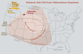
 Yellowstone volcano - ash beds.jpg 1,000 × 650; 297 KB
-
 Yellowstone volcano - ash beds.svg 1,430 × 930; 192 KB


Categories:
- Tuff rock formations in the United States
- Island Park Caldera
- Volcanism of the Yellowstone hotspot
- Rhyolite in the United States
- Ignimbrite sheets in the United States
- Tuff rock formations in Yellowstone National Park
- Ignimbrites in the United States
- Pyroclastic rocks in Wyoming
- Pyroclastic rocks in Idaho
- Yellowstone Plateau volcanic field
- Pleistocene geology of Idaho
- Pleistocene volcanism of Idaho
- Henry's Fork Caldera
- Ash horizons (volcanic)
- Pleistocene formations in South Dakota
- Pleistocene formations in Nebraska
- Pleistocene formations in Kansas
- Pleistocene formations in New Mexico
- Pleistocene formations in Colorado
- Geologic formations in Wyoming
- Geologic formations in Idaho
- Geologic formations in South Dakota
- Geologic formations in Nebraska
- Geologic formations in Kansas
- Geologic formations in New Mexico
- Geologic formations in Colorado
- Marker tephra
- Pleistocene eruptions
- Geologic formations of volcanic origin in the United States
- Rhyolitic tuff formations in the United States