File:NPS rainbow-bridge-geologic-map.jpg
Jump to navigation
Jump to search

Size of this preview: 455 × 600 pixels. Other resolutions: 182 × 240 pixels | 364 × 480 pixels | 583 × 768 pixels | 777 × 1,024 pixels | 1,466 × 1,932 pixels.
Original file (1,466 × 1,932 pixels, file size: 382 KB, MIME type: image/jpeg)
Captions
Captions
Add a one-line explanation of what this file represents
Summary
[edit]
| Description |
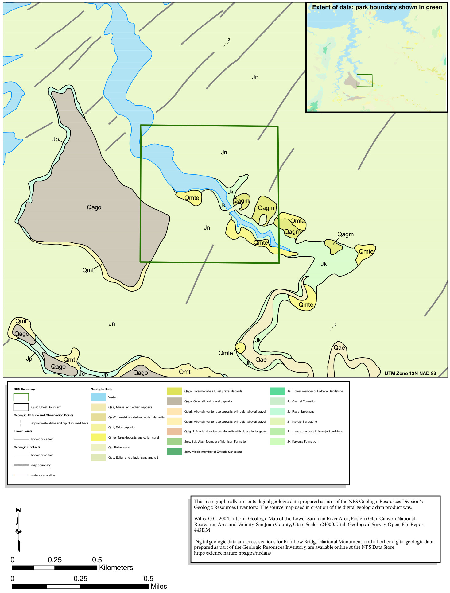
English: This Rainbow Bridge geologic map shows the more recent surficial deposits that are found overlaid on an endless field of Navajo Sandstone – the classic rock layer found in many Utah national parks. |
| Date | |
| Source | U.S. National Park Service (http://npmaps.com/wp-content/uploads/rainbow-bridge-geologic-map.jpg) |
| Author | U.S. National Park Service, restoration/cleanup by Matt Holly |
Licensing
[edit]
| This image or media file contains material based on a work of a National Park Service employee, created as part of that person's official duties. As a work of the U.S. federal government, such work is in the public domain in the United States. See the NPS website and NPS copyright policy for more information. |
File history
Click on a date/time to view the file as it appeared at that time.
| Date/Time | Thumbnail | Dimensions | User | Comment | |
|---|---|---|---|---|---|
| current | 01:59, 17 May 2017 | | 1,466 × 1,932 (382 KB) | RKBot (talk | contribs) | =={{int:filedesc}}== {{Information |description= {{en|1=This Rainbow Bridge geologic map shows the more recent surficial deposits that are found overlaid on an endless field of Navajo Sandstone – the classic rock layer found in many Utah national par... |
You cannot overwrite this file.
File usage on Commons
The following page uses this file:
Categories:
- Maps of Rainbow Bridge National Monument
- Geological maps of Utah
- Maps of Lake Powell
- Quaternary sediments in Utah
- Quaternary fluvial deposits in Utah
- Quaternary aeolian deposits in Utah
- Salt Wash Member, Morrison Formation
- Morrison Formation in Utah
- Morrison Formation maps
- Middle Member, Entrada Sandstone
- Lower Member, Entrada Sandstone
- Entrada Sandstone in Utah
- Entrada Sandstone maps
- Carmel Formation in Utah
- Carmel Formation - maps
- Page Sandstone in Utah
- Navajo Sandstone in Utah (Jurassic)
- Navajo Sandstone maps
- Limestone beds in Navajo Sandstone
- Kayenta Formation in Utah
- Kayenta Formation - maps