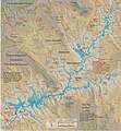
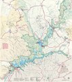
Category:Maps of Lake Powell
Jump to navigation
Jump to search
English: Maps of Lake Powell
Wikimedia category | |||||
| Upload media | |||||
| Instance of | |||||
|---|---|---|---|---|---|
| Category combines topics | |||||
| Lake Powell | |||||
reservoir Utah and Arizona in the United States | |||||
| Instance of | |||||
| Named after | |||||
| Location |
| ||||
| Has part(s) | |||||
| Inception |
| ||||
| Width |
| ||||
| Length |
| ||||
| Area |
| ||||
| Elevation above sea level |
| ||||
| Inflows |
| ||||
| Outflows | |||||
| Drainage basin | |||||
| Basin country | |||||
| Dam | |||||
 | |||||
Media in category "Maps of Lake Powell"
The following 18 files are in this category, out of 18 total.
-
Lake Powell Map.jpg 2,534 × 2,733; 1.42 MB
-
Lake Powell Map.pdf 1,275 × 1,379; 1.52 MB
-
NPS glen-canyon-bullfrog-halls-crossing-map.jpg 880 × 1,146; 149 KB
-
NPS glen-canyon-bullfrog-map.jpg 1,650 × 1,275; 285 KB
-
NPS glen-canyon-geologic-map-north.jpg 2,003 × 2,997; 2.24 MB
-
NPS glen-canyon-hite-area-map.jpg 1,760 × 1,360; 144 KB
-
NPS glen-canyon-hite-map.jpg 582 × 508; 84 KB
-
NPS glen-canyon-lone-rock-beach-map.jpg 1,360 × 1,031; 389 KB
-
NPS glen-canyon-map.jpg 2,953 × 3,354; 2.26 MB
-
NPS glen-canyon-map.pdf 2,531 × 2,875; 7.78 MB
-
NPS glen-canyon-page-map.jpg 1,484 × 1,116; 313 KB
-
NPS glen-canyon-wahweap-map-color.jpg 1,650 × 1,275; 392 KB
-
NPS glen-canyon-wahweap-map.jpg 1,166 × 1,114; 139 KB
-
NPS lake-powell-antelope-point-map.jpg 1,202 × 1,225; 113 KB
-
NPS lake-powell-halls-crossing-map.jpg 1,000 × 773; 98 KB
-
NPS lake-powell-restrooms-map.jpg 1,955 × 2,530; 382 KB
-
NPS lake-powell-wahweap-campground-map.jpg 1,620 × 897; 279 KB
-
NPS rainbow-bridge-geologic-map.jpg 1,466 × 1,932; 382 KB


