File:Mapa polityczna Afryki (1914).svg
From Wikimedia Commons, the free media repository
Jump to navigation
Jump to search

Size of this PNG preview of this SVG file: 704 × 599 pixels. Other resolutions: 282 × 240 pixels | 564 × 480 pixels | 903 × 768 pixels | 1,204 × 1,024 pixels | 2,407 × 2,048 pixels.
Original file (SVG file, nominally 704 × 599 pixels, file size: 188 KB)
File information
Structured data
Captions
Captions
Add a one-line explanation of what this file represents
| DescriptionMapa polityczna Afryki (1914).svg |
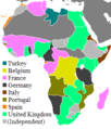
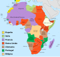
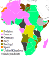
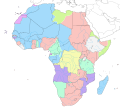
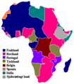
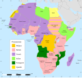
English: Political division of Africa in 1914
Polski: Podział polityczny Afryki w 1914 roku |
||
| Date | |||
| Source | Own work | ||
| Author | Mixx321 | ||
| Permission (Reusing this file) |
I, the copyright holder of this work, hereby publish it under the following license:
|
||
| Other versions |
[edit]
|
File history
Click on a date/time to view the file as it appeared at that time.
| Date/Time | Thumbnail | Dimensions | User | Comment | |
|---|---|---|---|---|---|
| current | 15:08, 16 January 2013 |  | 704 × 599 (188 KB) | Ciaurlec (talk | contribs) | Removed some flowed text |
| 12:08, 18 July 2011 |  | 704 × 599 (189 KB) | Mix321 (talk | contribs) | dr | |
| 18:22, 16 May 2011 |  | 704 × 599 (189 KB) | Mixx321 (talk | contribs) | dr | |
| 18:20, 16 May 2011 | 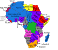 | 704 × 599 (189 KB) | Mixx321 (talk | contribs) | {{Information |Description ={{en|1=Political division of Africa in 1914}} {{pl|1=Podział polityczny Afryki w 1914 roku}} |Source ={{own}} |Author =Mixx321 |Date =2011-05-16 |Permission ={{GFDL-self}} |oth |
You cannot overwrite this file.
File usage on Commons
The following 47 pages use this file:
- File:Africa1913 fr.png
- File:Africa Colonial.png
- File:Africa colonization 1914.PNG
- File:Africacolony.PNG
- File:African colonization map (swedish).jpg
- File:Afrika 1913.png
- File:Afrika 1914.png
- File:Afrika 1914 - sr.png
- File:Afrika Kolonisation Farben.png
- File:Afrika koloniala 1914an.png
- File:ColonialAfrica-da.png
- File:ColonialAfrica-no.png
- File:ColonialAfrica.png
- File:ColonialAfrica Zh.PNG
- File:Colonial Africa 1800 map.png
- File:Colonial Africa 1870 map-fr.png
- File:Colonial Africa 1870 map.png
- File:Colonial Africa 1900 map-fr.png
- File:Colonial Africa 1900 map.png
- File:Colonial Africa 1913, pre WWI-es.svg
- File:Colonial Africa 1913, pre WWI.svg
- File:Colonial Africa 1913 map.svg
- File:Colonial Africa 1914 map-he.png
- File:Colonial Africa 1914 map.png
- File:Colonial Africa 1923 map.png
- File:Colonias en Africa (1914) mapa.png
- File:Colonies in Africa in 1914.jpg
- File:Decolonization of Africa PL.PNG
- File:FeizhouZhimindi.png
- File:Hui-chiu sit-bin-te 1914.png
- File:Kolonie Afryka 1947.PNG
- File:Kolonie afryka 1914.PNG
- File:Kolonien-Afrikas.svg
- File:Kolonisation Afrikas.png
- File:Map of Africa in 1939.png
- File:Map of Colonial Africa (1914)-sr.png
- File:Mapa del África colonial (1914).svg
- File:Mapa del África colonial (1914) ast.svg
- File:Mapa del África colonial (1914) eu.svg
- File:Mapa del África colonial (1939).svg
- File:Mapa del África colonial (1947).svg
- File:Mapa mudo del África colonial (1914).svg
- File:Mapa polityczna Afryki (1914)-es.svg
- File:Mapa polityczna Afryki (1914).svg
- File:ΑποικιακήΑφρική.png
- File:Колонии на Африка през 1914.png
- Template:Other versions/Colonial Africa
Metadata
This file contains additional information such as Exif metadata which may have been added by the digital camera, scanner, or software program used to create or digitize it. If the file has been modified from its original state, some details such as the timestamp may not fully reflect those of the original file. The timestamp is only as accurate as the clock in the camera, and it may be completely wrong.
| Width | 704 |
|---|---|
| Height | 599 |


